The wind will slacken before a new thermal drop mid-week
This Sunday the wind has exceeded 130 km/h


-
CAT -
CAST

The weather this weekend has been quite calm, although this Sunday the wind has once again taken center stage and has caused incidents and personal injuries, with gusts that have exceeded 70 or 80 km/h in many regions (you will find more data on the windstorm at the end of this information). Sunday's minimum temperature will be at the end of the day, when we will notice a new cooling, and next week we will be watching for a more forceful cooling starting Wednesday. Even so, this Monday we will start the week with a colder environment.

Monday: few changes
We will start the week with a colder, full autumn atmosphere, and an anticyclone that will return to dominate and end the wind at both ends of the country. The minimum temperature will be lower thanks to the decrease in wind speed and the clear sky, and midday will also be a little colder throughout the country. All this on a day with some remnants of rainfall at dawn on the northern slope of the Pyrenees, with a snow level of about 1,600 meters, and with the formation of low clouds on the central and northern coast from mid-morning and during the second half of the day.

Tuesday: many clouds, but very little precipitation
The week will progress and the weather will gradually change, on a Tuesday marked by an increase in cloudiness, which will leave the sky very cloudy or overcast at many times. Even so, very little rain is expected, with some minor showers or drizzles that will affect the central coast and will advance from west to east from mid-afternoon, in the form of snow at medium and high altitudes in the Pyrenees. The temperature will be similar to Monday's, with a colder environment due to the presence of clouds.
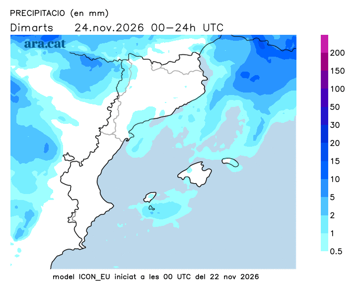
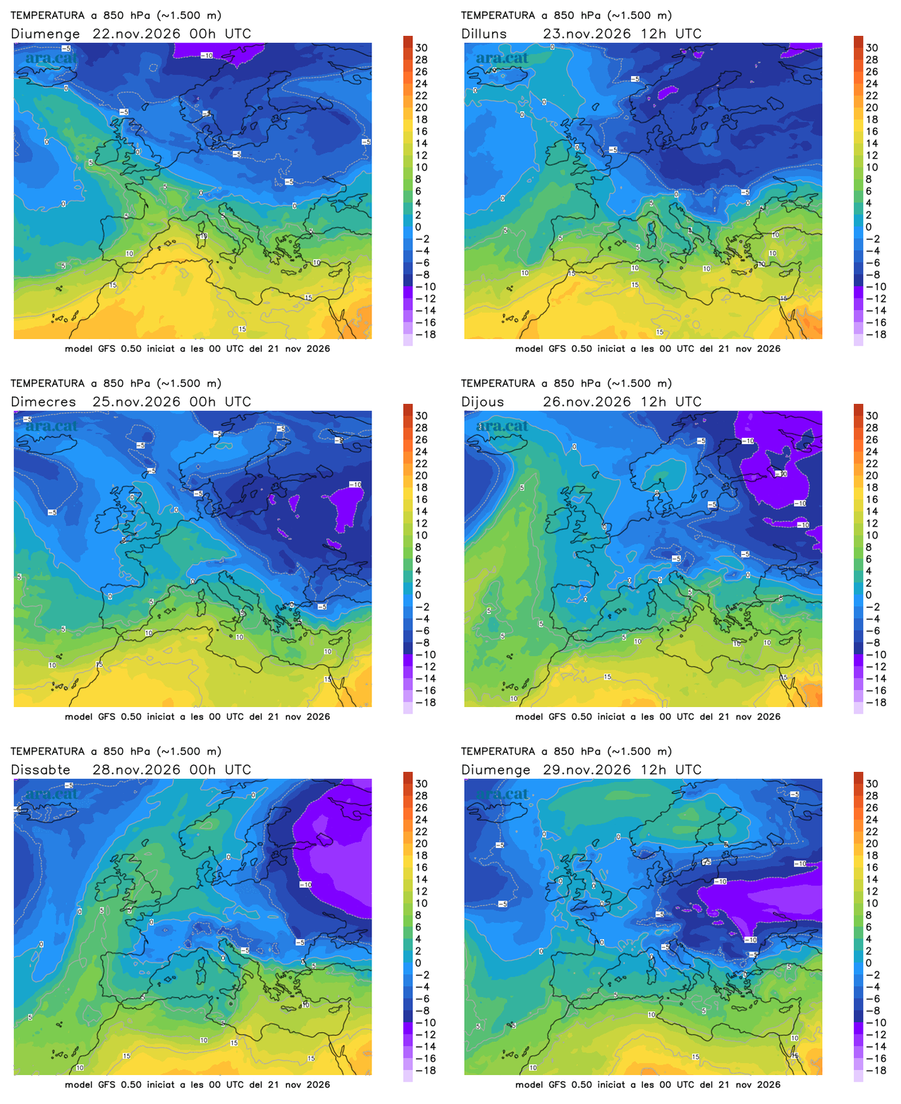
Possible cold front by the middle of next week
Between Tuesday and Wednesday, the approach of a pocket of very cold air will reactivate instability, with some showers, but the most important element that will accompany it will be precisely this colder air in the upper layers of the atmosphere, which will open the doors to a significant drop in temperatures. Colder environment here at home, from where we will look with some apprehension at the situation that the center of the European continent will experience, with extensive snowfall in countries like Poland, the Czech Republic, or the south and east of Germany.
Windstorm balance sheet
The westerly wind has made itself felt strongly this Sunday, with gusts that have exceeded 100 km/h in some points. In the early afternoon, the 135 km/h at Puig Sesolles, in Montseny, the 124 km/h at Portbou (Alt Empordà) or the 119 km/h at Ulldeter (2,413 m), in the eastern Pyrenees, stood out. The wind, however, has also been intense in areas where it is less common for it to blow, such as in Barcelona, where the Raval neighborhood recorded a maximum gust of 73.8 km/h, or in Alguaire (Segrià), where it exceeded 82 km/h.
