Last hours of calm and fair weather: rain and cold are knocking at the door
The weekend will be marked by an important change in weather

-
CAT -
CAST
BarcelonaThe weather has remained calm this Thursday, and Friday there will be few changes, with sun that will continue to combine with some thin clouds, low clouds, and fog. Temperatures will undergo few changes, with a warm atmosphere again at midday, although today they have dropped a little after the peak they experienced on Wednesday. But these will be the last hours of calm and fair weather, as from the weekend onwards the maps are confirming the significant change in weather that we have been announcing for days.
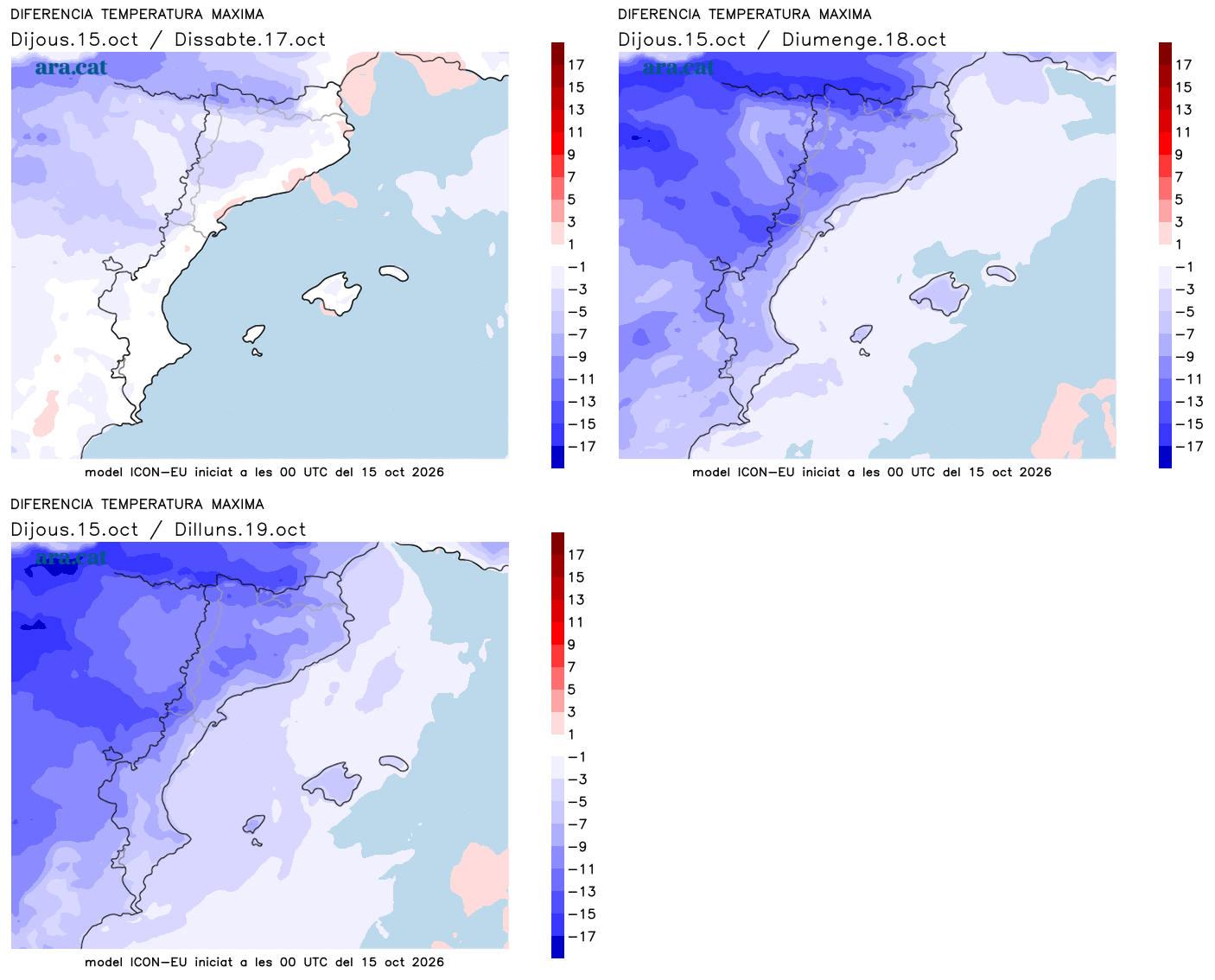
An anticyclone will settle over the British Isles and a storm will form in the Mediterranean. All this will allow the arrival of a pocket of cold air and the entry of humid and warm maritime winds into our region. A combination that will cause significant rain in our Mediterranean area. Depending on the final position of all these pieces, the rain will be more or less significant and widespread. What we will certainly notice will be a sharp drop in thermometers, with a full autumn atmosphere.

Friday: last day of calm
Calm conditions will still dominate this Friday, with plenty of sun in general, but veiled at times by the passage of thin cloud bands. For another day, there will be morning fog inland and some intervals of low clouds throughout the day in parts of the coast and pre-coastal areas. The novelty will be that in the afternoon the clouds will increase in the Lleida Pyrenees, where an isolated shower may already escape on the north face.

Minimum temperatures may rise slightly, with a cool morning atmosphere, while maximums will generally be similar. They will only begin to drop in the western Pyrenees. Most values will again range between 23 and 27 ºC, with an atmosphere that will remain warm for the time of year.
Sudden change over the weekend
On Saturday morning, temperatures will remain similar and calm in most regions, but cloud intervals will increase and the first showers will fall in the north of the country. It will be throughout the day—especially in the afternoon—that cloudiness will grow significantly, especially in the center and north of the territory, and will leave downpours and thunderstorms. They will especially affect the regions of the Pyrenees, the Pre-Pyrenees, Girona, and Barcelona.
On Sunday, the change in weather will consolidate. The different meteorological models disagree on the extent of the precipitation, as some point to general rainfall, locally with downpours, while others concentrate the episode in the regions of Girona and Barcelona.
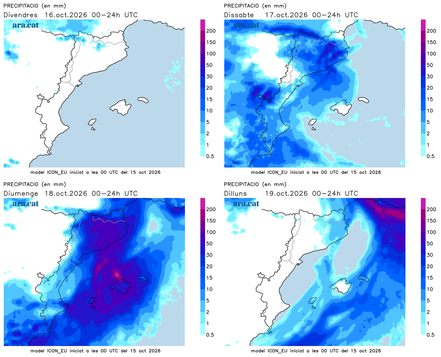
All of this will have to be confirmed, as it will depend on the final position of the cold air pocket and the arrival of maritime winds. Some maps suggest a possible easterly storm, with abundant rain. We will see how it all ends up positioned. What we will certainly notice is a sharp drop in temperatures. On Saturday the mercury will begin to retreat, and Sunday will already be quite a gray and cool or cold day, depending on the area. Autumn is advancing with a steady pace.