Rain until dawn and the cold will hit bottom in the next few hours
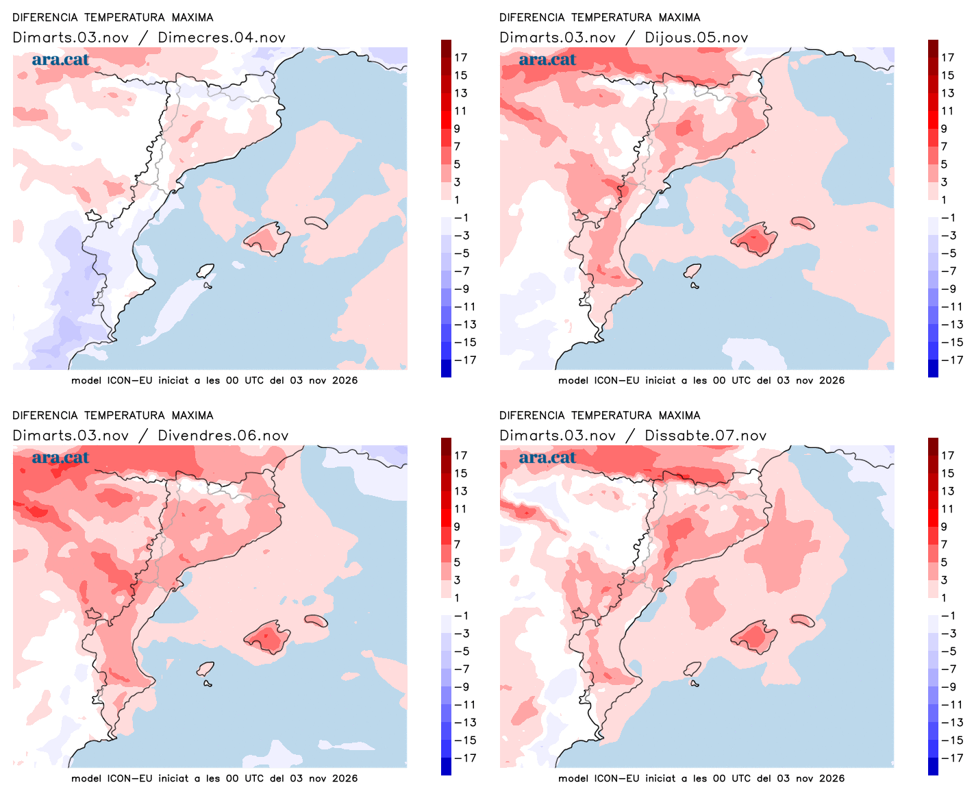
The environment will be of early winter at first hour, but the temperatures will go on recovering themselves the next days

-
CAT -
CAST
BarcelonaThe injection of cold air coming from northeastern Europe has caused a sharp drop in temperature that has left an atmosphere this Tuesday more typical of early winter than of mid-autumn. We have had to dress much warmer, and we have also had to open our umbrellas. The fact is that the rains have been gaining ground throughout the day. The most significant ones have affected the Costa Daurada, where since last night, for example, more than 85 l/m² have accumulated in the city of Tarragona, more than 80 in Torredembarra, and around 70 in Cunit. It has also snowed at the mid and high altitudes of the Pyrenees, with the most notable snowfall of this autumn so far.
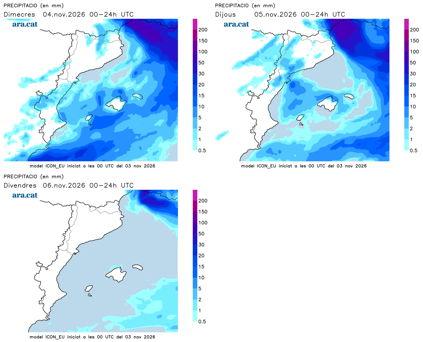
Some precipitation will still fall in many places—although now in a moderate way—until well into the early morning, especially in the center and north of the country, with a snow level of about 1,400 m. But tomorrow all of this will be history, and the sun and calm will prevail over a large part of the territory. Pay attention to the temperatures, as they will bottom out tonight. Early in the morning we will have to dress well, while at noon the maximums will begin to recover little by little.

Wednesday: calm returns
This Wednesday we will wake up to a cold and quite wintry atmosphere in general. Many minimum temperatures of 3 to 8 ºC are expected in the pre-coastal areas and inland, and 8 to 13 ºC on the coast, while in the Pyrenees frosts will be quite widespread. A good jacket or coat will be needed –depending on the area– first thing in the morning. Maximum temperatures will begin to rise, but slowly, with an atmosphere that will be between cool and mild. Many values between 15 and 20 ºC are expected.
All this with absolute calm and a sun that will gain ground and prevail in most counties. All this with nuances, however. In the morning there will still be quite a few cloud intervals in the northeast, with traces of some light rain or isolated showers in the Alt Empordà, Roussillon, and the Balearic Islands that will eventually move away. There will also be a lot of morning fog.

Towards the afternoon, cloud intervals will increase in the south of Catalonia, but especially in the Valencian Community, where some scattered showers will reappear. The mistral and tramontana winds will blow at both ends, especially in the morning.
Change of dynamics in the coming days
For the rest of the week we will enter a new meteorological scenario. The anticyclone in northern Europe will move and will stop sending us cold air. This will mean that we will enter a dynamic of Atlantic fronts that will arrive weakened to our area. Therefore, we expect days with changing skies and little rain in sight. On Thursday there will be some showers in the south and west of the country, but very little.
The winds will be warmer, from the south and west, which will cause temperatures to rise day by day –they will simply normalize for the time of year–, and the atmosphere will be softer and more pleasant, especially on Friday and the weekend. On the other hand, the nights will generally continue to be quite cold.