New change of weather Thursday, with scattered showers in some places
In the next few days we will enter an Atlantic dynamic that will bring us less cold, changing skies and little rain

-
CAT -
CAST
BarcelonaCalm and sun have returned to dominate this Wednesday in many regions after the general rainfall of Tuesday, which left more than 130 l/m² in the Camp de Tarragona and the first significant and general snowfall of the autumn at mid and high altitudes of the Pyrenees, with depths of between 5 and 15 centimeters. Temperatures have risen slightly at midday, after bottoming out during the night. Early in the morning, a jacket or sweater was necessary, with quite widespread frost in the Pyrenees and many minimum temperatures of 2 to 7 ºC inland and in the pre-coastal areas, and 8 to 13 ºC on the coast. It was a morning more typical of winter than of autumn.
But time gives no respite, and this Thursday a new change in the weather will arrive. It will be minor, but it will make the sky more laden with intervals of clouds, with some weak and scattered showers that will move from west to east, especially during the early morning and the morning. In fact, this afternoon the first showers have already fallen in the Ebro area. Not much, and it will not rain everywhere. In the coming days, we will enter an Atlantic dynamic that will bring us little rain and a less cold atmosphere.

Thursday: some showers
The passage of an instability line will bring more intervals of clouds everywhere this Thursday, even with overcast skies during the morning in many parts of the southern half of the country. Some weak and scattered showers will arrive, crossing from west to east during the early morning and morning. They will fall mainly in the regions of Lleida and Tarragona, but they may also reach other places in a testimonial way. Not much, all in all.
In the afternoon, some downpours will repeat in the Ebro area and the Lleida Pyrenees, while in the northeast there will be more periods of sunshine. Furthermore, throughout the day, irregular showers will also fall in the south of the Valencian Community and in the Balearic Islands, without ruling out some local downpours in Mallorca and the south of Alicante.

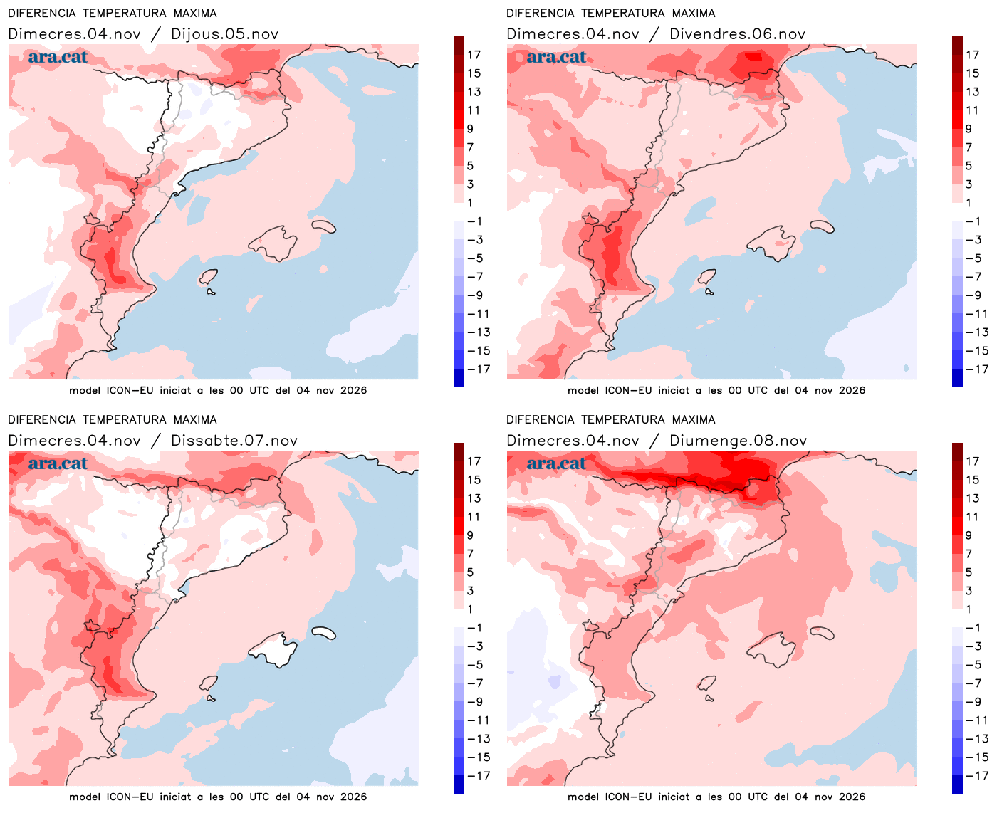
Temperatures will rise a little, both day and night. Cold atmosphere first thing in the morning, but less than Wednesday morning. Regarding maximums, most will move between 14 and 19 ºC.
Little rain and less cold in sight
On Friday the sun will prevail everywhere and it will be a calm and pleasant day, with a contrast between the morning cold and the mildness of midday, which will become more pronounced. Many highs of 15 to 20 ºC are expected. Starting from the weekend we will be under the influence of a deep Atlantic storm that will bring significant rainfall to the western peninsula, but only cloudiness will reach the Mediterranean.
This situation will push westerly and southerly winds towards us, which will cause the cold air mass of the last few days to leave. This will cause a clear rise in temperatures, which will be especially noticeable at the beginning of next week, when midday will be milder. All this will be short-lived, as the second part of next week could be unstable and colder again.