The rains and the full autumn atmosphere will return the weekend
The calm will be maintained until Friday, with high temperatures for the dates

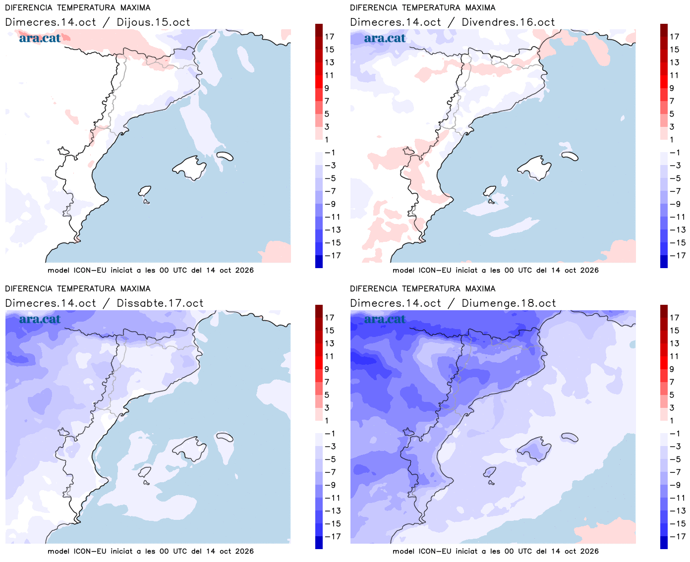
BarcelonaCalm weather will continue until Friday, with sun combined with thin clouds and high humidity, which will favor the appearance of new fog and low clouds, especially in parts of Central Catalonia, the coast, and the pre-coastal area. All this with temperatures that will remain warm for the time of year. But this situation is limited, as from the weekend on, rain and a full autumn atmosphere will return, with a clear drop in thermometers. The anticyclone will settle over the British Isles, and this will allow a pocket of cold air to reach our region which, combined with the entry of humid and warm maritime winds, will cause a clear increase in instability.

Thursday: without major changes
The meteorological situation will continue to be marked this Thursday by high humidity, which will cause many morning mists to appear inland, as well as intervals of low clouds in parts of the coast, the pre-coastal area, and Central Catalonia. These clouds will combine with the sun, which will once again dominate radiantly in the western half of the country and in the Pyrenees, with the permission of some thin clouds. Nuances in a calm day.
Temperatures will remain similar or drop slightly, both day and night. The nocturnal environment will be generally cool, and milder on the coast, without ruling out some late tropical value in the city of Barcelona for the umpteenth consecutive night. As for the highs, most will move between 23 and 26 ºC, higher in the south and in the West.

Pending important changes
Friday will be the last day of calm and warm weather, although in the afternoon some initial showers may already appear in the Lleida Pyrenees. Starting Saturday, instability will clearly increase, and rain will gain ground. The precipitation will last for several days, with a risk of new downpours like those that occurred last week.
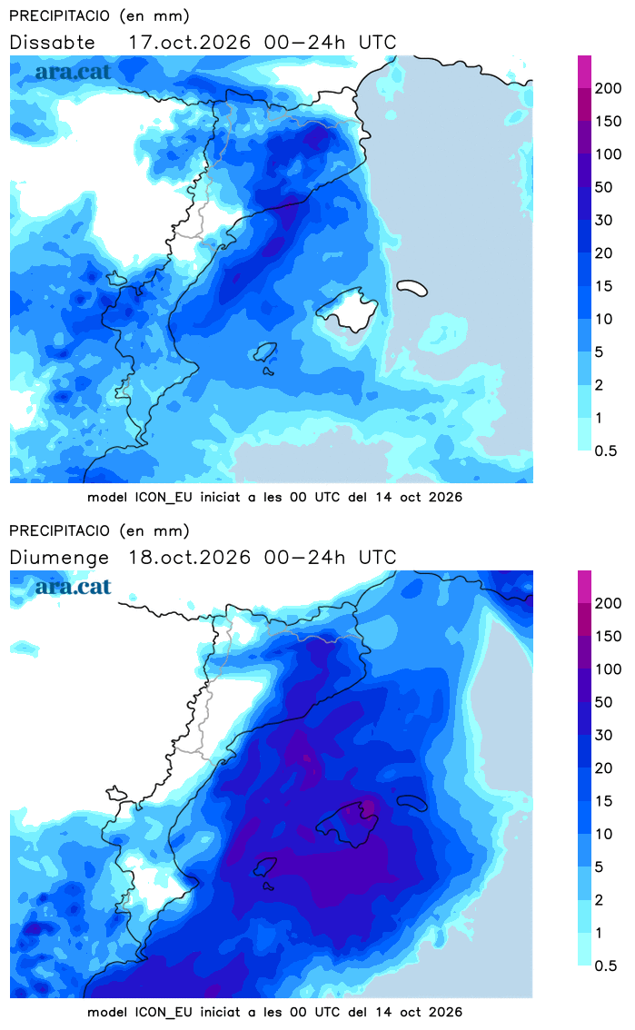
All of this will have to be followed very closely, as the situation is still uncertain. Everything will depend on the final position of the cold air pocket and the push of the maritime winds. The arrival of cold air will also cause a sharp drop in temperatures, with the return of full autumn weather starting from the weekend. It will also be necessary to see to what extent the snow level drops, as the snowfall could be significant in the high areas of the eastern Pyrenees.