At the end of the week a notable change of weather will arrive
The calm will dominate until then, with low clouds and fog in some places and fair weather


-
CAT -
CAST
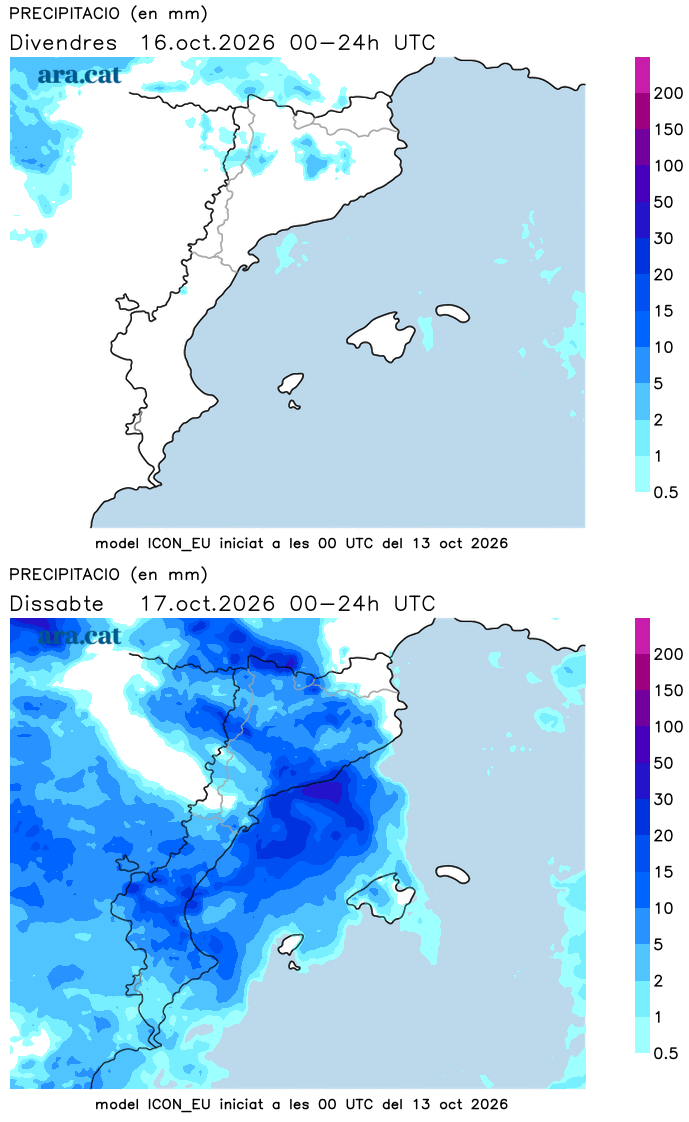
BarcelonaLow clouds and fog have been the protagonists this Tuesday in several regions, especially in the coastal, pre-coastal and Central Catalonia areas. There have even been some local drizzles in these areas. On the other hand, in the western half of the country, the sun has continued to dominate. Despite these two distinct types of weather, calm has been the protagonist in general, with temperatures that have remained between mild and warm. And this will be the trend for the coming days, with absolute tranquility. However, the maps are configuring a significant change in weather in the medium term that, starting from the weekend, will make precipitation reappear and will cause a notable drop in thermometers.

Wednesday: sun and low clouds
The weather will remain calm this Wednesday, but with low clouds and fog in many regions due to the high humidity. Perhaps the cloudiness will not be as dense and widespread as on Tuesday, but the sky will remain variable or partly cloudy at times in parts of Central Catalonia and the coast and pre-coast, especially the central one. The sun will prevail completely in the western half, in the south and in the Pyrenees.
All this with minimum temperatures that will drop slightly, although the night environment will remain between cool and mild, after a new late tropical night was recorded on Tuesday in the city of Barcelona. The maximums will be similar or will rise slightly, with many values from 23 °C to 27 °C, but locally 30 °C will be reached again in the Ebro valley.

Changes on weekends
Until Friday, calm conditions will prevail, with no rain anywhere and sunshine combined at times with some intervals of harmless clouds. Temperatures may even rise a little more on Friday. However, starting from the weekend, instability will increase as the anticyclone will be located over the British Isles, diverting storms to our latitudes and pushing maritime winds towards our region.
This will translate into precipitation, north wind at the extremes, and a clear drop in temperatures. A situation that may continue at the beginning of next week. All of this will have to be confirmed, but if the forecasts are met, we would be facing a new episode of rain and an atmosphere of late autumn. We will keep confirming it.