Alert in a large part of the country for new heavy downpours today
The weather will continue to be very unstable in our entire Mediterranean area

-
CAT -
CAST

Showers and storms are giving no respite, and today they will reappear in many regions. In fact, a large part of the country is on alert for this new wave of heavy rain that will take place mainly during the afternoon. In the morning there will be a break in the rain, although some initial showers will already fall in the south. Unlike recent days, the precipitation will arrive initially through the Ebre and Ponent areas, subsequently spreading towards the east and also reaching the coast, where some downpours will be repeated until nightfall. And the weather will not clear up in the coming days.
We find ourselves in a situation of marked instability in our Mediterranean area which, together with a sea that is very warm for the time of year, causes new downpours to appear and makes them more torrential than normal. The conditions are atypically almost tropical, and this means that uncertainty and the intensity of precipitation are the order of the day. A clear example is what happened yesterday, Monday, since the maps initially did not indicate a new episode of torrential rain on the coast and pre-coastal areas. Finally, a new mesoscale convective system was generated –a group of strong storms–, although it was not as extensive or intense as the one from the weekend.
The region most affected by yesterday's downpours was Vallès Oriental, with 107 l/m² accumulated in Granollers, where almost 350 have been recorded since the weekend. It is raining on wet ground, and all this means that flooding occurs quickly and that the flows of rivers and streams rise vigorously. Also notable are the 106 l/m² in the Vallcarca neighborhood of Barcelona, the nearly 80 in some neighborhoods of Badalona, or the 75 at the Fabra Observatory.

New showers and downpours
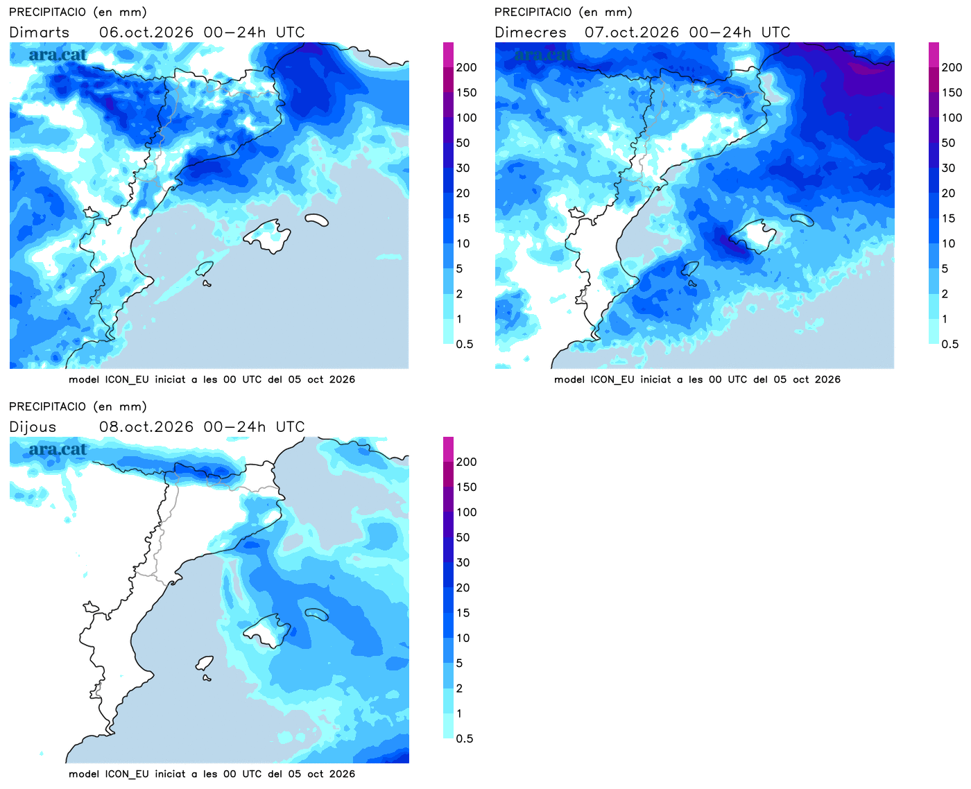
Looking ahead to this Tuesday, the morning will still be quite calm, although with many intervals of clouds, fog, and some initial scattered showers already in the south. It will be throughout the afternoon when the downpours and storms will regain ground irregularly. They will initially affect mainly points in the west, the south, and the Pyrenees and Pre-Pyrenees, but will eventually reach coastal sections. They may be strong and accompanied by downpours or other violent phenomena, which is why Meteocat keeps a large part of the country on alert for intense rain that could leave more than 40 l/m² in just half an hour. In many regions, the alert level is 4 out of six.
All in all with similar temperatures, although the maximum may rise slightly, especially in the northeast. Many values of 21 °C to 26 °C are expected, with the heat kept at bay.

Unsettled weather until mid-week
On Wednesday, downpours and storms will once again affect various points, especially in the northern half of the country, while on Thursday they will remain more concentrated in the northeast. In all cases, torrential downpours may occur again. It will also rain irregularly in parts of the Valencian Community—especially inland—and the Balearic Islands.
It is worth noting the uncertainty of the situation, which will mean that the forecast must be constantly updated, as the forecast can vary substantially within a few hours. All this with similar temperatures, awaiting the final stretch of the week to be calmer and clearly cooler.