All Saints' Day serene and windy at both ends of the country
Colder environment, waiting for general rains towards Tuesday

-
CAT -
CAST
BarcelonaThe night of the Castanyada will be calm, in general, with a lot of chill and a very autumnal feeling. However, in the south of the country some showers are being recorded that may be a bit bothersome during the coming hours. In l'Ametlla de Mar (Baix Ebre), the showers have accumulated 4.7 l/m2. Sunday, All Saints' Day, the sun will prevail and the mild weather will briefly intensify at midday. However, next week the maps are confirming an injection of cold air coming from central and eastern Europe that will bring us an advanced autumn atmosphere and more instability.

Chestnut Night
The night of the Castanyada is shaping up to be very peaceful, with increasingly clear skies, with the permission of the fog in the interior. In the evening, as we said, there will still be some showers in the Ebro, and during the night also in the south of the Valencian Country or in the Balearic Islands. Meteocat, in this sense, has issued a warning for heavy rain in the southern regions, valid until 1:00 a.m. on Sunday morning.
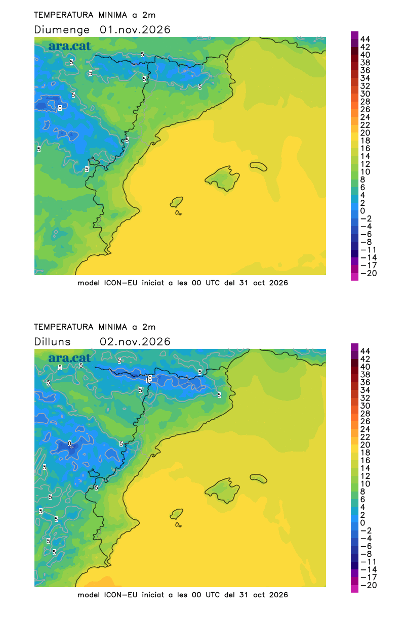
All this with night temperatures that will drop even further. It will be a cold night like the 'Castanyades' of the past, perfect for enjoying 'panellets', chestnuts, and sweet potatoes by the fire. Many minimums of 4 to 9 °C are expected in the pre-coastal area and inland, and below 15 °C on the coast. In the Pyrenees, there may be some light frosts. The mistral and tramontane winds will increase towards dawn in the Empordà and the Ebro regions.

All Saints' Day cold early on and clear throughout, with some fog
The instability will leave on Sunday, especially in the south, and sun and calm will prevail in general. It will be a day to take advantage of. Early in the morning it will be colder, but in the middle of the day the environment will be milder or, locally, a bit warm. Many highs of 17 to 23 °C are expected, and locally up to 25 °C in the regions of Tarragona. The Mistral and Tramontana winds will blow at both ends, especially in the Empordà, strengthening during the afternoon.

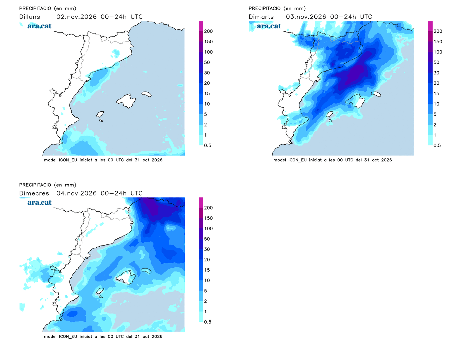
All of this will be short-lived, as at the beginning of next week an irruption of colder air arriving from central and eastern Europe will reach us. A cold air mass that will be channeled between the anticyclone located in central and northern Europe and a storm system located in the eastern Mediterranean.
Probably, this cold snap will have a maritime trajectory and will bring humidity that will cause precipitation to reappear, especially starting Tuesday, with snow at high and medium altitudes in the Pyrenees. All of this will have to be followed with attention and confirmed, but what is clear is that we will have to use jackets in the coming days, and surely coats in some areas.