Weekend under the indirect effects of the storm ‘Bruna’
They will be less bright days, but with little rain and temperatures that will be rising over the next few days


-
CAT -
CAST
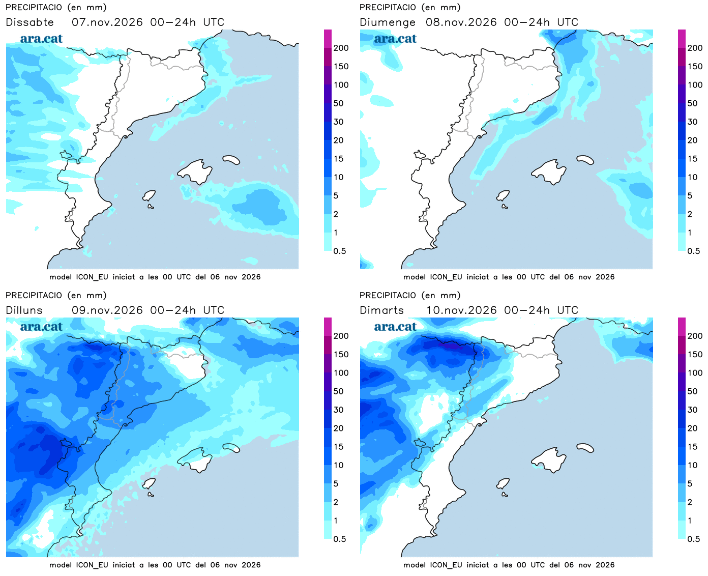
BarcelonaThe sun and the absolute calm of this Friday will not have much continuity in the coming days. Starting this weekend, we will be under the indirect effects of the great Atlantic storm Bruna, which will bring a lot of rain to the west of the peninsula. At home, however, very little water is expected for the moment. We will have a Saturday and a Sunday with a more changeable sky due to the presence of quite a few cloud intervals. But beyond some light rain or a very weak, local, and passing shower, no rain is expected. Temperatures will clearly rise starting Sunday, as the counter-clockwise turn of this storm –located off the western peninsular coast– will push warmer south-westerly winds towards us. Models indicate that next week could begin with an increase in instability.

Saturday: more clouds
Cloudiness will clearly increase this Saturday. The sky will be between variable and partly cloudy, even overcast at times in some cases due to the passage of these high and mid-level clouds. However, no rain is expected, in general. Only some light drops or a weak, local, and passing shower may occur. A less bright day, but with practically no risk of rain. Morning fogs will also repeat, which will again take hours to lift in the west.
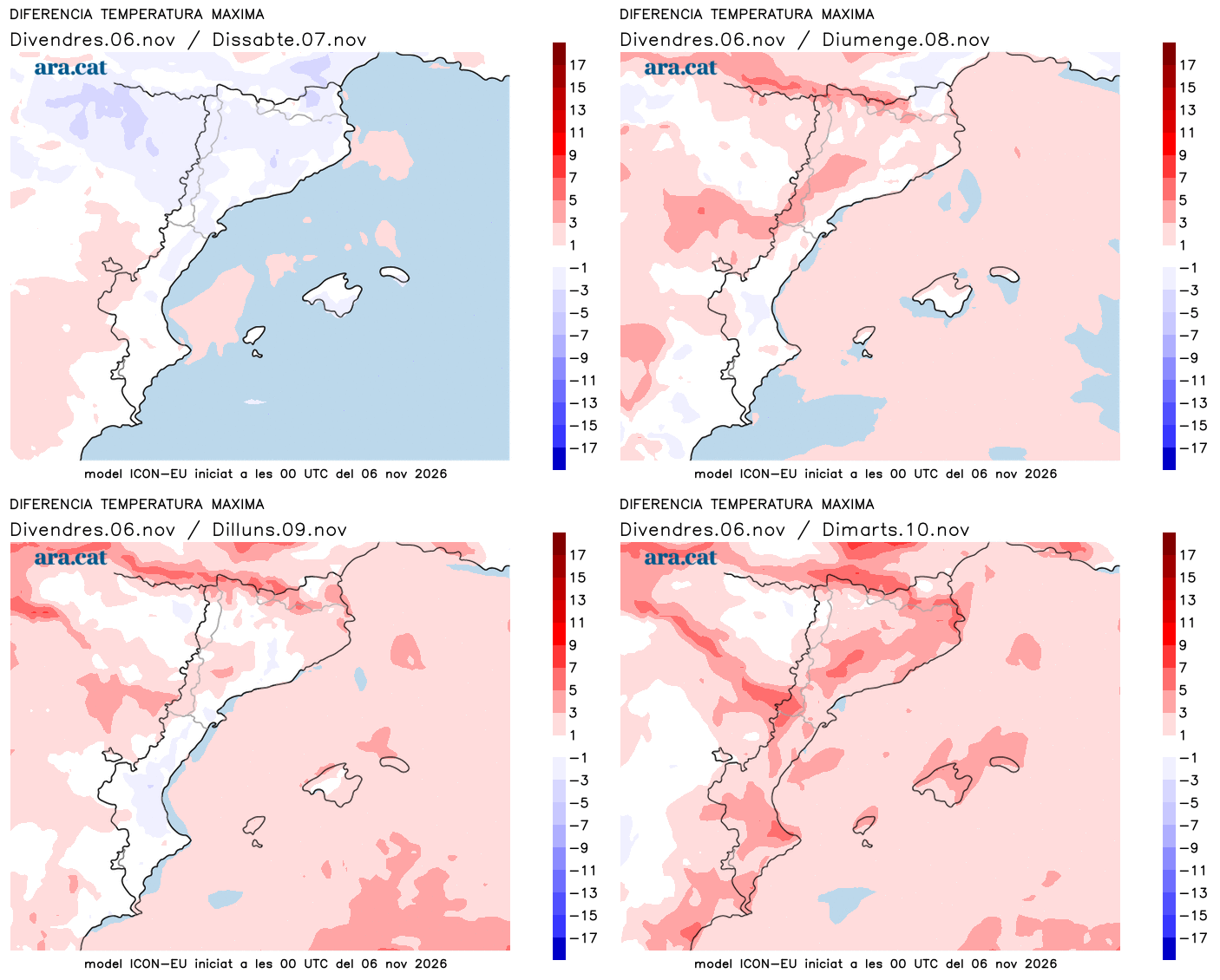
Minimum temperatures will rise slightly, but the cold atmosphere will remain early in the morning, with new frosts in the Pyrenees area. Maximums will drop slightly on a transitory basis, mainly due to the presence of clouds, which will prevent the sun's more direct heating. Many values of 13 °C to 18 °C are expected, slightly higher on the coast and in the south.
Sunday: without major changes
Throughout Sunday, bands of clouds will continue to circulate. The morning will likely be sunnier, but throughout the day the clouds will increase. A changeable sky that will not bring rain either, without ruling out some local drops. Temperatures will rise, both by day and by night, especially the highs, with a milder atmosphere at midday.
Little cold and more showers next week
The rise in temperatures will intensify at the beginning of next week, with little cold at night and great mildness at midday. Many highs of 17 °C to 23 °C are expected, but locally 25 °C may be reached in the Terres de l'Ebre and in parts of the coast. Values above the usual average for this time of year that will make the Saint Martin's summer feel real.
The maps indicate that the storm Bruna could affect us a little more and increase instability, with a risk of showers. An outcome still uncertain that will have to be confirmed, although, outside the Lleida Pyrenees, the rain would not be significant.