Some showers and autumn in its pure state at the gates of the Castanyada
The temperatures will continue to drop, and the instability will increase in some points

-
CAT -
CAST

The cooling was more evident yesterday along the coast and pre-coastal areas of Barcelona, and in the northeast, with between 2 and 4 degrees less than in previous days. Conversely, towards the southern interior of the country, temperatures still locally reached 25 or 26 ºC. A thermal drop that will accentuate even more in the coming days. We will arrive at the Castanyada and All Saints' Day weekend with a full autumn atmosphere: nights will be cold and midday periods between cool and mild. All of this will be the result of the arrival of cold northeast winds coming from Eastern Europe, which, at the same time, will increase instability. Some showers are expected in parts of the Ebro, the northeast, the Balearic Islands, and, especially, the Valencian Community.

Friday: more instability
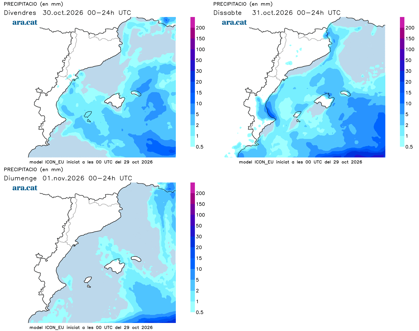
Cloud intervals will increase this Friday in many regions. The morning will even be cloudy in some points of the center, the south, and Ponent. There will also be a lot of fog inland until mid-morning. On the other hand, the sun will prevail over most of the Pyrenees, the Pre-Pyrenees, and the northeast, and will gain ground in the afternoon in more areas of the northern half of the country in the afternoon. Throughout the day, some scattered showers will appear in the Terres de l'Ebre and nearby areas, such as the mountains of Tarragona. At the last minute, some may also reach the Costa Brava.

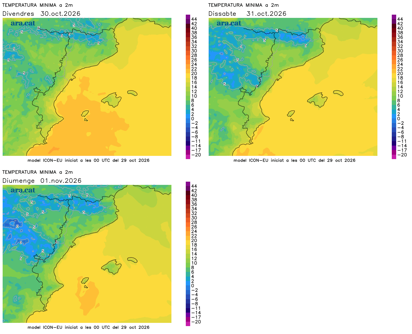
In addition, there will be irregular showers in the Valencian Community and the Balearic Islands, with some isolated storms, such as in the Pityusic Islands. Winds will range from northeasterly to easterly, which will accentuate the feeling of coolness. Minimum temperatures will be similar or will rise in the south, with morning coolness or cold. Maximum temperatures will drop slightly, with many values from 17 to 23 ºC, and higher in the south.
Chestnut festival like those of the past
Temperatures will drop a little more on Saturday, and there will be a cool to mild atmosphere during the day. Castanyada night will be quite cold, like those of old, something that does not usually happen lately in the context of the global warming we are experiencing. Lows will range between 3 and 8 ºC in most of the pre-coastal and inland areas, and below 15 ºC along the entire coast. In the Pyrenees, there could be some weak frosts.
During the day, many highs will range between 16 and 21 ºC –a little higher in the southern interior–, while on Sunday they will rise slightly in a transient manner. All this with variable skies on Saturday, with a risk of scattered and short-lived showers in the northeast, in the Ebro region, and in the Balearic Islands. In the Valencian Community, the rains may be more significant, especially between Valencia and the north of Alicante. On the other hand, sun will generally dominate on Sunday.
The maps maintain that next week we could receive an injection of even colder air coming from central and eastern Europe, with an environment that will be even like late autumn with a risk of new rainfall. A still uncertain forecast that we will have to specify as we go.
