Without significant rain in sight, but full autumn weather
Only local showers will escape in some places, and temperatures will continue at bay

-
CAT -
CAST
BarcelonaAfter some local and minor showers in the northeastern regions between yesterday afternoon and this early morning, no precipitation is expected anywhere today and it will be a calm day. However, the tail end of an Atlantic front is crossing us, which will cause the sky to be more variable overall and the weather to be cooler. In fact, this morning we woke up to colder temperatures in most regions, and even with frosts that have gained ground in the Pyrenees. No significant new rain episodes are expected in the coming days. The weather will continue to change, with little rain but with intervals of clouds that will come and go. Temperatures will experience ups and downs and will be kept in check, with a full autumn atmosphere and cold nights.

Thursday: more clouds and cooler
The weather will undergo some changes this Thursday. The passage of a frontal tail will increase intervals of high and medium clouds throughout the day. The sky will be more variable, and even overcast at times in the Pyrenees and nearby areas. But no rain is expected, without ruling out some very local and isolated drops in the northeast of the country.
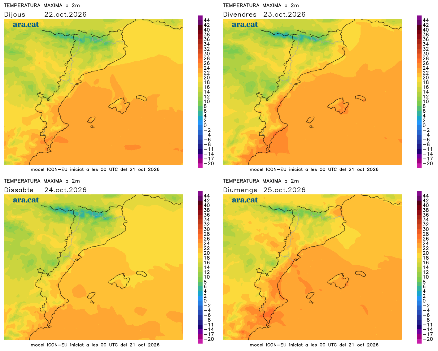
However, temperatures will drop. Minimums have already generally retreated, especially in the southern half, and have only risen slightly in areas of the northeast. A large part of the country wakes up below 10 ºC, and only on the coast is this value reached or exceeded. There are inland areas that have recorded minimums below 5 ºC, and in the Pyrenees there are frosts, especially at high altitudes. Cold atmosphere early in the morning, it is necessary to bundle up. The drop in maximums will be quite widespread, with a cooler atmosphere and many values between 15 and 20 ºC. Moderate mistral and tramontana wind until mid-morning in the north of Empordà and in the Ebro.

Few important changes
On Friday, the north wind will strengthen again and the sun will return to dominate most regions, although some local afternoon showers may break out in the Pyrenees and the north of the Girona regions. Temperatures will rise temporarily, but will drop again on Saturday, with an even cooler and more autumnal atmosphere.
Some meteorological models indicate that on Saturday some showers could reactivate in the Girona and Barcelona regions, as well as in the Pyrenees. But this is not at all clear yet, and in any case it would not have continuity, as Sunday would be a mostly quiet day. We are heading towards a 'Castanyada' that, unlike in recent years, seems that it will record temperatures typical for the time of year.