The historic rain storm continues to discharge in the northeast of the country
A large storm system has left accumulations close to 300 mm

-
CAT -
CAST
BarcelonaThe red alert remains activated due to the episode of torrential rain in the coastal, pre-coastal and northeastern regions of the country. An extraordinary convective mesoscale system has generated torrential rains, especially in the pre-coastal and central coastal areas, with accumulated amounts until 10 a.m. this morning of 288 l/m² in Vilassar de Mar, 255 l/m² in Mataró (Can Canyelles) or 248 l/m²in Granollers. Ultimately, the medicane (Mediterranean mini-hurricane) did not form, but, as the models indicated, the accumulated rainfall amounts have been historic. Notable are the 68 l/m² that fell this morning in just half an hour in Granollers, a figure of extraordinary torrential intensity. In Pineda de Mar, several rescues were carried out in ground floor homes and vehicles submerged by water, and in the city of Barcelona (Can Bruixa), the record for accumulated precipitation in 24 hours (data since 1914) was broken, with a total of 202 l/m².
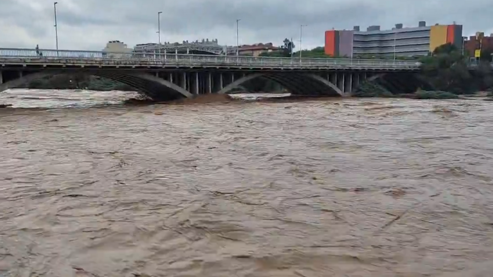
The torrential nature and the exceptional amounts accumulated in a few hours have caused the flow of the Besòs river to reach 936 m³/s in Santa Coloma de Gramenet, far above the more than 500 reached during the Gloria storm. To get an idea, the flow of the Besòs is carrying three times more water than the Ebro river. Early this morning there is a hydrological alert for possible overflows in the Besòs or the Tordera, where, unfortunately, there has been a fatality. Another person has lost their life in Montornès del Vallès and there is another person missing near the Pineda stream.
Meteocat has updated the data for the accumulated rainfall during this episode (until 10 a.m.):
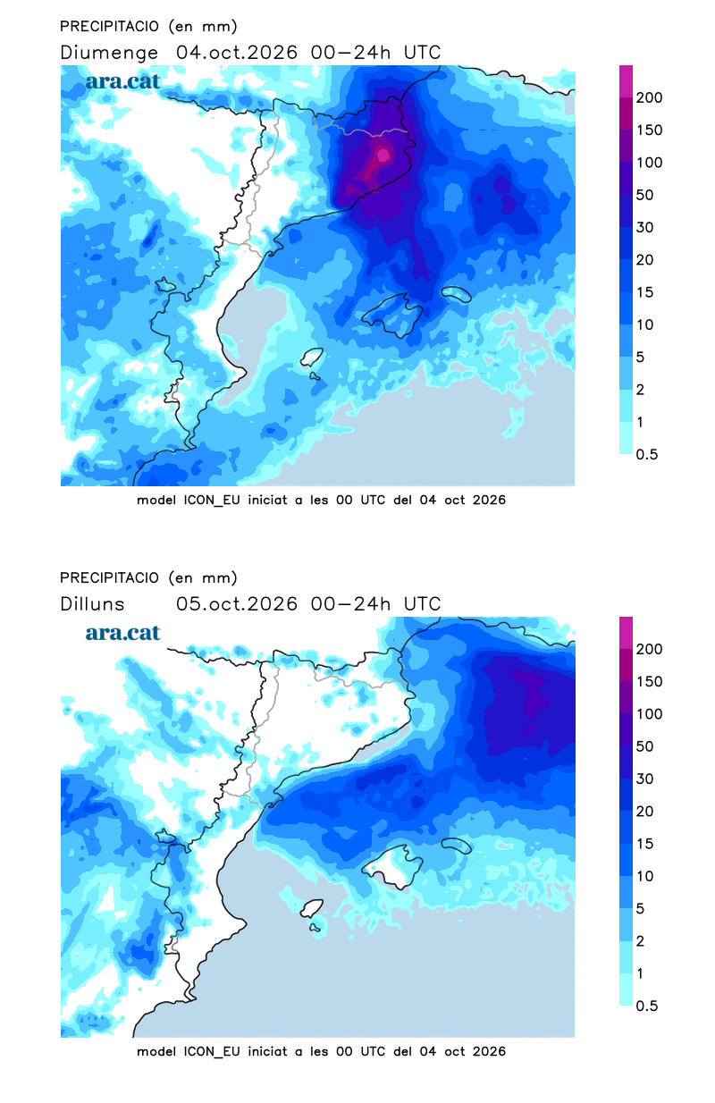

With current maps, rainfall will continue to be intense and extraordinary in the northeast, the north coast, and the pre-coastal area of Barcelona, with significant local accumulations in a few hours. Meteocat alerts are for intense rain and accumulations of more than 40 l/m² in half an hour, 90 l/m² in three hours, and more than 200 l/m² in 24 hours. After a morning with downpours, the rain will continue to discharge with intensity between the Barcelonès and the Empordà, also affecting the Girona regions, especially on the Costa Brava and the north of the Maresme.
This situation of marked instability is typical of autumn, aggravated by a sea much warmer than it should be at this time of year. This year, records for the average sea surface temperature in the Mediterranean have been registered, reaching 28.6 °C on August 14 (data from Copernicus Marine Service, @CMEMS_EU). In Catalonia, the sea has reached its highest recorded average temperature this summer at 21.1 ºC.
During the afternoon the disturbance will move towards the northeast of the country and the rain will concentrate in the easternmost Pyrenees and Pre-Pyrenees. At the end of the day, the downpours will be focused on the northern coast and pre-coastal areas.

Unsettled start to the week, with new showers
We will start the week with clearings, especially in Ponent and in the south. On Monday at midday, clouds will grow again and some scattered showers will fall. On Tuesday, thunderstorms will reactivate in the north and also in the Ports de Tortosa. It will not be completely clear until the end of the week, and temperatures may rise a little but, in no case, do they intend to drop.
