Some changes due to the passage of worn-out Atlantic fronts
Sun combined with the passage of intervals of clouds, but with little risk of rain and an autumn atmosphere

-
CAT -
CAST
BarcelonaBoth today and in the coming days, the weather will remain changeable, as, although high pressure and sun will dominate, we will continue to be under the indirect effects of some Atlantic fronts. In short, the sky will continue to undergo changes, but with very little rain in sight. Today, for example, will be a fairly sunny day, but between the evening and dawn, some showers will reappear. Temperatures will experience new rises and falls, but will always remain in check.

Friday: more sun and mildness
The sun will return to dominate in general this Friday, with the permission of some decorative brushstrokes of thin clouds, much scarcer than on Thursday. But the approach of a new worn-out Atlantic front will cause an increase in cloud intervals in the Pyrenees and the northeast during the afternoon, where some local and scattered showers may escape. Some isolated downpours that will be more likely during the evening and night in the regions of Girona, and in the early morning they may reach the central coast. Furthermore, late in the day, precipitation will arrive on the north face of the Pyrenees, where the snow level may drop at night to 1,800 m.
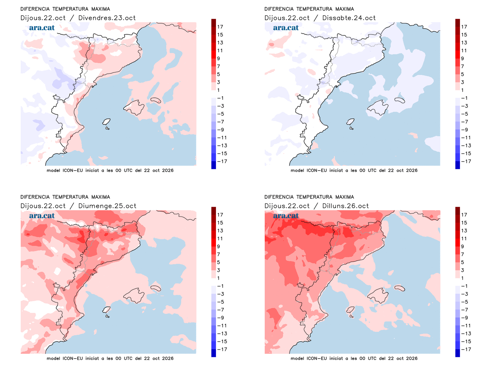
All this with temperatures that will rise, both day and night. The minimums have not dropped as much as yesterday, although the moderately cold environment is maintained first thing in the morning. Midday will be milder and many maximums will oscillate between 17 °C and 23 °C. An increase that, in part, will be thanks to the westerly wind, which in the middle of the day will blow moderately again in many points of the center and south of the country. In addition, the mistral and the tramontane will strengthen again in the Ebro and the north of the Empordà.

Quite a productive weekend
The weather will continue to change over the weekend, but with little risk of rain. Saturday will again be a day with more intervals of high and mid-level clouds, but beyond some remains of an isolated shower or sprinkles on the north face of the Pyrenees and in the northeast, no precipitation is expected. The north wind will blow at the ends of the country. Sunday will generally see sun prevail, and in the evening new showers will arrive on the northern Pyrenean face.
Temperatures will drop again on Saturday, with cooler conditions overall. But on Sunday thermometers will climb again, with more mildness. Be that as it may, the coming days will maintain the usual values for the season, with cold nights and mild afternoons, also heading into the All Saints' holiday. No significant change in weather is seen in the medium term.