Radical change of weather: alert for intense rain, winter cold and snow
Temperatures will plummet on Tuesday, with values clearly lower than those usual for this time of year

-
CAT -
CAST
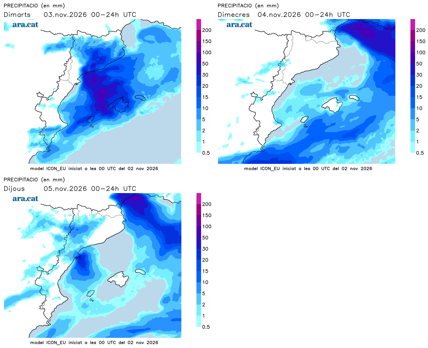
BarcelonaThe weather has started to undergo changes this Monday. The atmosphere has been clearly cooler in general, and cloudiness has been present in many parts of the coast and the pre-coastal area, where from this evening the first showers are expected. During the evening, the night and the early morning, the rain will increase along the coast and pre-coastal area of Barcelona and Tarragona and nearby zones, and locally there may be some downpour accompanied by hail. Meteocat has activated the alert for intense rain that may leave more than 20 l/m² in just half an hour or more than 60 l/m² in three hours in these sectors until Tuesday.
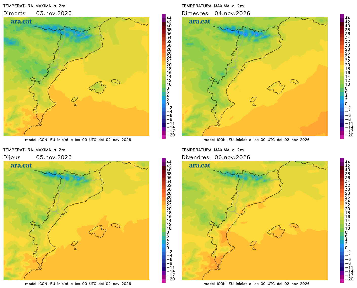
All of this will be the starting point for this new and important change in the weather, which for this Tuesday will bring a sudden drop in temperatures and even more instability. A cold day is expected in general, with an atmosphere more typical of late autumn or early winter. You will need to bundle up well. Rain will fall in many regions, and the snow level will plummet in the Pyrenees. The injection of cold air coming from Eastern Europe will leave values between 4 and 8 degrees below average. Over the next few days, thermometers will gradually recover, with calmer weather.

Tuesday: cold, rain and snow
The intense downpours from the night on the coast may still repeat on Tuesday, especially in the morning around the Camp de Tarragona. Cloudiness will be abundant in a large part of the country all day, with grey skies in many regions and a risk of precipitation that, in general, will be between weak and moderate, occurring intermittently. Even so, one cannot rule out some sudden downpour in points of the coast and the pre-coast. It will also rain in many parts of the Valencian Community and the Balearic Islands, with a risk of some heavy rain in the south of Valencia, Alicante, Mallorca, and the Pityusic Islands.

The snow level will plummet in the Pyrenees down to 1,500 m or slightly below. The snowfall will mainly affect the southern slope, with accumulations of 5 to 15 centimeters at higher altitudes, although these figures may be exceeded in some spots. Therefore, the most significant snowfall of the autumn so far could occur at mid and high altitudes in the Pyrenees.
This drop in the snow level will be the result of the plummeting temperatures. A cold and practically wintry day is expected, with the highlight being the injection of cold air. Many maximum temperatures will range between 10 and 15 ºC, but the cold will be even more intense in mountain areas, with below-zero values all day at high Pyrenean altitudes. The north wind will be particularly noticeable in the Ebro and Empordà regions.
More calm in the coming days
On Wednesday, the sun and calm will return to dominate, while waiting for some weak precipitation to potentially arrive from the west on Thursday. Over the next few days, the anticyclone in northern Europe that caused the arrival of cold air will move again, and this will cause us to return to a dynamic of Atlantic fronts and milder weather. Therefore, calm will prevail, with changeable skies and little significant rain in the medium term. Temperatures will gradually recover and normalize.