Increase of clouds on the coast and general thermal drop
Thermometers on the way down and rains starting Tuesday

-
CAT -
CAST
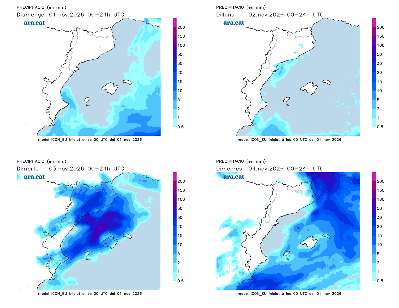
BarcelonaWe will start the week with an anticyclone, but with some nuances. The arrival of a cold air mass from the interior of the European continent will cause the weather to change in our territory. While we will enjoy a stable day in the west of the country, on the coast and in the pre-coastal area the day will be determined by an increase in cloud cover. As the hours go by, there will even be some drizzle or a few showers, and by Tuesday the rain could become widespread, starting in the south and on the coast, to then spread towards the north.

Monday with more clouds in the south and the eastern half of the territory
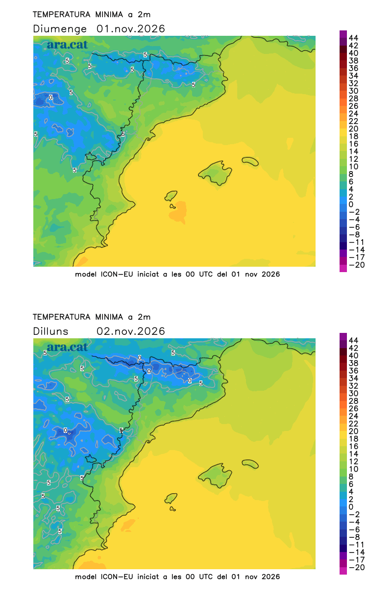
The morning will begin with sun in the interior and in the Pyrenees, with the exception of the plains of Ponent and Central Catalonia, where fog will keep the atmosphere overcast and humid. At first light, a cold atmosphere will be felt, especially in the Pyrenean valleys, where values between 0 °C and -2 °C will be recorded. On the Costa Brava they may drop to 6 or 7 °C and in parts of the central coast they will move around 10 °C and 12 °C for the minimums. The thermometer will recover at midday but will not rise beyond 19 °C. Many highs of 15 °C to 18 °C are expected, and locally up to 20 °C in the regions of Tarragona or in the Empordà. The Mistral and Tramontana wind will blow at both ends of the country and will ease during the afternoon, turning to south or south-east.

During the afternoon, some showers may fall on the coast or in the pre-coastal area, although they will generally be weak. The sea will remain rough, with swells or heavy swells. In the west or in the Vic plain, the fog will break up, but the low clouds will not disappear.
Rainy and colder Tuesday
On Tuesday, an irruption of colder air arriving from central and eastern Europe will reach us. A cold air mass that will be channeled between the anticyclone located in central and northern Europe and a low-pressure system located in the eastern Mediterranean.
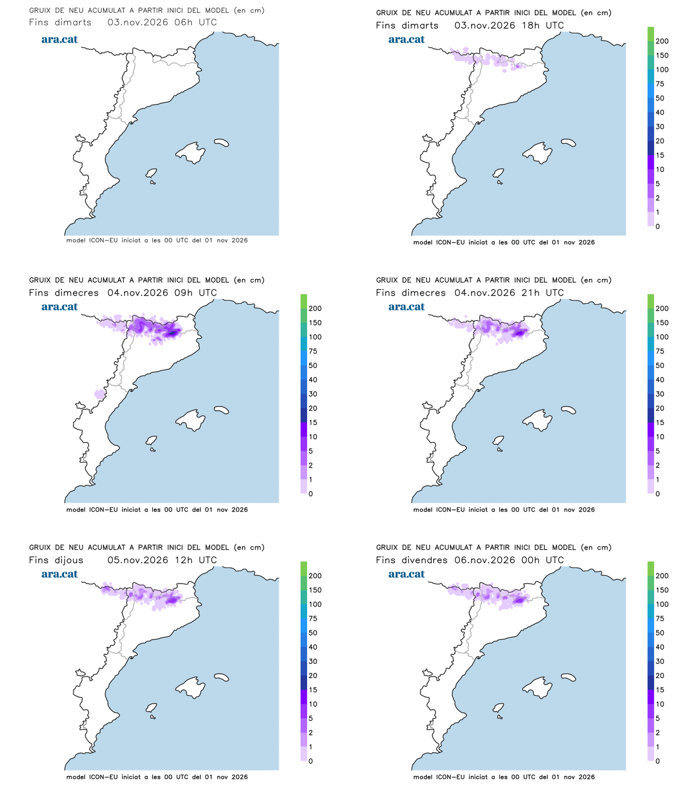
This cold air influx will have a maritime path and will bring enough humidity to reactivate precipitation, especially starting Tuesday, with snow at high and medium altitudes in the Pyrenees. The snow level will start at 2,000 m but will drop rapidly to 1,500 m. The easternmost Pyrenees could be well dusted with snow. Between Tuesday afternoon and Wednesday, 5 to 10 cm could accumulate at 2,300 m.
We will have to follow this episode closely, but what is clear is that we will have mid-autumn temperatures and unsettled weather.