More morning cold, mid-days of full autumn and changing weather
No new episode of rain is expected, but there will still be some local showers

-
CAT -
CAST
BarcelonaCalm has prevailed in most regions in the last few hours, following the rainstorm of the last few days, which has been historic, record-breaking, and tragic in the south of the Valencian Country. Nevertheless, yesterday some afternoon showers were repeated in the Girona regions that left, for example, 14 l/m² in Vilablareix (Gironès). And this morning, above all, what we notice is colder weather, as with a clearer sky, thermometers have been able to drop more at night. It is necessary to dress warmly to leave the house early in the morning. Both today and in the coming days, no new major storms are expected in our area, although the weather will remain changeable and, despite the sun dominating, some local showers will still occur. The atmosphere will remain in full autumn mode.
The rain episode has moved in the last few hours to northwestern Italy and the Mediterranean coast of France, where several records for rainfall intensity have been broken due to heavy torrential downpours. Data that certify the serious effects caused by a sea that is much warmer than it should be in autumn. In Catalonia, various points on the coast and the pre-coastal area -especially the central one- already accumulate between 200 and 400 l/m² this month of October, in some cases more than half of what rains in a whole year. Between Saturday and Tuesday, many municipalities registered between 20 and 50 new l/m², but in points of the coast and, above all, in the eastern Pyrenees and Pre-Pyrenees, more than 100 l/m² were exceeded.

Wednesday: quite calm, with nuances
The weather will remain calm in most regions today. Plenty of sun in general, with the permission of some decorative brushstrokes of thin clouds. However, in the afternoon, clouds will grow again, which will leave some irregular showers in the Pyrenees, the regions of Girona, and the north of Barcelona. In general, not much, but between the evening and dawn, some very local, more intense downpours may appear on the central coast, which is why Meteocat has activated a yellow alert for heavy rain in some coastal regions.
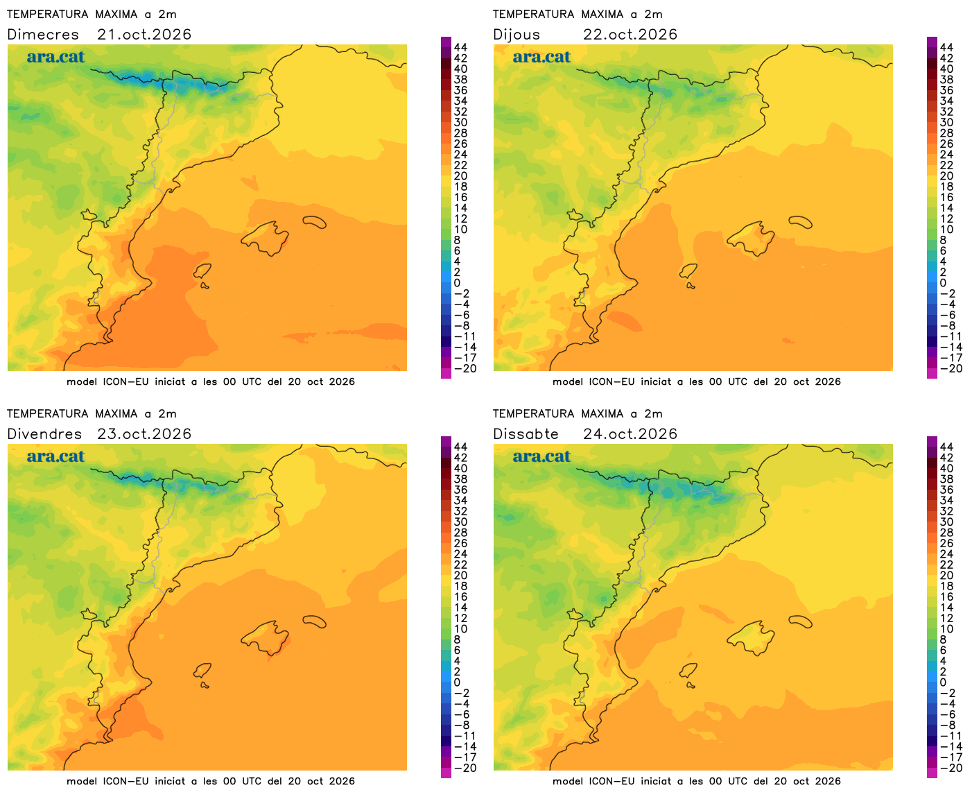
All this with minimum temperatures that have clearly dropped, as the night has been clear. Many minimums of 4 to 9 ºC have been recorded in the interior and in many parts of the pre-coastal area and the northeast, from 0 to 5 ºC in the Pyrenees and from 10 to 15 ºC in a large part of the coast and in the south of the country. The highest ones at both ends, due to the wind. In the early hours, a jacket is essential to leave the house. The maximums will rise in the northeast and fall in the Pyrenees, but in the rest they will remain similar. Many values will move between 16 and 22 ºC, locally higher in the south. Mistral all day in the south, strong tramontane in the afternoon in the north of the Empordà and moderate westerly wind in many regions in the middle of the day.

Few important changes in the coming days
On Thursday temperatures will drop and there will be more cloudy intervals, while on Friday the sun will return to dominate. Beyond some local showers in the Pyrenees and in the northeast, no rain is expected, and a north wind will blow that will leave on Thursday but will return on Friday. No significant rain is in sight, the sky will be changing and the atmosphere will be even more autumnal over the weekend.