Temperatures begin to drop after the heat peak
In the next few days we will recover the usual temperature for the time of year and the sky will no longer be totally clear everywhere

-
CAT -
CAST
BarcelonaThe little summer reached its peak yesterday, with an atmosphere clearly too warm for the season that left many maximums of 21 to 26 ºC, but locally these figures were exceeded in Priorat and the Ebro valley, reaching 27 ºC. Unusual values for the end of October, with up to five degrees above the average. But this mass of warm air will be leaving starting this Wednesday, with temperatures that will be dropping and normalizing completely throughout the week. Calm will continue to dominate, but some changes will begin to appear. We will arrive at the Castanyada with an atmosphere usual for the time of year: at night it will be cold, and at midday it will no longer be hot.

Wednesday: first changes
During the early morning hours, a few light drizzles may escape on the north face of the Pyrenees and between the coast and pre-coastal areas of Barcelona and Tarragona. Not much, but altogether it will mean that in these areas there will be more cloud intervals during the morning, especially low clouds. There will also be many morning fogs and low clouds inland and in the pre-coastal areas.
Throughout the day, the sun will dominate in most regions, but in the afternoon, low clouds will remain and cloudiness will grow between the counties of Barcelona and especially Girona. A localized drizzle or very local shower cannot be ruled out in the northeast interior, especially in mountain areas. The tramontane wind will blow all day in the Empordà, and the mistral only in the morning in the Ebro area.

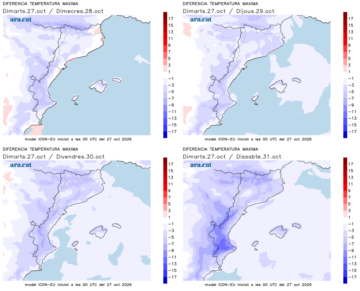
Regarding temperatures, the minimums have risen, with much more moderate cool air early in the day, while the maximums will begin to retreat. The drop will be evident inland and in the Pyrenees, but near the sea this thermal change will not yet be very noticeable. Many maximums of 19 to 24 ºC are expected, a little higher in the southern interior.
Pending further changes
During the second half of the week, the anticyclone will be located further towards central and northern Europe, which will allow for the entry of colder northeasterly winds into our region. This will cause a more pronounced drop in temperatures. Therefore, during the Castanyada and All Saints' Day weekend, we can expect cold nights and afternoons that are between cool and mild.
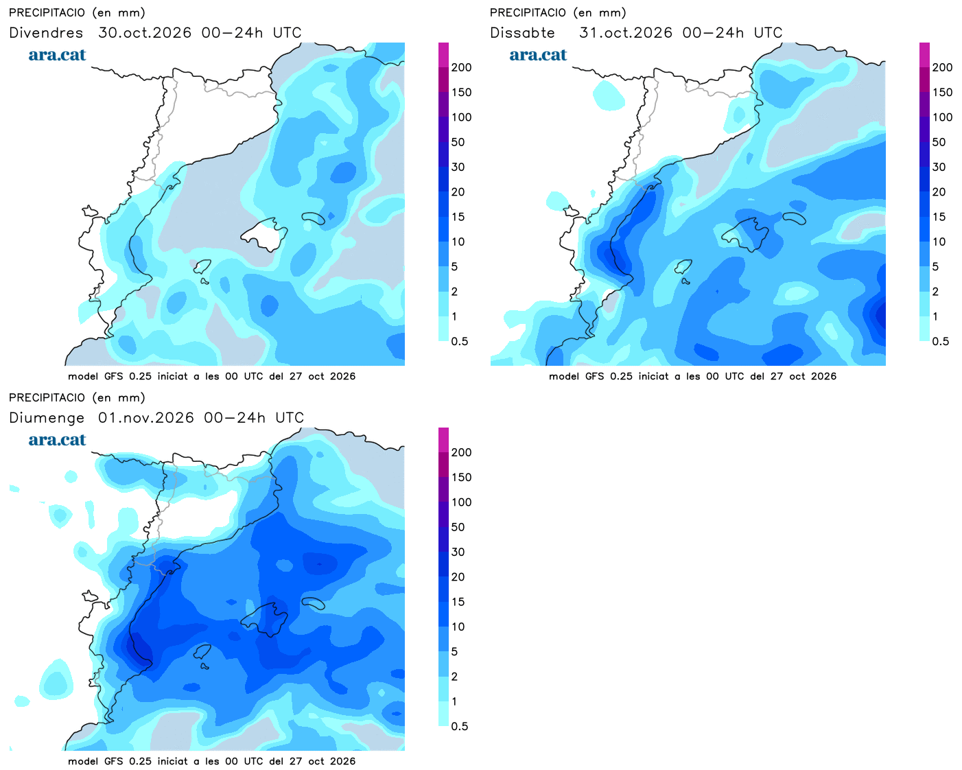
But instability will also increase, as cold air at high altitudes will be accompanied by maritime winds in the Terres de l'Ebre, the Valencian Community, and the Balearic Islands. Precipitation is expected in these areas. Current maps indicate that the weekend could be rainy, especially in the Valencia area, with locally abundant rainfall. A situation that will need to be confirmed. In any case, a full autumn atmosphere is guaranteed for eating chestnuts and panellets by the fire.