Catalonia suffers a new day of floods due to the torrential rains
Firefighters rescue about twenty people trapped by water in the Terres de l'Ebre
-
CAT -
CAST
BarcelonaTorrential rains continue to affect various parts of Catalonia. This Tuesday, the forecast for new downpours has put the entire coast on alert, from the Terres de l'Ebre to the Gironès. Once again, several roads have become impassable due to accumulated water, and images of firefighters rescuing people trapped by water inside cars have been repeated. The forecast is for the storm to last until after midnight and to affect the coastal, pre-coastal, Pyrenees, and western Pre-Pyrenees regions with varying intensity.
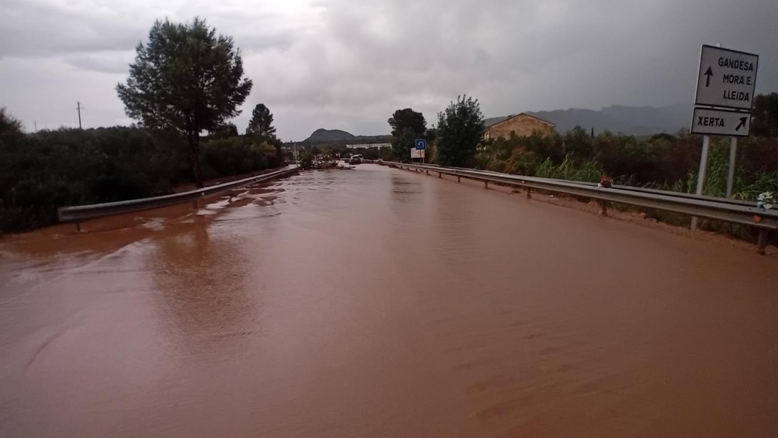
The first damage occurred in Xerta, in the Baix Ebre. The torrential downpours in the Terres de l'Ebre have left more than 40 l/m² in half an hour. The Minister of Interior, Núria Parlon, explained that in Xerta, the Generalitat Firefighters rescued eighteen people trapped by the water. They also assisted two in Vandellòs and two more in Cambrils.
Finally, the ES-Alert warning has also been extended to Granollers. In the Vallès Oriental region, the passage of these new storms has kept the municipalities that were already punished by the downpours on Monday on alert. As a preventive measure, the town councils have suspended cultural and sports activities and classes during the afternoon. In fact, this Tuesday in Granollers, repair work for the damage caused on Monday continues, as does the search for a twelve-year-old minor. Repair work also continues in Pineda de Mar.
"New scenario" starting Wednesday
Minister Parlon has specified that the storm may last until past midnight and has asked to avoid flood-prone areas. Looking ahead to Wednesday, Parlon explained, torrential downpours are not expected, but there will be rain. "We must not let our guard down, but it seems they will be less intense," noted the head of Forecasting at Meteocat, Santi Segalà, who has predicted "a new scenario" starting Wednesday.
The new round of showers and storms this afternoon is occurring in an atmospheric situation different from that of recent days. Until now, the Mediterranean has been the great driver of the rains, with humid easterly winds and water warmer than normal that fueled the strong storms, with the formation of significant mesoscale convective systems that left extraordinary downpours between the weekend and Monday on the coast and pre-coastal areas. In contrast, this Tuesday the main impulse is arriving from the Atlantic. A pocket of cold air located in the western peninsula has increased instability, with the formation of showers inland that have swept across the country and reached the coast.
The latest episodes had a permanent contribution of humidity from sea to land, which allowed storms to strengthen on the Catalan coast and, in some cases, to regenerate over and over again over the same areas, with static and extraordinarily torrential downpours. Now the engine is mainly the Atlantic disturbance: the rains can be equally strong and leave localized downpours, but with a different dynamic, as they will move more quickly from southwest to northeast, and not from sea to land. Even so, when the precipitation reaches the coast and clashes with the humidity and maritime heat, they may gain intensity, which is something that usually happens in autumn in our region. The showers have already begun to fall in the west and south, locally with vigor.
