Temperatures will continue to drop on a stormy Wednesday.
The maximum temperature will be more restrained everywhere, with highs between 25 and 30 °C.
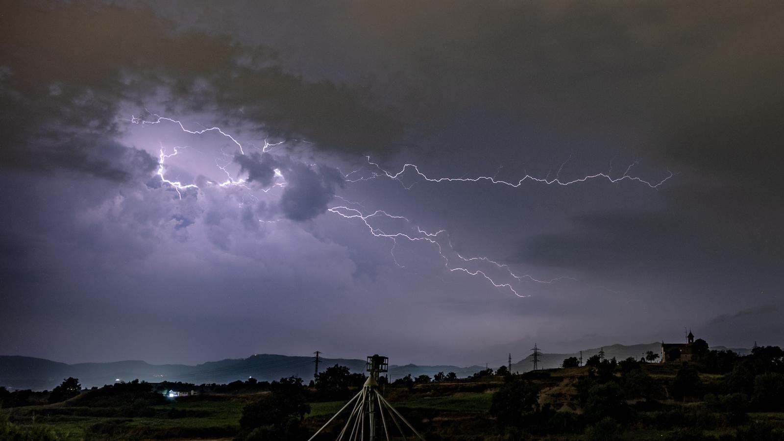

BarcelonaThe heat wave is now history, and the focus now shifts to the arrival of cold air from above, which has already brought some intense storms on Monday and Tuesday afternoons. This situation has been repeated this past night, and Wednesday will be unstable, with scattered showers that will be locally intense and will contribute to an even more pronounced drop in temperature. Temperatures will therefore fall far short of the levels reached a few days ago (more data on the heat wave and storms is available at the end of this report).

Wednesday: showers also on the coast
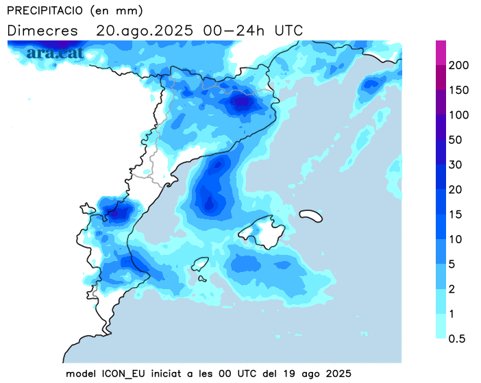
By Wednesday, temperatures will return to normal, and the drop in temperature will be marked, especially at midday, although during the early hours there will also be a significant difference compared to Tuesday. During the morning, a band of showers will cross the country from west to east, locally accompanied by thunderstorms, but it will be during the afternoon that showers and thunderstorms will occur in the Pyrenees, the Pre-Pyrenees, and the regions in the eastern half of the country, which will also reach the pre-coastal region and some coastal areas. The atmosphere will be clearly cooler, with highs ranging between 26 and 28°C on the coast, 27 to 31°C inland, and 18 to 23°C in the Pyrenean valleys.
In this regard, the Catalan Meteorological Service maintains a warning of danger for intense rainfall, covering the regions of Ripollès, La Garrotxa, Osona, La Selva, Vallès Oriental, and the coastal stretch between Maresme and Montsià. In these regions, more than 20 mm of precipitation could fall in one hour, and the showers could be accompanied by thunderstorms and hail.
Showers will persist for several days.
On Thursday, rain will be restricted to the northeast, with locally intense thunderstorms, and on Friday, it will be virtually dry. Temperatures will stabilize by Thursday, with mild temperatures during the middle of the day and even cool in some areas during the evening hours.
Heat wave and storm assessment
The heat wave we've experienced in the country during the first two weeks of August has been intense and long-lasting, with many days of exceptionally high temperatures throughout the country. In fact, Sunday was the 16th day this summer on which the Meteocat Automatic Meteorological Station Network reached or exceeded 40°C, making 2025 the year with the most 40°C days on record in Catalonia. These are some of the notable highs from the episode:
- 43.8°C: Vinebre and Benissanet
- 42.4 °C: the Masroig
- 42.3 °C: Ribarroja Reservoir
- 42.2 °C: Ascó
- 41.8 °C: Lleida - La Fenosa and Torres de Segre
- 41.7 °C: Aldover and Limiana
- 41.6 °C: Albesa and Tremp
The arrival of cold air from high altitude caused the first widespread showers on Monday afternoon, locally accompanied by thunderstorms and hail or stones. The most notable rainfall was 77 l/m² in La Seu d'Urgell, 68 l/m² at Lake Redon in the Aran Valley, 44 l/m² in Espot (Pallars Sobirà), and 29 l/m² at the Queralt sanctuary (Berguedà). During the second half of Tuesday, the rain was again concentrated in the western Pyrenees, with 52 l/m² in Sort, 37 l/m² at Lake Redon, and 33 l/m² at Pont de Suert.
During the early hours of Thursday, the rain has been intense in the same regions of the northern half of the country, accumulating 42 l/m² in Guixers (Solsonès), 33 l/m² in Lladurs, also in Solsonès, and 31 l/m² in Oliana, in Alt Urgell. All of this means that in some places the rainfall has exceeded 100 l/m² in just three days.
