Sunday with sun, light winds and some showers in the evening
The thermometer will rise to the northeast, with the garbinada
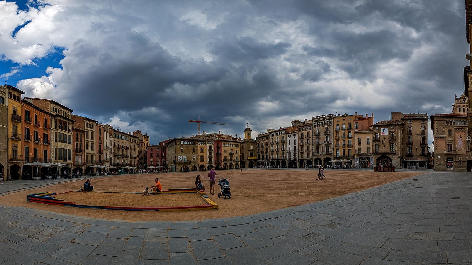

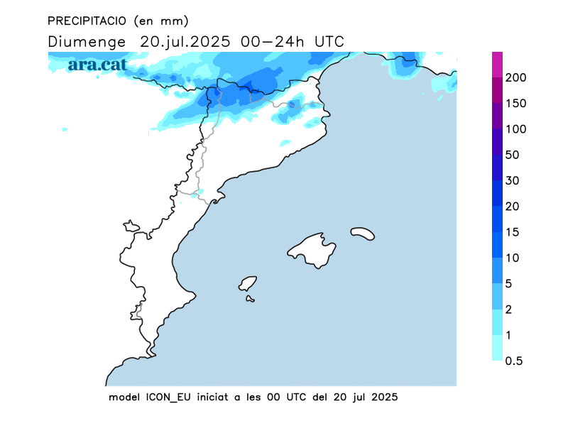
BarcelonaThe approach of a new front will increase cloud cover today, especially in the Pyrenees and the west, in the evening. Yesterday, Saturday, an early front brought a few showers and thunderstorms (you'll find a list of accumulated rainfall at the end of this article). In principle, this Sunday will be more sunny, but it won't clear the air completely. Showers will recur in the afternoon and evening, and they may reach more regions by the middle of next week.

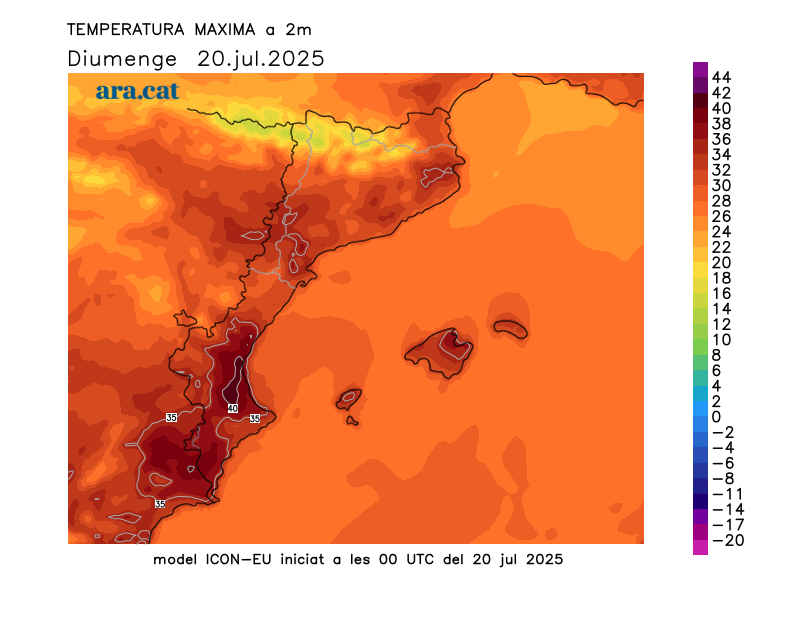
Sunday: temporary rebound in heat
The day begins sunny, and low clouds maintain the muggy feeling on the coast, where lows are still tropical (around 26°C have been recorded in Barcelona (in El Port) and Tarragona). Elsewhere, a few thin clouds appear and the atmosphere is calm, with only a few fog banks and low clouds in the valleys and plains of Berguedà and Osona. During the second half of the day, dark clouds will gather in the Pyrenees, in the central pre-coastal region, and towards the Els Ports mountain range.

The approaching Atlantic front will be responsible for this increased cloud cover. Some showers may fall in the Pyrenees and the Lleida Pre-Pyrenees towards mid-afternoon and at night, possibly spreading northeastwards.
Models indicate that the showers forecast for this afternoon or evening may be locally intense, with hail and debris. Meteocat has issued an advisory regarding this possibility.

Temperatures will rise temporarily, awaiting a small respite expected on Monday. The arrival of a warm westerly wind inland and a garbí wind in the northeast will send temperatures soaring, especially in the Pla de Lleida region and the northern regions of Girona. Many highs of 31 to 35°C are expected, but higher in the inland Empordà region, where they will reach 36 or 37°C. Temperatures will remain unchanged along much of the coast, and temperatures are even expected to drop on the southern coast, following Saturday's warm surge.
Be that as it may, the heat will be fully summery on a fairly quiet, classic day of dog days.
Bearable heat next week
We'll start next week under the indirect influence of a deep low in the British Isles, which will send us some cold air aloft. This will cause temperatures to drop further, and throughout the week we'll have normal temperatures for this time of year, or slightly below average. That means the heat will be bearable, especially on Monday, with cooler temperatures, for example, in the Pyrenees and Pre-Pyrenees. We're in the middle of the dog days, and that means the weather will be warm, but no extremes or major heat waves are on the horizon.
All of this with new, fairly localized afternoon showers in parts of the Pyrenees and Pre-Pyrenees. Maps indicate that showers and thunderstorms could gain intensity on Wednesday and Thursday and affect more regions. This situation should be confirmed, although it doesn't seem very significant.
New records and data for July
Sea water temperatures broke a new heat record this Friday. Observer Josep Pascual reports that the latest measurement of the sea surface in l'Estartit (Baix Empordà) registered 26.84°C, four degrees above average and the highest value for July in 51 years of data.
Furthermore, on July 5, there was a blast that caused material damage between Sallent and Artés, in Bages. This is confirmed by a report by Meteocat, which also states that on Saturday the 12th, there was a record number of waterspouts in July, specifically six.
The study details that the blast reached a wind speed of 150 km/h in the midst of a strong storm. The storm affected a 4.7 km long and 2.5 km wide strip, with hundreds of trees uprooted or damaged, and damage to roofs and decks. The downpours are not typical of July, but the collision between the DANA and the intense heat accumulated on the ground and at sea created a phenomenon more typical of late summer.
Accumulated rainfall up to 6 p.m. on Saturday:
- Water: 20 l/m2
- Gisclareny: 14 l/m2
- Day: 11 l/m2
- Puigcerdá: 11 l/m2
- Cardona: 10 l/m2
- the Quart: 9 l/m2
- Pine: 8 l/m2
- Ship: 6 l/m2
- Vallfogona de Balaguer: 2.5 l/m2
- Panadella: 2 l/m2
- Cervera: 1.6 l/m2
- Tárrega: 1.5 l/m2
- Flails: 1.5 l/m2
- Barcelona (Port): 1 l/m2
