Week of quiet mornings and afternoons with spring showers and thunderstorms
Temperatures will remain high for the season, and suspended dust will arrive mid-week
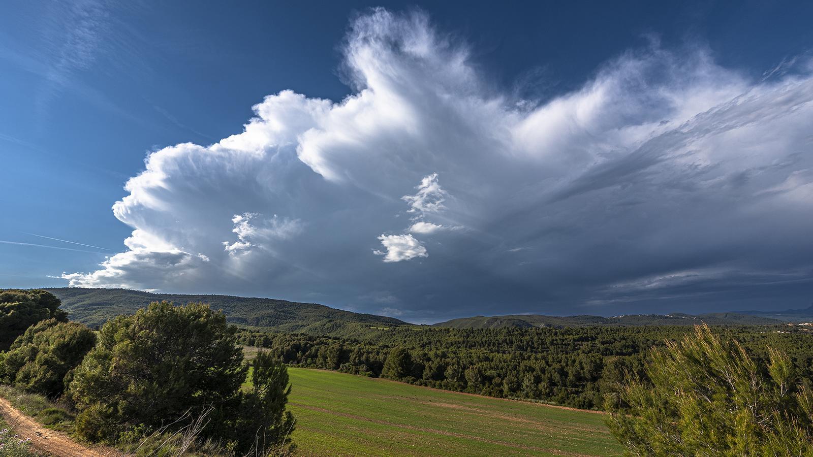
BarcelonaThe presence of a bit of cold air at altitude and a slight drop in atmospheric pressure have made daytime clouds grow with enthusiasm in mountainous areas this weekend, with showers and storms that have intensified and will reappear on the afternoons of this new week. All this after yesterday's showers and storms - some of them of a certain intensity - mainly affected points in the northern half and left up to 38 l/m2 in Cadí Nord, 21 in La Seu d'Urgell (Alt Urgell) or 20 in Molló (Ripollès). The downpours even reached - much weaker and more worn out - points on the coast and pre-coast of Girona and Barcelona. And this situation will extend for more days, also for Sant Jordi, with high temperatures for the season and increasing dust in suspension. Meteocat maintains an alert for intense rain in some counties:

Monday with new afternoon storms
The same meteorological dynamic as last week will be repeated. A calm and very sunny morning, with some morning fogs or low clouds in inland plains and the Ebro Delta, and the arrival of high and medium clouds. However, instability will increase from midday and cloudiness will grow in mountainous areas and north of Central Catalonia.

During the afternoon, storms are expected in parts of the Pyrenees, the Pre-Pyrenees, northern Central Catalonia, the Ports area, and other areas in the northern half, such as the Girona regions or the Barcelona coast. Even some showers may arrive very weakened on some coastal stretch of the northeast. The downpours may fall, locally, with some intensity and with hail. Towards the end of the day, a weak shower may fall in Ponent, in the afternoon. Outside these areas, the meteorological situation will continue to be marked by calm, although during the afternoon bands of clouds will arrive from the storms that have formed inland and in the north of the territory.
Temperatures will remain above what is typical for these dates, with no morning frosts (not even at high altitudes in the Pyrenees), and with minimums ranging between 13 ºC and 15 ºC (in the Pyrenean valleys they will not drop below 7 ºC). Maximums will again be around 30 ºC in Ponent and in the rest they will range between 25 ºC and 28 ºC. On the coast, they will be more restrained, around 22 ºC.
Uncertain afternoons in the Pyrenees throughout the week
On Tuesday, afternoon showers and storms will repeat in mountainous and inland areas, although afternoon instability will affect fewer regions. On Wednesday and Thursday, showers will repeat, although more isolated. Thermometers will not undergo significant changes, and values will remain above the usual average for this time of year, except on the coast, where the temperature will be what would be expected for these dates due to the regulating effect of a still cool sea. Suspended dust will increase throughout the week.
Rain accumulated until 8:30 PM on Sunday:
- Cadí Nord (2,145 m): 38 l/m2
- Camprodón: 24 l/m2
- La Seu d'Urgell: 21 l/m2
- Mill: 20 l/m2
- Gisclareny: 17 l/m2
- Núria (2,000 m): 16 l/m2
- Castellnou de Bages: 5 l/m2
- Puig Sesolles (1,666 m): 4 l/m2
- Dosrius: 1 l/m2
