More peaceful Sunday, with inland fog and thin clouds
The thunderstorms will no longer repeat, but the morning will be cooler

-
CAT -
CAST
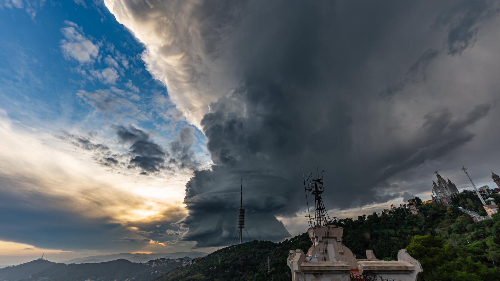
BarcelonaThis Saturday the expected front reactivated and left more activity than expected. While the models indicated some thunderstorms in the south, the cloud masses finally grew strongly and several convective nuclei discharged in parts of Ponent and the pre-coastal area, with thunderstorms, hailstorms and some hailstones. All in all, these are the remains of the storm Bruna, already weakened, but which upon approaching our latitudes still generated quite a stir. The Ebro, Ponent and the pre-coastal area have been the sectors with the most water collected. Standing out are the 46 l/m2 in Ulldecona or the 20 l/m2 in Els Hostalets de Pierola (Anoia). In Castellbisbal 11 l/m2 fell, accompanied by a storm and hail.
The downpours were locally intense. For example, in Ulldecona (Els Valentins) a maximum intensity of 42 l/m2 was recorded in half an hour (at the end of this information we attach a list of the accumulated rainfall).

Sunday: sun, thin clouds and inland fog
Sunday morning will be calm and mostly sunny, with the exception of fog, which can be abundant in the interior. However, throughout the day, the approach of a new worn-out front associated with another Atlantic storm will cause cloudiness to increase rapidly from west to east.
The sky may even become overcast in the afternoon in the western half of the country, where some light rain or scattered showers will arrive, especially in the Pyrenees and the Pre-Pyrenees of Lleida and the Ebro. In many cases, we will be talking about meager accumulations, with tenths of a liter. On the other hand, towards the coast and the pre-coastal area of Barcelona and Girona, there will be more variability and clearings. In the Lleida Pyrenees, the snow level will drop to 2,300 meters.
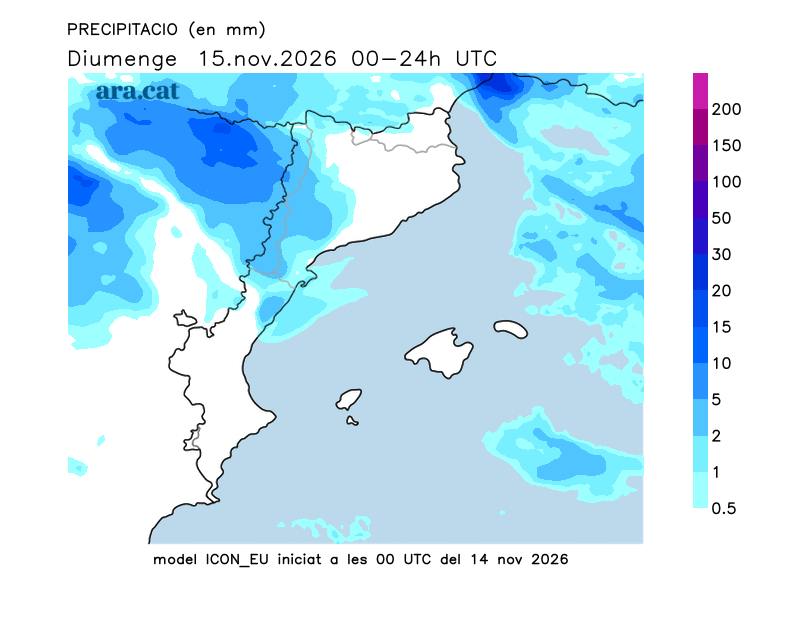
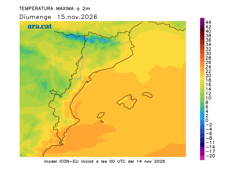
Temperatures will drop a little more, with a full autumn atmosphere at night and in the early hours, with minimums between 6 °C and 11 °C inland. On the coast, they will hover around 14 °C. The environment will be mild during the day and maximums will range between 15 °C and 19 °C, with values of up to 22 °C in the Terres de l'Ebre region.

Next week with worn-out fronts and high temperatures
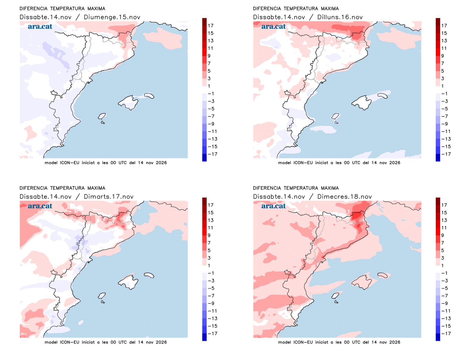
The week will be marked by a similar tone, that is, the passage of worn-out Atlantic fronts. Between Monday and Tuesday a warm front will make the thermometer rise and will send bands of high clouds. Sunrises and sunsets will be very photogenic due to the reddish skies. The westerly, temperate winds will make the thermometer rise and the sensation will be closer to the end of September than to November. Temperatures will remain between 3°C and 5°C above what would be expected on the coast or pre-coast, with maximum values close to 24°C in the Empordà, on the coast or in the Ebro region. Towards the end of the week, the thermometer may drop a little and approach the normal values for these dates.
Accumulated rainfall up to 7 PM on Saturday:
- Ulldecona: 46 l/m2
- Batea: 29 l/m2
- Maials: 22 l/m2
- Mas de Barberans: 20 l/m2
- Els Hostalets de Pierola: 20 l/m2
- Aldover: 18 l/m2
- Castellbisbal: 11 l/m2
- Precipitation: 9 l/m2
