Maximum alert is activated in several regions for the episode of torrential rains
Showers and storms will affect above all the coast, the pre-coast, the northeast and the Pyrenees
-
CAT -
CAST
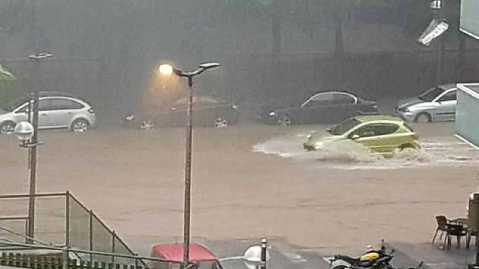
BarcelonaMeteocat has activated a red alert –the highest possible– in view of the new episode of torrential rain expected in the coming hours in many counties of the coast, the pre-coastal areas, and the northeast of the country. Precipitation has already started to fall during the morning in the Ebro region, and throughout the day –especially in the afternoon– it will spread to many points of the coast, the pre-coastal areas, and the northern half of the country, with some downpours. It will be towards the night, the early hours, and Sunday morning when the peak of the storm is expected. With current maps, the rains could be intense and extraordinary in the northeast, the coast, and the pre-coastal area of Barcelona, with local accumulations that may exceed 200 or 300 l/m² in a few hours, strong winds, and extreme phenomena. Meteocat's alerts are for intense rain and accumulations of more than 40 l/m² in half an hour, 90 l/m² in three hours, and more than 200 l/m² in 24 hours.
A situation of marked instability in the Mediterranean typical of autumn, aggravated by a sea much warmer than it should be at this time of year. In fact, some meteorological models indicate a cyclonic movement of rainfall off the Catalan coast, which highlights the potential of the episode. There is even the possibility of a medicane forming (a small Mediterranean hurricane), which would be extraordinary, a phenomenon that has already occurred on some occasions in the Mediterranean due to the high sea temperature and the strong contrast of the existing air masses. This scenario will have to be followed very closely, because sudden rises in rivers, streams, torrents, and ravines can occur, with flooding. Much caution. All this after the last rainstorm in the Terres de l'Ebre left more than 200 l/m².

Saturday: new showers and storms
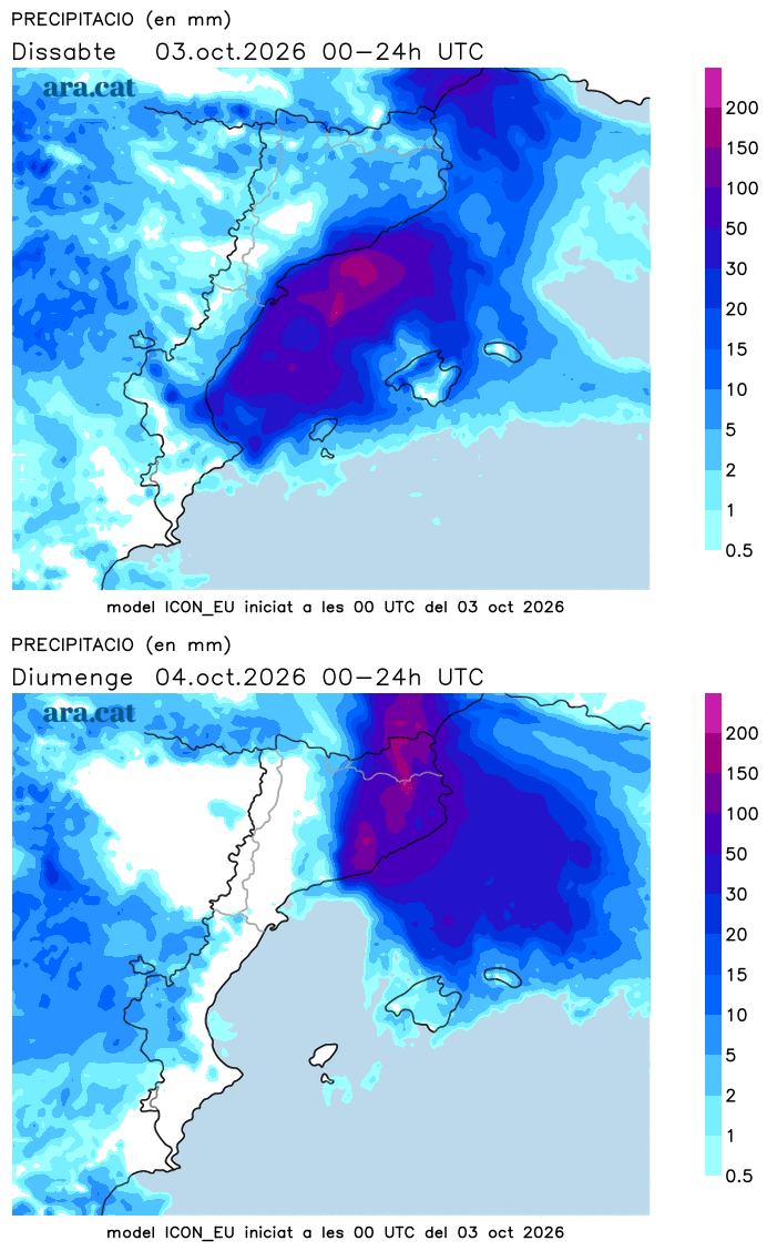
The rain will give a respite to most regions this Saturday morning, although showers and some downpours may already arrive from the early hours in the Valencian Country and the Terres de l'Ebre. It will be from noon onwards and during the afternoon when new showers and irregular storms are expected in many places, especially along the coast, the pre-coastal area, Central Catalonia, the Pyrenees, the Pre-Pyrenees and the northeast. Rain that can be heavy. The rain will gain ground and intensity at night.
In the rest of the Valencian Country and the Balearic Islands, some more scattered showers may also fall. All this with temperatures that will rise in Ponent and the Ebre, but will drop in Barcelona and Girona. Heat kept at bay and nights between cool and mild, with maritime winds.
Sunday: more rain
With still a bit of uncertainty, the maps indicate that on Sunday the rainfall may be more continuous and very abundant in many points of the coast, the pre-coastal area, and the northeast. A day again quite gray that will hardly leave rain in the regions of Lleida, where there will be plenty of clearings. The downpours may be torrential in Barcelona and Girona.
Next week the weather will remain quite unsettled with a bit of everything and a roller coaster of thermometers, which will suffer ups and downs depending on where the wind blows from. The days that it may rain the most would be especially Wednesday and Thursday, although all of this will have to be confirmed.
