Low clouds will increase on the coast, although there is no change in the weather in sight
This Sunday 27 °C have been reached in the southern half


-
CAT -
CAST
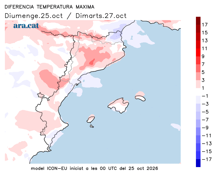
BarcelonaThe weekend has been dominated by anticyclonic calm, without any notable meteorological news and with a temperature that, although it has remained between cool and cold during the night and early morning, has risen clearly at midday. The coming week will begin marked by stability and by a temperature that will rise a little more, with a very mild environment during the central hours of the day.

Monday: few changes
Start of the week with few variations regarding the meteorological situation, dominated by the anticyclone in our region but marked by the passage of storms and Atlantic fronts in many parts of the continent. This will mean we will once again have bands of high clouds combined with sun, apart from the appearance of some harmless low clouds that will mainly affect the central coast and pre-coastal areas, where they will prevent the temperature from rising as much. In the rest of the country, the temperature will rise a little more and some maximums will approach or exceed 26 °C or 27 °C, a prelude to a Chestnut Festival that is once again shaping up to be not very cold.

Tuesday: more high clouds
Few changes for Tuesday, in a new day marked by the passage of bands of high clouds that will cross the sky from west to east and will leave a filmy sky in many moments. Even so, there will also be plenty of sunny spells. The temperature will rise, both by day and by night, and many thermometers will reach 22 °C or 23 °C, and will once again exceed 25 °C or 26 °C in the extreme south.