New little summer, wind and more clouds than rain the next days
The circulation of Atlantic fronts that will arrive worn out in our area will continue to dominate

-
CAT -
CAST
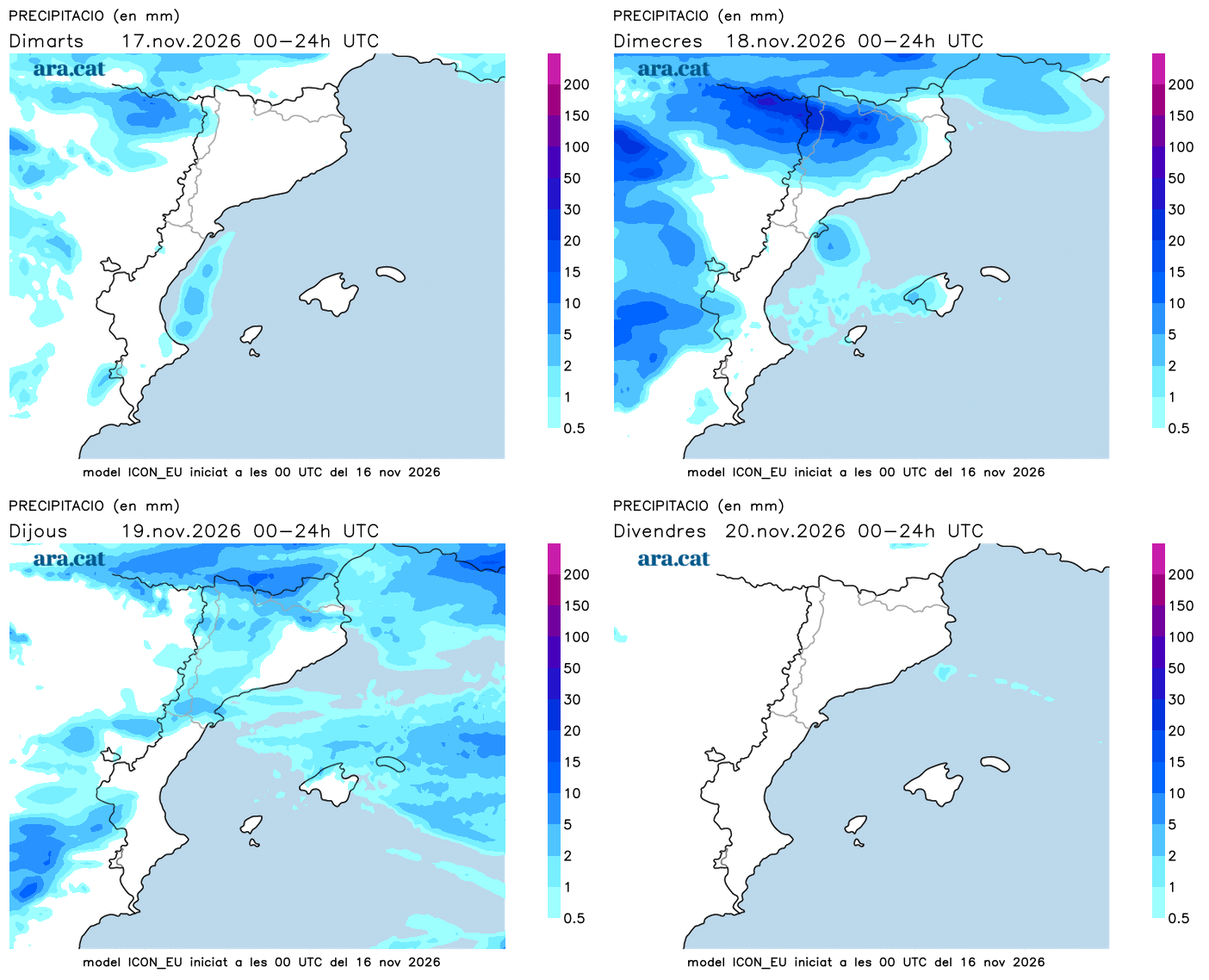
BarcelonaThe change of week has not brought any change to the meteorological dynamics. For another week, we will continue under the effects of Atlantic circulation, with the passage of worn-out fronts associated with deep low-pressure systems that will remain far from our region. Between Tuesday and Wednesday, there will be quite a few intervals of clouds and wind will blow from between the west and the southwest, with a clear rise in temperatures. It will be an Indian summer with capital letters, as temperatures will be between 5 and 10 degrees above average. Some light rain or showers will arrive from the west, which will leave more water in the Pyrenees and the western Pre-Pyrenees. But in most counties, very little water is expected, if any at all. The most significant rainfall will again be concentrated in the western half of the peninsula. No change in dynamics is seen in the medium term, although in the second part of the week the atmosphere will be clearly more autumnal.

Tuesday: more clouds and wind
The approach of a new worn-out Atlantic front will bring changes this Tuesday. Cloudiness will clearly increase everywhere, with periods of even overcast skies, especially in the regions of Lleida. Abundant high and mid-level clouds will circulate. Despite this, there will also be clearings and, in general, no rain is expected. Only some light sprinkles or weak and passing showers will arrive in the West and, especially, in the western Pyrenees and Pre-Pyrenees.

The wind from between the west and southwest will strengthen and blow strongly, especially between the coast and the pre-coastal areas of Barcelona and Girona, with rough seas and intense gusts, particularly in elevated areas. Meteocat has activated a yellow alert for strong winds that may exceed 72 km/h in regions of this area. Temperatures will rise a little more, both during the day and at night, with moderate morning coolness and very mild conditions at midday. Many highs of 17 to 23 °C are expected.
Peak of the little summer on Wednesday
Temperatures will peak on Wednesday, with a warm atmosphere for this time of year and values well above average. The most pronounced rise will be felt along the coast and pre-coastal areas due to strengthened winds from the west and southwest, with many values ranging from 20 to 25 °C. From the afternoon onwards, precipitation will arrive from the west which, until Thursday morning, will water the Pyrenees, the Pre-Pyrenees, and surrounding areas. On the other hand, little rain is expected elsewhere, beyond weak and passing showers.
Once this front passes, the doors will open to a cooler air mass that will cause temperatures to drop starting Thursday. Therefore, the final stretch of the week will be marked by a more autumnal atmosphere, but with no sudden drop in temperatures in sight. The dynamic of weakened Atlantic fronts will continue.