Locally heavy downpours until night, but calm is already arriving
The sun will return to dominate everywhere on Friday, with temperatures that will hit bottom, with cold at first hour

-
CAT -
CAST
BarcelonaThe change in weather has brought us a clear cooling this Thursday –especially in the northern half of the country–, the first dustings of snow at high altitudes in the western Pyrenees, a strong northerly wind at the ends, and new downpours and thunderstorms in the northeast that, until nightfall, will still fall and affect the central coast. So far, the 38 l/m² accumulated in Banyoles (Pla de l'Estany), the 28 in Cantonigròs (Osona), or the 27 in Fogars de la Selva (Selva) stand out. Regarding the wind, the 127 km/h recorded in Portbou (Alt Empordà) and the 101 km/h in El Perelló (Baix Ebre). Meteocat maintains alerts activated for intense rain until midnight on the central coast and for strong wind and rough seas in the Alt Empordà.
It is the final firecracker of the instability, since starting this Friday the sun and calm will dominate everywhere for quite a few days and the north wind will gradually lose momentum. But watch out for the temperatures, as they will bottom out on Friday and will even be slightly below average. You will need to bundle up more early in the morning, as it will be cold, while during the middle of the day the atmosphere will be between cool and mild. The weekend will be one to take advantage of.

Friday: calm returns
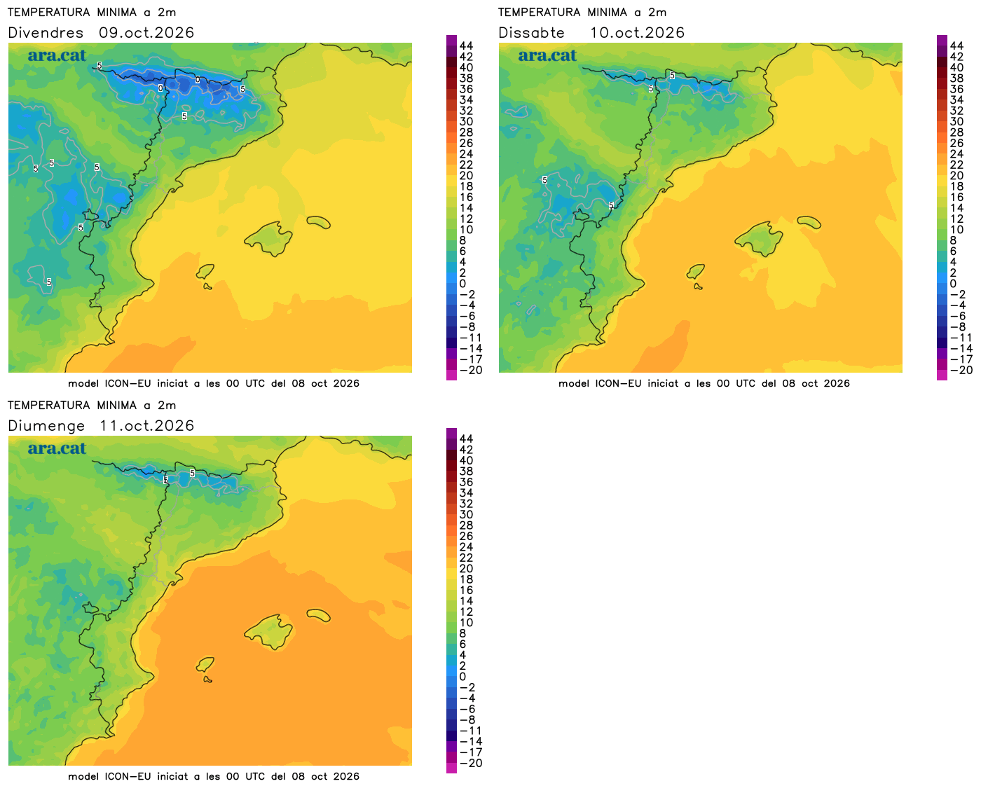
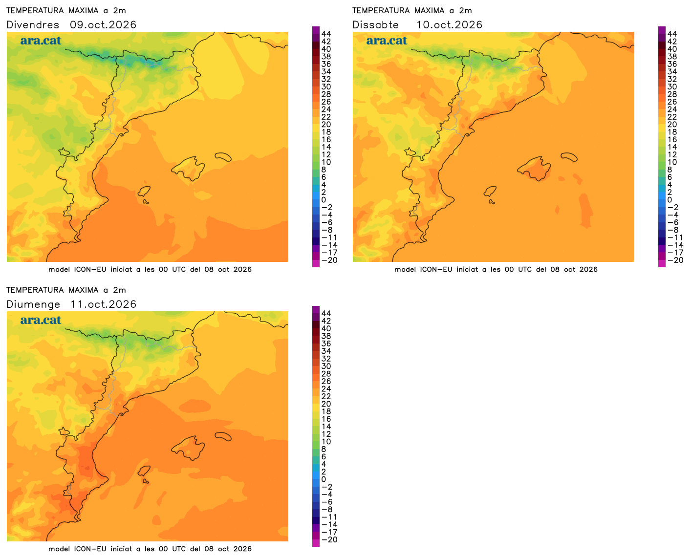
This Friday we will wake up to a clearly colder environment everywhere. A jacket will be essential in many regions, and a good sweater will even be needed on the coast. Most minimum temperatures will range between 5 ºC and 10 ºC inland and in parts of the pre-coastal area, but in the Pyrenees they will remain lower, with frosts especially at medium and high altitudes. On the coast, many values will be between 12 ºC and 17 ºC. Maximum temperatures will also remain low, with most records between 17 ºC and 23 ºC.

A full autumn day that will be marked by widespread sun and absolute calm. It will not rain anywhere after many days of downpours and heavy rain. The mistral and tramontana winds will blow strongly until the morning on the peaks of the Pyrenees, in the Empordà and the Ebro, but in the afternoon the wind will lose strength and will be concentrated in the Empordà. Only traces of some local showers will remain between Mallorca and Menorca.
Weekend to take advantage of
The weekend will be generally quiet, with sun dominating especially on Saturday. On Sunday, a tail of a front will brush against the Pyrenees. This will cause an increase in cloud intervals in general – especially in the north of the country – but it will not rain. Only a few showers may escape in the northern Pyrenean face.
No new episode of significant rainfall is seen in the medium term. Temperatures will rise from the weekend onwards, but they will simply normalize, with an atmosphere between mild and slightly warm in the middle of the day, and very cool or cold nights. In short, we will have the atmosphere that belongs to this time of the year.