Kilometre by kilometre through the new southern border of Lebanon
L'ARA enters with the Blue Helmets in the territories of the country occupied by Israel

-
CAT -
CAST
Kfar Kila (Southern Lebanon)The armored vehicle advances slowly. Not out of caution, but because every kilometer requires relearning a territory that has changed. A few weeks ago, this road was still closed even to the United Nations Blue Helmets. For the first time in several months, a patrol from the United Nations Interim Force in Lebanon (UNIFIL) travels from the east to the west sector of the south of the country. For the soldiers, it is a journey. For Lebanon, the reflection of a new reality.
"For us, it is important to reopen the east sector. We haven't been able to come for quite a few months –explains Lieutenant Thomas as the convoy leaves the Deir Kifa barracks–. Now we are regaining our freedom of movement and can help the population again."
The road we have been traveling for months was out of reach of the international mission. The war between Israel and Hezbollah had turned these border towns into a combat zone, but the ceasefire and then the framework agreement opened a new chapter. It does not mean that normality has returned, but rather that some movements are once again possible.
For decades, the reference to southern Lebanon was the Blue Line, the demarcation line established by the United Nations between Lebanon and Israel after the Israeli withdrawal in 2000. Today, this border no longer fully explains what is happening on the ground. The new reality is marked by the so-called Yellow Line, a security strip under Israeli control that extends up to ten kilometers into Lebanese territory and has transformed the military geography of the border.
The dispute over this strip also continues on the political front. While Israeli Prime Minister Benjamin Netanyahu insists that Israel maintains its security zone, the Lebanese army denounces new violations of the ceasefire that hinder its deployment in various areas of the south. In the middle, there remains a territory where the new rules are not yet consolidated. The armored vehicle advances towards the first checkpoint of the Lebanese army. From here begins this new border.

In Shaqra, the change is visible. At the very top of a hill appears the medieval castle of Doubeih. The fortress dominates the valley, but the image that attracts all eyes is another: an Israeli flag waving on the rampart.
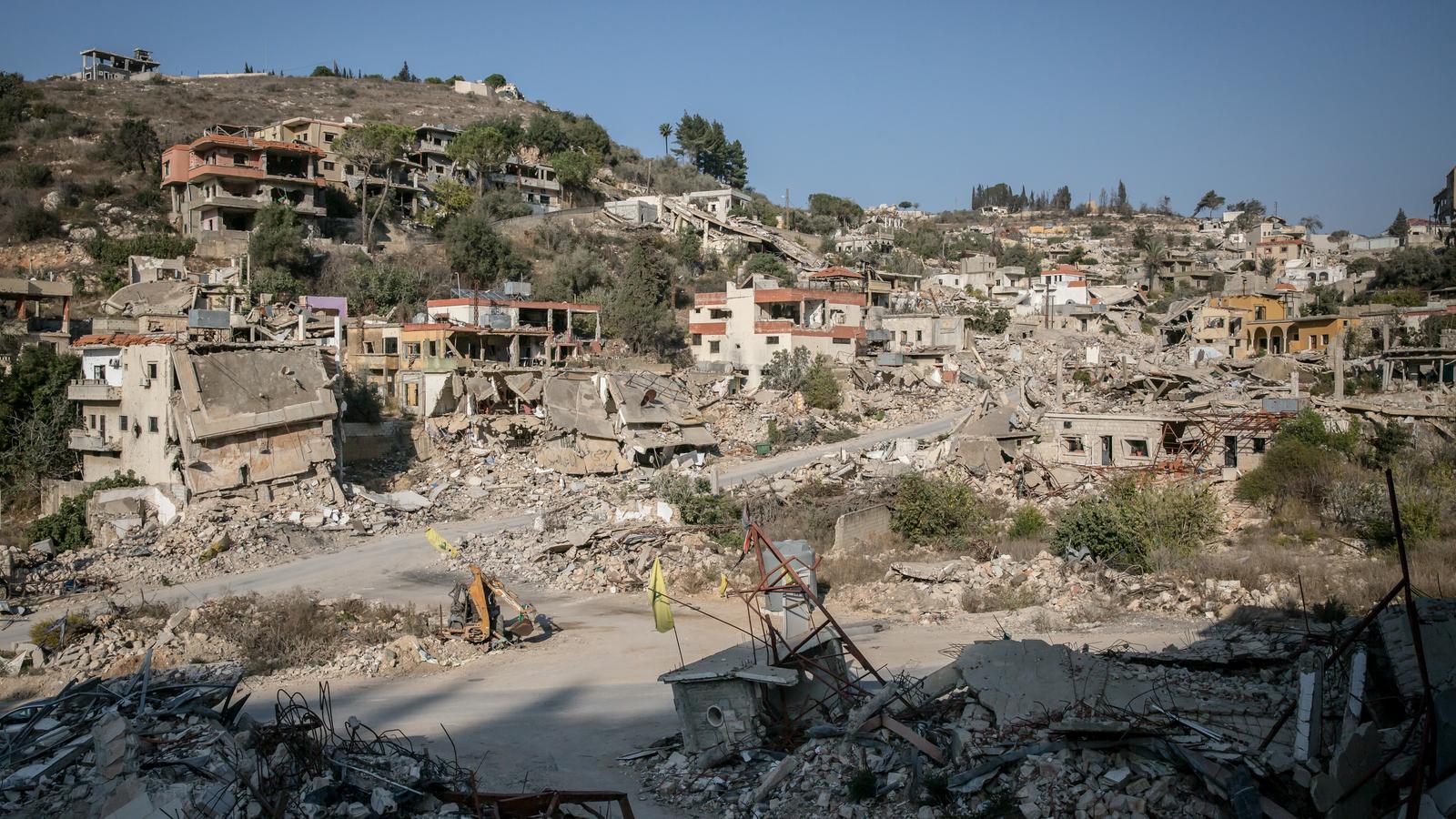
Further on we pass through the localities most affected by the fighting: Houla, Kfar Kila, Odaisseh. Villages that seem suspended in time. Houses crossed by bombings, streets turned into corridors of rubble, abandoned fields. In some places only mountains of ruins remain where entire neighborhoods used to be. Along the route, checkpoints, concrete walls and military positions appear. A border that is no longer just drawn on maps, but on the landscape itself.
Unknown terrain
The patrol continues to a high point from which the soldiers can observe the valley. Captain Julien looks through binoculars towards an area under Israeli position that the mission has not yet been able to reconnoiter. "We are here to have a view of the valley and be able to provide accurate information about what is happening there," he explains. A team has gone down to check the terrain. UNIFIL needs to reconstruct the operational map of an area where military movements have changed and where positions that did not exist yesterday are now part of the landscape.
For years, the Blue Helmets patrolled mainly to monitor the Blue Line and accompany the implementation of United Nations Resolution 1701. Today, in addition, they are working to reopen roads, support demining operations, locate unexploded ordnance, and allow some areas to become passable again. "We are here to secure the areas before the population can return," explains Sergeant Luigi as his team inspects a road contaminated by explosive remnants.
A few kilometers from the most devastated areas, some Christian villages still retain part of their population. They are isolated communities, with limited services and a constant uncertainty about what will happen tomorrow. Many depend on humanitarian and religious organizations. Every week convoys loaded with food, medicine, and essential products arrive in these towns.
Hani Tawk, coordinator of a network of Catholic organizations, explains that their mission is not just to bring material aid. "When they see us, they know they are not alone – he says –. Our presence is more important than the things we bring." For many inhabitants, abandoning the village means running the risk of not being able to return. "If we leave the land, we lose it forever," Tawk summarizes. They live in the midst of a border they do not control, without a strong presence of the Lebanese state and under the shadow of an occupation that could last for years.
This is precisely one of the objectives of the framework agreement between Israel and Lebanon, to progressively return a central role to the Lebanese state in the south. The plan foresees a gradual deployment of the Lebanese army in the so-called pilot zones, a step aimed at strengthening its presence, advancing towards the disarmament of Hezbollah, and creating the conditions for an eventual Israeli withdrawal. But on the ground, no one expects a quick solution. It is a long process, full of obstacles and conditioned by political and military developments. Southern Lebanon continues to try to recover something much more difficult: the certainty that its roads, its villages, and its borders will one day belong again to the people who live there.
