Muggy weather on the coast and a couple of degrees cooler in Ponent
The heat will ease off a bit today, but will intensify again next week.


BarcelonaThe warm air mass from North Africa is keeping the temperature sweltering across the country, especially in Ponent, where temperatures soared past 37°C yesterday (37°C in Poal and Alfarràs and 36°C in Tremp). In Banyoles, temperatures reached nearly 36°C, and in El Vendrell, they reached almost 34°C.
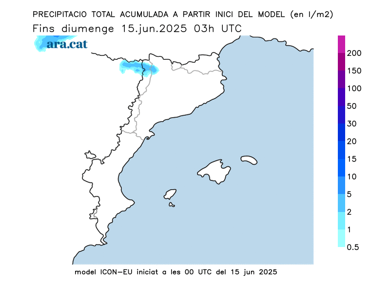
However, there will be a slight respite this Sunday. It won't cool down much, but temperatures will drop by two or three degrees in the Lleida region. It will be hot, but not as extreme. All this, with showers and some storms recorded during the early hours of this morning and throughout this morning and midday, which have accumulated 10 mm in Sasseuva and Vielha and lesser amounts in other parts of the Pyrenees and the western Pre-Pyrenees (1 mm in Tremp and 2 mm in Tírvia and Pont de Suert).

The heat will continue and even intensify next week, especially towards Tuesday.

Sunday: muggy weather on the coast and less extreme heat in Ponent
Low clouds are expected along the coast during the early morning and early morning hours, with a somewhat cloudy sky in the northern third. There will be some showers in parts of the Pyrenees and western Pre-Pyrenees, locally forming thunderstorms, which could develop until midday. By mid-morning, the weather will clear up across the rest of the country, with generally clear skies.
Temperatures will drop slightly, especially in the north of the country. However, this will be a subtle drop, as it will still be very hot, with highs of 31 to 33°C in much of the inland and pre-coastal areas, and somewhat higher in Ponent and Empordà, where they will hover between 33°C and 35°C. We will experience a midsummer atmosphere, with tropical nights and markedly muggy conditions on the coast (last night, temperatures did not drop below 23.5°C in Barcelona or 23.7°C on Buda Island in the Ebro). Lows, in many coastal areas, will continue to hover around 23°C, with high humidity. Sunshine will combine with bands of high, thin clouds, and in the afternoon, storm clouds will again gather in the Pyrenees and Pre-Pyrenees, bringing occasional showers, especially in the west.
Monday, hot flashes with some isolated showers
The morning will be sunny, with some thin clouds and low clouds on the coast and the pre-coastal area. In the afternoon, clouds will gather in the Pyrenees, the Pre-Pyrenees, and inland areas of Girona, where some isolated showers may occur, sometimes forming thunderstorms. Temperatures will remain high, above average but not extremely hot. In the West, they will reach 35 or 36°C, and on the coast, they will not exceed 27°C.
Warmer weather next week
Far from abating, the heat will continue into next week, even reaching a new scorching peak between Tuesday and Wednesday. In fact, models indicate a new advance of the warm mass from North Africa, which will send temperatures soaring again on Tuesday, with highs once again reaching 39°C in the West. Along the coast, apart from the muggy conditions, the salty sea air will keep temperatures at around 28°C or 29°C. This is unbridled heat in what has been an extraordinarily hot month of June.

It looks like we'll be approaching the Sant Joan long weekend with a fairly calm weather forecast and temperatures above average, although they might drop a bit.
Heat report for the week
Temperatures reached their peak last Wednesday in many regions, especially on the coast and in the pre-coast areas of Barcelona and Central Catalonia, where they reached 37 or 38°C locally. Even in the city of Barcelona itself, temperatures exceeded 33°C. However, the arrival of dark clouds prevented temperatures from rising as high as Tuesday in Poniente, where they barely reached 35 or 36°C, far from the 38°C mark. The exception was Artesa de Segre (Noguera), where there was a brief, scorching peak of up to 38.4°C, which turned out to be the highest maximum in the entire country. Tuesday and Wednesday were the hottest days of the year. These are the most notable maximum values from a stifling Wednesday:
- 38.4°C, Artesa de Segre
- 38 °C, Artes
- 37.7 °C, the Canoso
- 37.5 °C, Caldes de Montbui
- 37.4 °C, Oliana
- 37.4 °C, Castellbisbal
- 37.4 °C, Oliola
- 37.3 °C, Baldomar
- 37.2 °C, Tárrega
- 37.2 °C, Parets del Vallès
- 37 °C, Vallirana
- 36.9 °C, Massoteras
- 36.6 °C, La Pobla de Segur
- 36.2 °C, Sabadell
Also noteworthy are the tropical lows, which have lost ground after being repeated on Tuesday and Wednesday in several locations, including inland, especially in high elevations. However, the coast is where the most lows above 20°C have been recorded. Particularly noteworthy is the Raval neighborhood of Barcelona, where the low was 23.5°C on Thursday but close to 24°C on Tuesday. The Fabra Observatory also did not drop below 22.8°C on Thursday night, and Montserrat mountain reached 21.4°C, while at lower altitudes it was cooler. Cities such as Lleida and Girona experienced their first tropical night early Tuesday morning, but both Wednesday and Thursday saw a cooler night.
This Sunday the minimum temperatures did not drop below 23.5 ºC in many observatories on the central coast, the Costa Daurada and the Ebro. Some of the maximum temperatures from yesterday, Saturday, were the following:
- 37 ºC, the Poal
- 37 ºC, Alfarràs
- 37 ºC, Lleida-La Fenosa
- 36 ºC, Tremp
- 35 ºC, Banyoles
- 34 ºC, El Vendrell

