Goodbye to the downpours today, but remains of some showers and a clear cooling down
The strong storms will no longer repeat themselves in Catalonia, but the weather will not clear up

-
CAT -
CAST
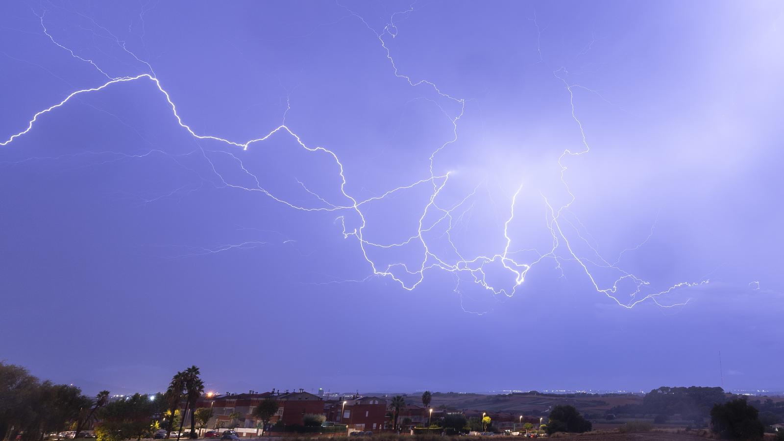
BarcelonaThe episode of showers and heavy storms in the last few hours has left authentic torrential downpours and records that, locally, have brushed or exceeded 100 l/m², most of them falling in a short time. The thunderstorms affected the northeast in particular during the afternoon, with some downpours accompanied by hail or stones, as was the case in the city of Girona itself. 50 l/m² were reached or exceeded in some cases. But the main event arrived in the evening and at night, when the showers and storms gained strength and extent on the coast and pre-coast of Barcelona and nearby areas, such as Central Catalonia, as well as in the Valencian Community and the Balearic Islands. In regions such as Barcelonès, Vallès Occidental, Baix Llobregat, Garraf, and Alt and Baix Penedès, the rain was falling for hours, with moments of torrential intensity and many lightning bolts and thunder. All this caused floods and many incidents, such as the closure of the Ronda de Dalt in Barcelona and the death of a man dragged by a stream in Garraf. In addition, in the Valencia area, the rain has also caused havoc (you will find all the data and images of the episode at the end of this information).
All of this has diminished during the early hours, and first thing this Thursday morning only some showers will continue to fall in parts of the coast and inland areas of Barcelona. Although some locally heavier downpours could still occur -especially by the sea-, in general the episode is now history in Catalonia, and today, despite not completely clearing up, not much rain is expected in general. In fact, Meteocat has already deactivated the large number of alerts for intense rain that were in place over the last few hours. Sunny spells will gradually gain ground from west to east as the hours pass, with remnants of these showers still in the central coast, as well as in the Balearic Islands and the south of the Valencian Community. Northerly wind at the ends, and cool atmosphere everywhere.

In the afternoon the weather will not clear up completely. Some local showers may repeat in parts of the coast between Barcelona and Tarragona, as well as in the northeast and the Pyrenees. Not much, and they will be local phenomena, but the sky will remain variable in these areas and with slight instability. Some irregular downpours will also repeat in the interior and south of the Valencian Community, as well as in the Pityusic Islands and Mallorca, without ruling out some locally strong thunderstorms yet. The mistral wind will ease, while the tramontane will persist.

Sharp cooling
Beyond the instability, this change in weather has also been accompanied by a sharp cooling. In fact, yesterday the maximums already dropped, with most values between 25 and 30 °C, although in the interior of the Ebro, temperatures still locally reached 32 or 33 °C. In any case, nothing to do with the more than 37 or 38 °C reached on Tuesday in the south of the country. Therefore, we have left behind the extraordinarily atypical mid-summer atmosphere.
During the night the cooling has been notorious and widespread, with cold even in mountain areas, but still with a lot of cloudiness that prevented the mercury from dropping further. Therefore, the coming nights will be very cool or cold depending on the region, without new tropical minimums on the coast.
As for midday, the heat will be well curbed, with values generally below 30 °C. On Thursday, the drop will consolidate, with most maximums between 23 and 28 °C, lower in mountain areas and slightly higher in the southern interior. Although we will notice a rise in thermometers over the weekend, in general, values will remain normalized for the time of year, with controlled heat.
The weather for the coming days
On Friday the weather will not be completely clear, and some local showers will be repeated in the northeast, in the Pyrenees and, above all, between the south of the Valencian Community and the west of the Balearic Islands. But the weekend will be much calmer, with sun that will prevail in general and absolute calm. The north wind will not completely disappear, especially the tramontane, which will continue to blow especially in the north of the Empordà.
Balance of the storms and downpours
The episode of heavy storms and torrential downpours in the last few hours has left very significant rainfall records in some areas. The storm hit the Girona regions and nearby areas in the northeast hard in the afternoon, and throughout the evening and night it concentrated and intensified on the coast and pre-coast of Barcelona, in Central Catalonia, in the Valencia regions and, during the early morning, in the Balearic Islands. In the case of Catalonia, the highest records have ranged from 50 to almost 100 l/m², many of which fell in just half an hour. Even towards the Penedès, the torrentiality was locally extreme, with almost 100 l/m² falling in just one hour. This has caused rivers and streams to rise suddenly and has caused flooding and many incidents. It is also worth highlighting the large number of lightning strikes that have fallen and illuminated the sky of half of Catalonia. These are some of the most notable data and images of the rain that has fallen in the last few hours:
- 124 l/m²: Olèrdola
- 106 l/m²: Barcelona (Horta)
- 93 l/m²: Moià
- 90 l/m²: Canyelles
- 82 l/m²: Sant Pere de Ribes
- 75 l/m²: Vacarisses
- 74 l/m²: La Bisbal d'Empordà
- 73 l/m²: Garraf Natural Park
- 72 l/m²: Terrassa (Can Boada)
- 67 l/m²: Barcelona (El Coll-Vallcarca)
- 61 l/m²: Fornells de la Selva
- 57 l/m²: Terrassa (Sant Pere)
- 53 l/m²: Cassà de la Selva
- 50 l/m²: Vallirana
- 50 l/m²: Banyoles
Regarding the Valencian Community, the downpours especially affected the regions of Valencia, including the ground zero of the 2024 DANA, where the sound of mobile phone alarms once again stirred the memory of that fateful night almost two years ago among the population. In some cases, more than 100 l/m² have accumulated in less than 24 hours, as is the case in the municipality of Torrent, where, along with other towns, serious flooding and many incidents have occurred. Just as in Catalonia, the torrential nature of the downpours has stood out in the Valencian Community, as more than 70 l/m² have accumulated in just half an hour. Storms more typical of tropical zones that are becoming increasingly frequent at the end of summer and in autumn in our area due to the sea temperature, which does not stop rising and fuels the intense rain.
