Changing weather and more autumnal, but little cold for now
Temperatures will drop and we will continue under the influence of Atlantic fronts

-
CAT -
CAST
BarcelonaWe leave behind a windy Thursday in many regions. A westerly wind that at times shifted a bit to north-westerly, and that left many gusts between 50 and 90 km/h throughout the territory, especially in the southern coast and pre-coastal areas. Notable are the 95 km/h in Miami Platja (Baix Camp) or the 94 km/h in Font-rubí (Alt Penedès). But where the wind blew hardest was in the high peaks of the Pyrenees, the Pre-Pyrenees, the north of Alt Empordà and the Montseny, where 100 km/h were exceeded. Notable are the 143 km/h reached at Puig Sesolles (1,666 m).
The wind will die down on Friday, but in the coming days there will be resurgences and the weather will remain changeable due to the passage of new worn-out Atlantic fronts. Temperatures have started to drop and today the highest maximums did not exceed 22 °C, nothing like the almost 27 °C on Wednesday. The atmosphere will be increasingly autumnal.

Friday: quite a quiet day
The bands of high and medium clouds will increase this Friday, but they will not prevent it from being a calm day with no precipitation anywhere. The sun will be more veiled, even with somewhat more prominent intervals of clouds in the south of Catalonia and in the north of the Valencian Country. The wind from between the west and northwest will not disappear completely in the southern half of the country, but it will gradually decrease.
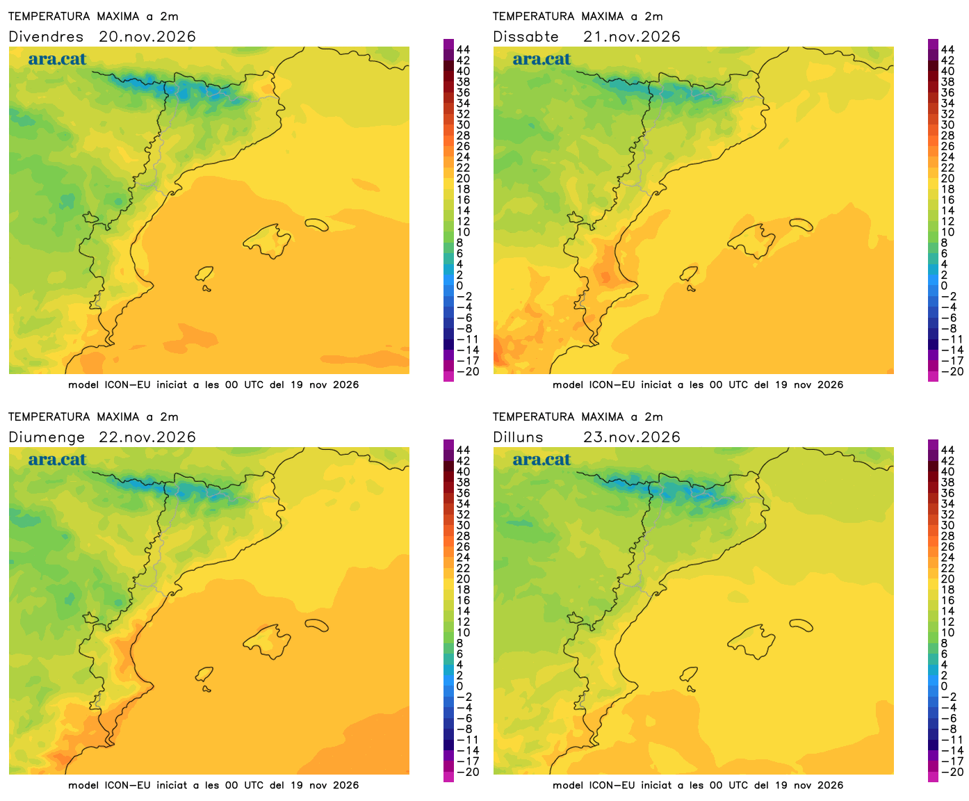
Temperatures will drop a bit more, both by day and by night. Early in the morning we will notice more freshness or cold in general, with frosts at the high altitudes of the Pyrenees. In the middle of the day, the atmosphere will be between mild and cool, with many highs of 15 °C to 20 °C.

Changing weekend
The passage of a new worn-out Atlantic front will cause new changes this weekend. Saturday will be a day with more clouds. Throughout the day, some drizzles or showers may arrive from the west which, between the evening and Sunday dawn, will spread to more places and will mainly affect the Pyrenees and Pre-Pyrenees of Lleida.
Once the front passes, Sunday will be a sunnier day, but a new gust of wind is expected, in this case of mistral and tramontana, which will mainly affect the southern half of the country and the north of Alt Empordà. Temperatures will suffer few changes, and next week they could drop with more intensity.