Front of showers at night and strong winds afterwards
The temperatures will begin to drop starting this Thursday

-
CAT -
CAST
BarcelonaThe Indian summer peaked this Wednesday, with weather too warm for the time of year. Values clearly above average, with many highs between 21 °C and 25 °C, especially on the coast and pre-coastal areas, but even higher in the south of the country. Notable are the 26.8 °C reached in Aldover (Baix Ebre) or the 26.5 °C recorded in the city of Tarragona. All this after the previous night was exceptionally mild, with some slightly tropical minimums around 20 °C in spots along the coast. A rise in temperatures that is the result of re-heated westerly winds. But changes will arrive over the next few hours.
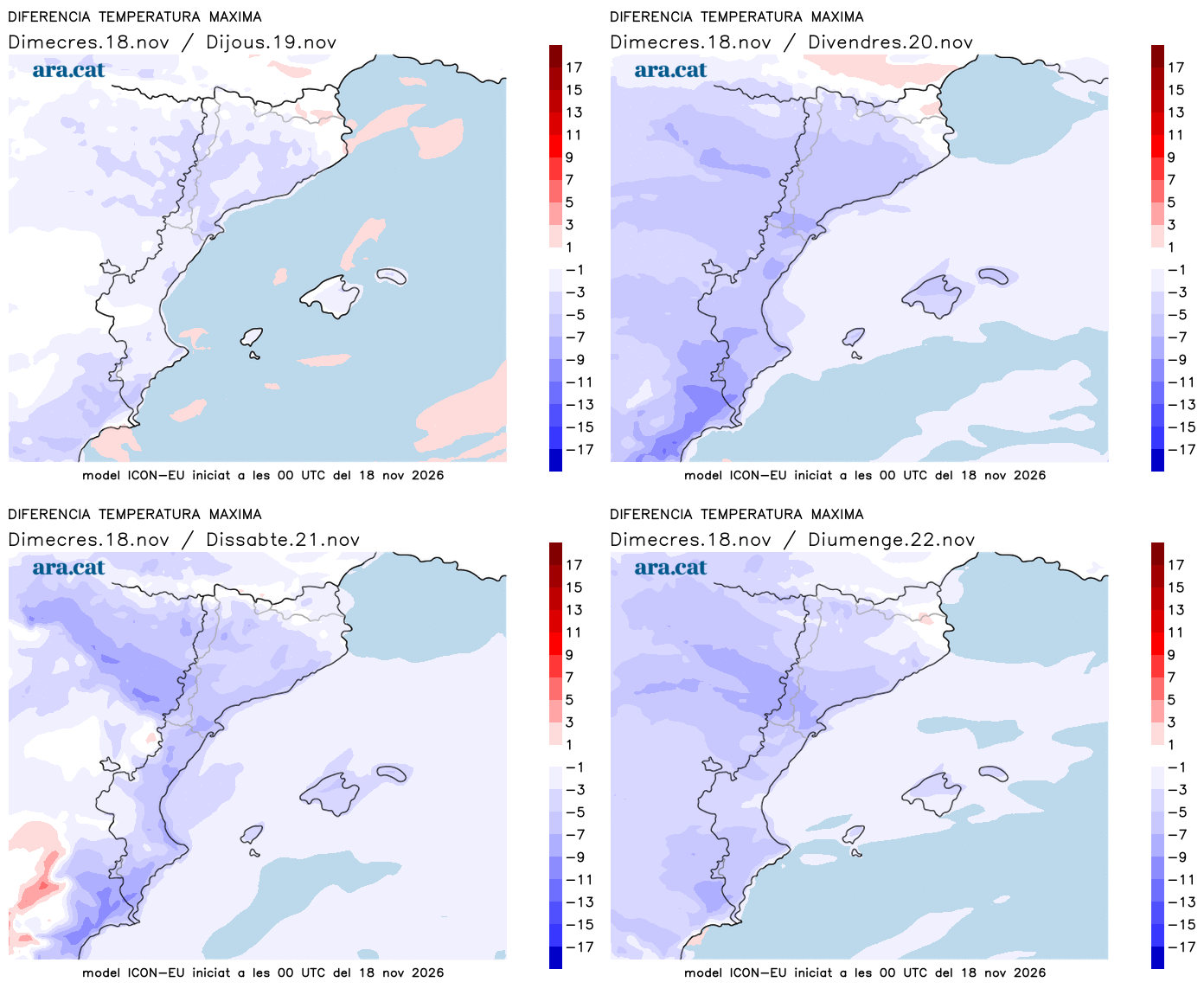
The approach of a new, slightly more active Atlantic front will cause more cloudiness everywhere until dawn and a round of showers that will travel across the country from west to east. Not much in general. Once the front passes, the wind from the west and northwest will strengthen and blow hard in many regions. Starting this Thursday, temperatures will begin to drop, and we will end the week with a more autumnal atmosphere.

Thursday: wind alert
The passage of the front will reactivate the westerly wind, which will blow from the northwest at times. At dawn, it will already be felt in many regions, with very strong gusts exceeding 100 km/h at high altitudes. And throughout Thursday, the gusts will be especially noticeable in the regions of Tarragona and Barcelona and in Ponent. The north wind will also blow strongly until midday in the north of Alt Empordà and in Northern Catalonia, while the strong winds will also affect the Valencian Community and the Balearic Islands. Meteocat has activated an alert for strong wind that may leave gusts exceeding 72 km/h in several regions.
All this with an unsettled maritime situation and sun that will generally prevail. It will be a much more serene and sunny day, although in the morning there will still be some remnants of precipitation on the north face of the Pyrenees. In the afternoon, clouds will also grow in the northeast interior and in the Pre-Pyrenees that may leave some local showers. Not much overall, with a snow level that will drop to 2,000 m or below. Temperatures will begin to drop and will no longer reach Wednesday's extremes, with a decrease that will be more abrupt in the southern half of the country.

More autumnal atmosphere in the coming days
Both Friday and over the weekend temperatures will drop further and we will return to an environment more typical for the time of year, in full autumn, leaving behind the little summer of recent days. Many highs will range between 15°C and 20°C, and nights will be clearly colder, with frost in the Pyrenees.
The wind will gradually ease and will no longer be as intense or widespread. Regarding the state of the sky, it will continue to change due to the influence of Atlantic fronts. However, once again, very little rain is expected. Between Saturday afternoon and Sunday morning, showers will arrive from the west that will basically affect the Pyrenees and Pre-Pyrenees of Lleida again.