Alert in large part of the country for strong storms tomorrow
The passage of an active front will cause an extensive spell of showers and a subsequent cooling
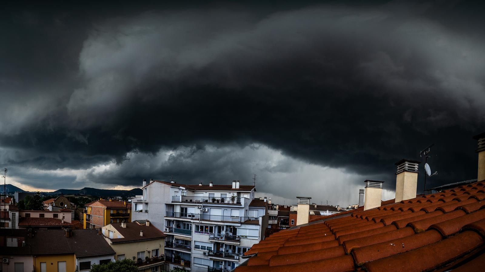

BarcelonaThe weather has been much calmer and sunnier this Wednesday, with lower temperatures and moderate heat. But this calm will not last long, as this Thursday the meteorological situation will become very complicated. The passage of an active front will reactivate instability, with a spell of showers and thunderstorms that between Thursday afternoon and Friday morning will sweep across a large part of the country from northwest to southeast. It will not rain during the morning yet, but there will be more and more clouds and a more variable or partly cloudy sky.

After the intense and atypical heat of recent days, the clash of air masses could cause downpours accompanied by hail, sleet, and strong winds, especially in Central Catalonia, the eastern Pyrenees and pre-Pyrenees, and the northeast. The Inuncat plan is activated in alert phase and Meteocat has issued warnings for downpours that could leave more than 20 l/m² in just half an hour.
Furthermore, Meteocat is premiering a new warning in this episode: accumulations of 60 l/m² in just three hours. An alert that affects the regions of Ripollès, Garrotxa, Osona, and Lluçanès. In these areas, the main event of this spell of heavy storms is expected.
Little or much, it can rain in practically any place, although the regions in the northern and eastern half will be the most affected. More transient showers can also arrive in the regions of Ponent, Camp de Tarragona, or the Ports area. Between the afternoon and night, the maestral and tramuntana wind will also reactivate in the Ebro Delta and especially in Empordà. There is an alert activated in Alt Empordà for strong gusts exceeding 108 km/h.
Clear refreshment after the storms
On Thursday, minimum temperatures will rise, while maximum temperatures will undergo few changes in most regions. However, they will begin to drop in the Pyrenees and in parts of the interior and south. On the other hand, they will rise temporarily in the northeast before the rains arrive. Therefore, many maximums of 26 to 31°C will be repeated, lower in mountain areas.
The front will sweep away the mass of warm air that was still affecting us. Therefore, once it crosses us, the cooling will be significant. Friday morning will be very cool everywhere, including the coast, while many maximums will only move between 23 and 28°C, locally higher in the Ebro and Ponent regions, and lower in mountain areas.
A more controlled heat, with values more normal for the season than those we have had in recent days. However, this breathable and cooler atmosphere will not have much continuity, as from the weekend the thermometers will start to climb again. It will get hotter and hotter, and it seems that next week could be very warm for the dates again.
All in all with more calm and sun in general. On Friday, there will be remnants of clouds and some scattered showers in the northeast, with tramontana wind in Empordà. And the weekend will be placid, with only a few afternoon showers in the Pyrenees.
