Alert in many regions for heavy rains starting Saturday
The change of weather will come accompanied by a clear cooling of full autumn


BarcelonaAfter many days of calm and weather that is too warm for the time of year, the weather will become complicated this weekend. The anticyclone will move to northern Europe and, at the same time, a storm will form in the Mediterranean. All this will open the doors to the arrival of a pocket of cold air at high altitude coming from central Europe towards the Iberian Peninsula, as well as humid and warm maritime winds towards the Catalan coast. This will clearly increase instability, with the return of rain and a sudden, full autumn atmosphere. The sea water remains warmer than it should be, which can cause the rainfall to be more intense, just as it has been in recent weeks.
On Saturday morning it will not yet be raining and the atmosphere will be mild, but cloudiness will increase. It will be from midday and the early hours of the afternoon when the first showers and thunderstorms will appear in the regions of Girona, the Pyrenees, and the Pre-Pyrenees. During the afternoon, the rainfall will spread towards the regions of Barcelona and, subsequently, to more areas, especially on the coast and pre-coast of Tarragona.
In the afternoon there could already be downpours in the northeast, and the main event would arrive between the evening and the night on the coast and pre-coast of Barcelona and in Central Catalonia, with rain that could locally be torrential and leave significant water accumulations in a short time. Civil Protection has activated the Inuncat plan alert, while Meteocat has activated warnings in many regions, especially in Girona, Barcelona, and the Camp de Tarragona, for intense rain. It could leave more than 40 l/m² in just half an hour, or locally more than 90 l/m² in three hours. The Vallès Oriental, the Maresme, and the Selva are on red alert.
And Sunday?
Looking ahead to Sunday, the various meteorological models have not quite reached an agreement on the final distribution of the rain. With the current maps, everything seems to indicate that it will be a gray day, with rain that may fall anywhere in the country, locally still with some downpours, especially between Tarragona and Barcelona.
Everything will depend on the final position of the cold air pocket and the more or less direct impact of the sea winds on our area, which for the moment seem to be blowing from the northeast. In fact, there is a possibility that a heavy easterly rain event will end up occurring. A situation that will have to be followed very closely. Be that as it may, it will be an umbrella Sunday.
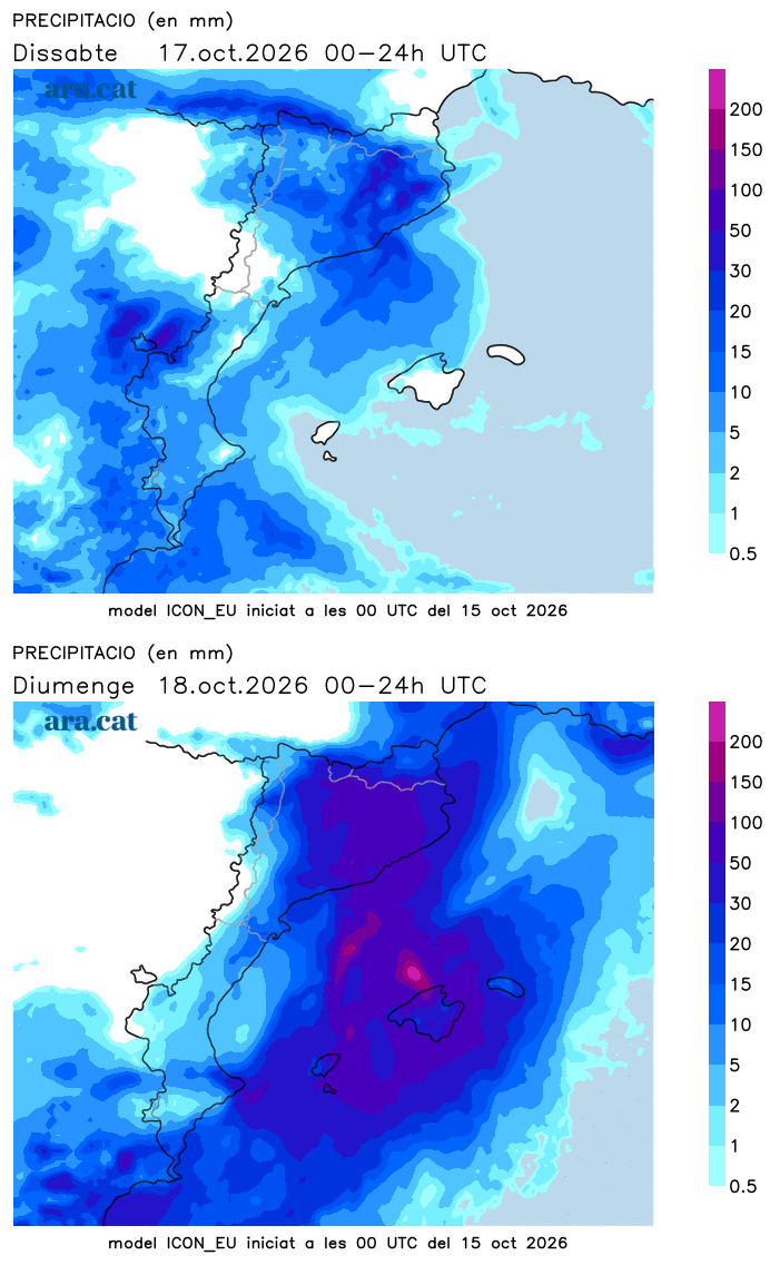
Starting on Sunday it will also rain heavily in the Valencian Community and the Balearic Islands, where there may also be downpours. Aemet has already activated alerts in these sectors due to intense rain. In fact, in the Balearic Islands, in the Valencian Community, on the coast and pre-coast of Barcelona and on the southern face of the Pyrenees and Pre-Pyrenees, more than 100 or 150 l/m² can accumulate in some cases throughout the episode. Next week the instability is expected to continue.
Drop in temperatures and snow in the Pyrenees
There will also be significant changes regarding temperatures. On Saturday they will be dropping, and many minimums will be recorded at the end of the day. It will be on Sunday when this drop will be more abrupt and we will notice a marked cooling. The drop in the mercury can reach up to 10 degrees compared to previous days.
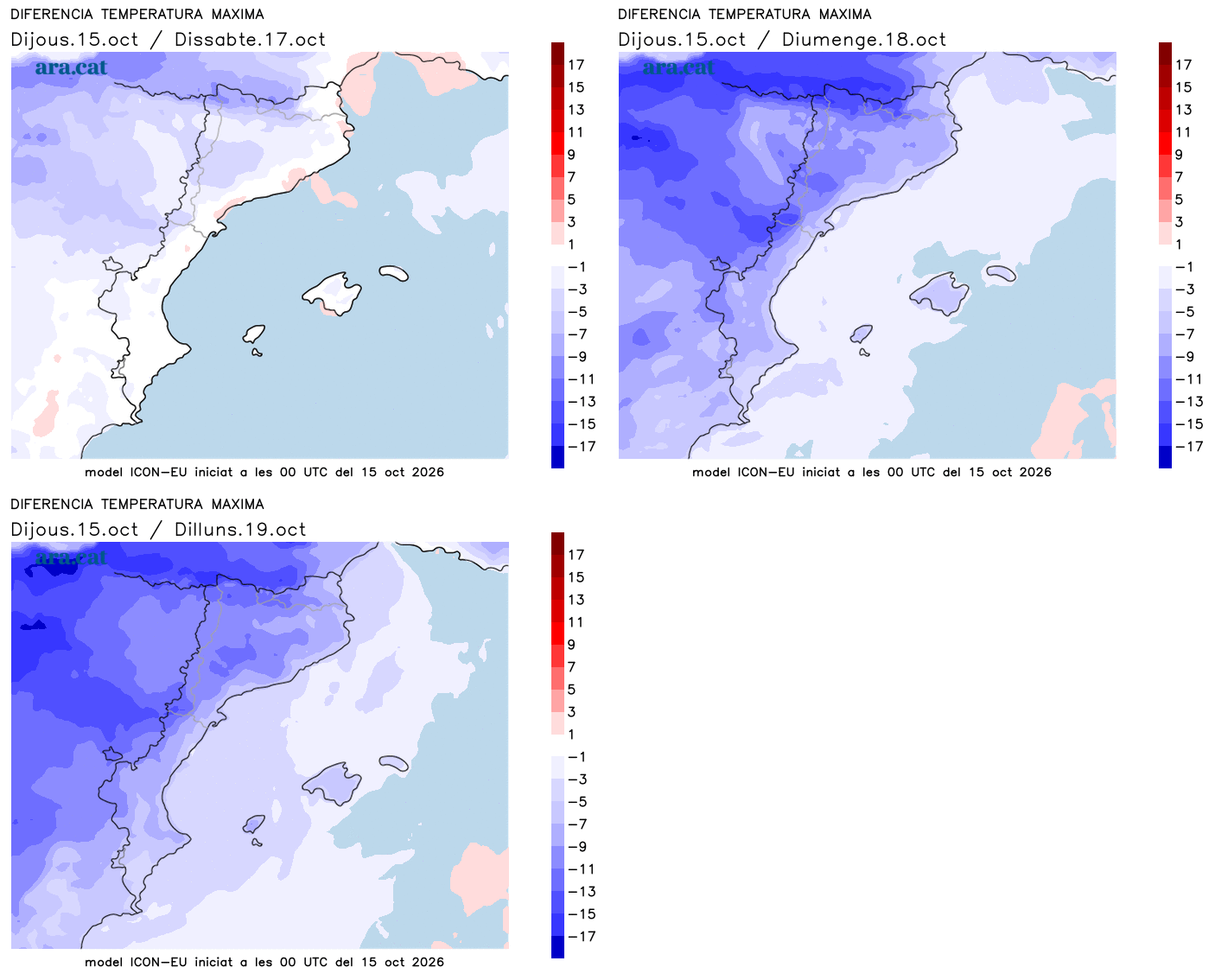
The atmosphere will be very cool or cold in general on Sunday, like late autumn, with many maximums of 13 to 17 °C, but lower in mountain areas. A coldness that will be accentuated by the cold northeasterly winds, which will blow moderately or with some strong gusts on the coast of Barcelona and Girona. On the Costa Brava, the tramontane will dominate. It will be necessary to quickly retrieve the jackets from the closet.
In the high and medium altitudes of the Pyrenees, temperatures will drop below 0 °C in the coming days, with a snow line that may fall to 2,000 m or below, depending on whether more or less cold air enters at altitude. Therefore, the high elevations of the mountain range will be whitened.
