Torrential downpours in the eastern half of the country
A large storm system can leave accumulations greater than 200 mm

-
CAT -
CAST
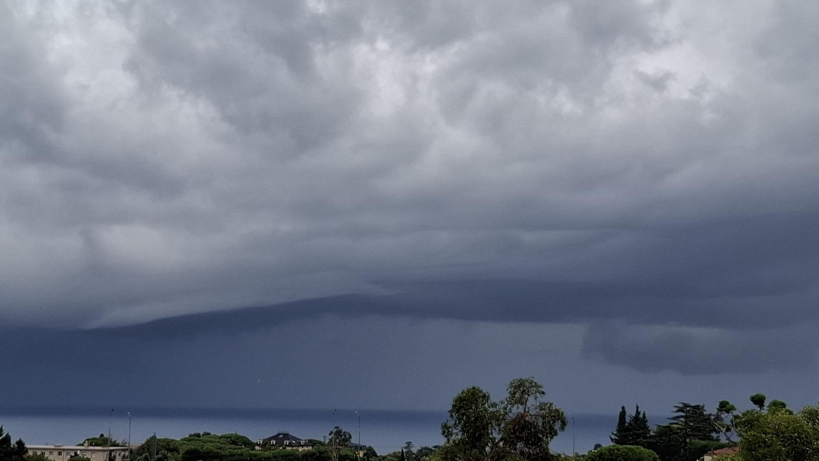
BarcelonaThe red alert remains activated in light of the new episode of torrential rain expected over the coming hours in many coastal, pre-coastal, and northeastern regions of the country. The tropical characteristics of this exceptional situation create the possibility that a small medicane (Mediterranean hurricane) could be generated. Various meteorological models, such as the Arome, indicate the formation of a convective vortex that could approach the central Catalan coast, with strong wind gusts and intense precipitation, with accumulations exceeding 200 mm. This convective phenomenon generates great uncertainty. We repeat that it is an unlikely scenario, but, in the event that it occurs, it is quite dangerous.
This cyclonic system or mini-hurricane has occurred on some occasions in the Mediterranean due to the high sea temperature and the strong contrast of existing air masses. This scenario must be followed with great attention, because sudden rises in rivers, streams, torrents, and ravines can occur, leading to flooding, therefore, and great caution is recommended. All this comes after the last rainstorm in the Terres de l'Ebre left more than 200 l/m².
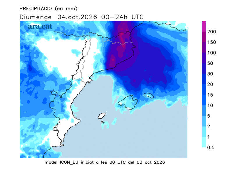

It will be towards Saturday night and during the early hours and morning of Sunday when the peak of the storm is expected. With the current maps, the rains may be intense and extraordinary in the northeast, the coast and the pre-coastal area of Barcelona, with local accumulations that can exceed 200 or even reach 300 l/m² in a few hours, with strong winds and extreme phenomena such as waterspouts or tornadoes. The Meteocat alerts are for intense rain and accumulations of more than 40 l/m² in half an hour, 90 l/m² in three hours and more than 200 l/m² in 24 hours. After a dawn with downpours, the rain will continue to discharge with intensity between the Barcelonès and the Empordà, and also affecting the regions of Girona and the east of Central Catalonia.
This situation of marked instability is typical of autumn, aggravated by a sea much warmer than it should be at this time of year. This year, records for the average sea surface temperature in the Mediterranean have been set, reaching 28.6 °C on August 14th (data from Copernicus Marine Service, @CMEMS_EU). In Catalonia, the sea has reached its highest average temperature ever recorded this summer, at 21.1 °C.
During the afternoon, the disturbance will move towards the northeast of the country and the rain will concentrate in the easternmost Pyrenees and Pre-Pyrenees. By the end of the day, the downpours will remain focused on the northern coast and pre-coastal areas.

Unsettled start to the week, with new showers
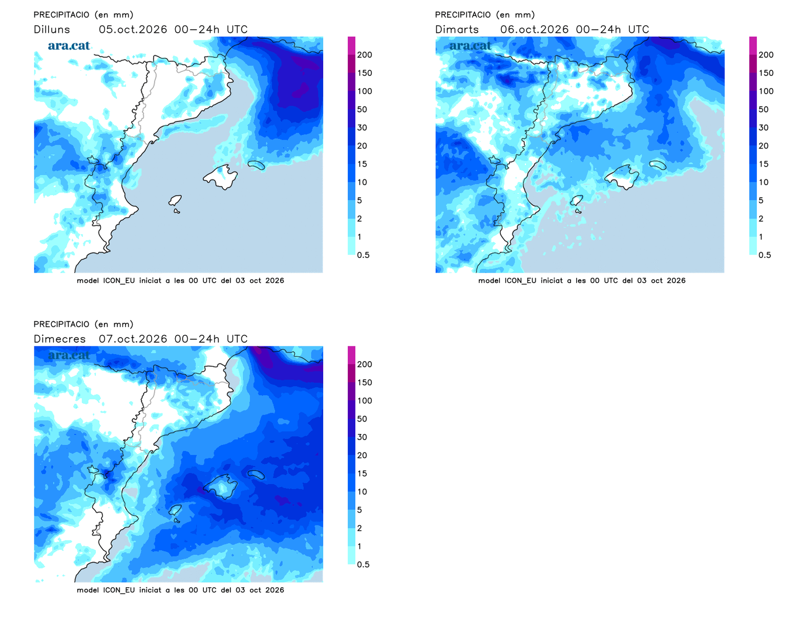
We will start the week with clearings, especially in Ponent and in the south. On Monday at noon, clouds will grow again and some scattered showers will fall. On Tuesday, thunderstorms will reactivate in the north and also in the Ports de Tortosa. It will not be completely clear until the end of the week, and temperatures may rise a little but, in any case, they have no intention of dropping.