The summer begins with a heatwave: will it be the trend for the coming months?
The temperatures will be extreme in the first days of the new season, with the first 40 °C of the year
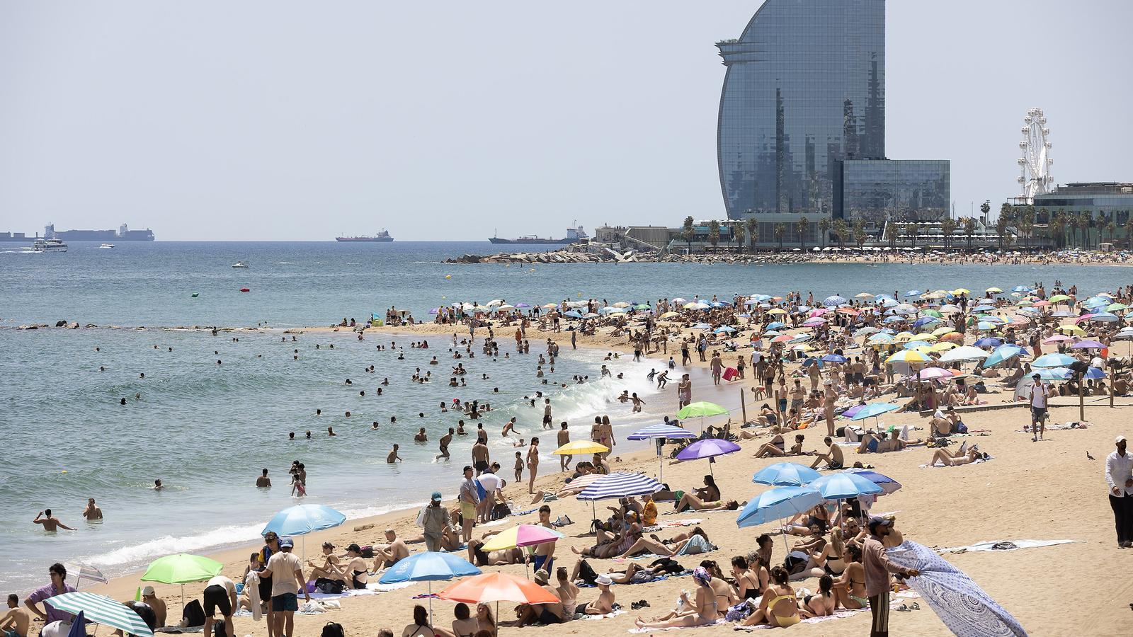

BarcelonaAfter the intense heat of recent days and experiencing the warmest spring since records began, the astronomical summer will officially begin this Sunday at 10:24 AM, even though it seems to have set in weeks ago. And it will arrive in grand style, as the first heatwave of the year will also kick off. The anticyclone and the gust of warm air from North Africa will strengthen, driven by southerly winds that will cause a low-pressure system located in the Atlantic.
Therefore, the first few days of the new season will be suffocating, with extreme heat and values between 8 and 13 degrees above the usual average for this time of year in much of the country. This weekend, temperatures could already reach 40°C in Ponent and the Ebro valley, but the peak of this episode will be experienced on Monday, with many maximums of 35 to 40°C across the country, very heavy sultriness on the coast, and restless nights in many regions. Tropical minimums will become widespread, and on the coast, there will be some torrid ones, above 25°C. Meteocat has activated warnings for intense heat in many regions, and Civil Protection has put the Procicat plan on alert.
"Maximum temperatures could exceed 40°C in Ponent and Terres de l'Ebre," warns Santi Segalà, head of the Prediction area of the Meteorological Service of Catalonia (Meteocat), in statements to ARA. However, the intrusion of a large amount of suspended African dust may prevent heat records from being reached. "This could cause maximum values to be more restrained and not reach the extremes of other episodes, but, on the other hand, it could cause nighttime heat to be more intense," he assures.
This heatwave will affect the entire Iberian Peninsula and half of Europe, especially western France, where several records could fall with up to 45°C. From Tuesday, the mercury will begin to drop, but temperatures will remain very high for the season for practically all of the rest of June.
This Saint John's will be one of the warmest since records began, with an especially high risk of fires. In addition, the rains of recent months have caused a lot of vegetation to grow, and currently all these grasses have dried out prematurely, which is fuel in case of fire. You will need to be very careful when lighting fireworks, at a minimum distance of 500 meters from wooded areas.
Another torrid summer?
Summer will begin with extreme heat, but what will happen the rest of the season? Long-term forecasts from the main seasonal meteorological models indicate that, one more year, this summer will once again register temperatures above the average "in the Iberian Peninsula and all of Western Europe," says Segalà.
According to these forecasts provided by Meteocat, July would be the warmest month of all, with a global average of nearly 1.5 degrees above the climatic average. August and September would also be warm months, with between half a degree and one degree above the average. Therefore, it seems that this episode of exceptional heat will not be the only one this summer. We will see if records are broken, after the last four years have been the warmest in history since records began, with 2022 at the very top of the podium.
Regarding precipitation, Segalà explains that July would be quite normal, or slightly drier in the Pyrenees. Considering that it is one of the driest months, we should expect little rain. However, August and September stand out, as they would be "rainier than normal in general," assures the expert. According to projections, in August it would rain mainly in the Pyrenees and the northeast – with the classic summer storms – and in September precipitation would particularly affect the coast, with the "classic autumn pattern." We will see what happens, as these long-term forecasts must be taken with a pinch of salt.
Catalonia, the new Andalusia
The accelerated rise in temperatures in recent years, with more than 2 °C above pre-industrial levels, has turned Catalonia and the entire Mediterranean into a zero zone for global warming. "Right now in Catalonia we have temperatures comparable to those recorded in eastern Andalusia fifteen or twenty years ago, such as Malaga or Almeria," explains Segalà.

And our coasts suffer more and more marine heatwaves, with the impact this has on species. The sea temperature is already between one and two degrees above average each year, with very high peaks in summer. Warmer water prevents the coast from cooling down with the sea breeze, and can fuel more extreme weather phenomena.
New heat thresholds
To declare a heatwave, there must be at least three consecutive days with extreme heat and values exceeding the heat thresholds set for each point in the country. A scenario that will take place in the coming days, especially inland. Faced with the constant rise in temperature, Meteocat has just changed these thresholds.
Until now, they were updated annually according to temperatures recorded in the last ten years. But since heat has been suddenly more extreme since 2022, this scale has been extended to the last fifteen years, which will allow for a "more solid" statistical reference base. "The new climate scenario forces us to adapt weather hazard warnings and, in reference to heat, we see that the current warnings needed some modifications designed for people's health," explains in a statement the director of Meteocat, Sarai Sarroca.
“The last summers have been extraordinarily hot, and it cannot be that the threshold rises so much every year, since in the end we will warn of temperatures of 42°C, when with 39°C the risk to health is already important”, assures Segalà, who adds that the temperature increases faster than human adaptation.
The new thresholds have a cap of 40°C in the warmest areas of the country. These are changes that have been agreed upon by the departments of Health and Labor, Meteocat, and Civil Protection, also within the framework of the Operational Plan to prevent the effects of heat on health (POCS).
The warning threshold – the degrees of temperature that are considered exceptional and deserve to activate danger warnings – corresponds to a calculation of the 2% hottest days observed in this series of years and sets the threshold among the highest values in the series.
