Calm and warmer today, awaiting some changes tomorrow.
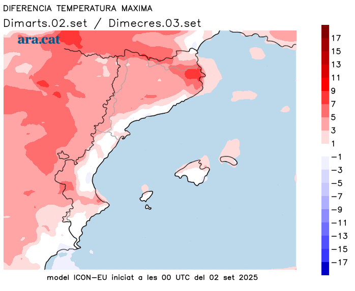
Temperatures will soar especially in the Girona region.

BarcelonaCalm has returned in the last few hours after the heavy storms that affected some regions between Sunday and Monday. All this with a clearly cooler nighttime atmosphere everywhere, even chilly in the Pyrenees early in the morning, where for the second consecutive night, temperatures dropped below 10°C in the valleys. Lows indicate that autumn is approaching, but the heat remains in the middle of the day. In fact, today's news will be the temperatures, which will rise, with more intense heat in the middle of the day. The rise in highs will be particularly noticeable in the regions of Girona, and especially in Alt Empordà, due to the warming southerly wind. All this with a placid weather situation that will continue today, with generally sunny weather and some low coastal clouds. However, on Thursday, we will be hit by the tail end of a small front that will reactivate scattered showers in some areas of the country. A minor change in the weather that will not continue into the weekend.

Wednesday: warmer and very calm
Minimum temperatures have once again been very cool throughout the region. Temperatures ranged from 10 to 15°C inland, 12 to 17°C on the pre-coastal coast, and 16 to 21°C on the coast (lowest on the Costa Brava). A warm sweater is needed early in the morning in many regions, while the morning is once again colder in the Pyrenees, with minimum temperatures dropping below 10°C in the valleys, but a rise in the high altitudes has already been noted. This is a prelude to the rise in maximum temperatures expected today, which will be particularly noticeable in the Girona region. The warming southerly wind will send temperatures soaring in this northeastern part of the country, especially in the Alt Empordà region, where temperatures could rise by more than 5°C. Many highs of 30 to 35°C are expected in this area, as well as in the West and the southern interior. In the rest of the country, most temperatures will range between 27 and 32°C.
As for the sky, the sun will dominate most areas. There will only be a few low clouds along coastal stretches, which will be more prevalent in the morning and may occasionally affect some pre-coastal areas. In the afternoon, thin clouds will reach the northern regions of Lleida, and harmless storm clouds will grow in the Pyrenees.
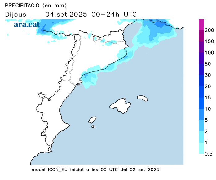
Small front heading into Thursday
The passage of a small Atlantic front on Thursday will revive some instability. Cloudy spells will generally increase, with some spotty showers expected in parts of the Pyrenees, the Pre-Pyrenees, the northeast, and the coast. Overall, these showers are relatively light, with the possibility of local thunderstorms. A few showers will also occur in Els Ports and the Castellón region on Friday, with local storms expected, but no rain is expected elsewhere.
All with rising minimum temperatures, with less cool morning temperatures. Maximum temperatures will drop slightly, although the drop will be most noticeable on Friday in the Girona region after the peak of the warmer months. Looking ahead to the weekend, the mercury will rise again overall. The weather is generally warm and muggy along the coast, with temperatures around normal or slightly above average.
