A new warmer weather is coming: temperatures will reach 40°C again this week.
The sun will be the star of the week's start in much of the country.


BarcelonaThe sun will be the star of the coming days, along with intense heat, with temperatures set to soar starting Tuesday and remaining well above average throughout the first half of August. After a relatively mild end to July, even a bit cool in some places, the dog days will end with persistent heat brought on by the arrival of warm air from the north of the African continent. All this without any significant changes in the weather in sight and with some harmless cloudy periods.

Monday: notable temperature rise
The week begins with much more stable and calm weather, although during the morning there will still be periods of low clouds on the southern coast and in nearby regions, although they will tend to clear as the hours pass. Elsewhere, the sun will be the main focus, with some harmless high clouds circulating in the sky and the growth of some developing storm clouds in the Pyrenees, with no risk of rain. Temperatures will rise sharply during the central hours of the day, with the mercury reaching 36°C or 38°C in the West, with minimum temperatures increasingly approaching the threshold of a torrid night on the central coast.
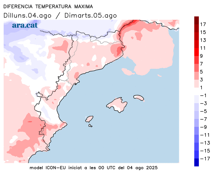
Tuesday: clear sky
A splendid day: sunshine will dominate everywhere and for practically the entire day. Only a few decorative storm clouds will grow in the afternoon in the north. Southerly winds will gain ground as the hours pass, without any complications, and temperatures will rise slightly. Lows will hover around or reach above 25°C on the central and southern coasts, and highs will once again reach 38°C or 40°C in the west.
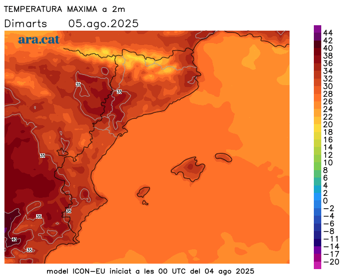
The heat will be intense throughout the week
The warm air mass from the south, which will send temperatures soaring, could accompany us throughout the week and even intensify towards the weekend, with highs that could once again reach or exceed 40°C or 41°C occasionally in the usual inland areas of the Ebro Valley. Elsewhere, the heat will also be intense, with highs of 34°C to 37°C inland and 30°C to 33°C on the coast.
Nights will be heavier and more difficult to sleep throughout the week, not just on the coast. Furthermore, the mugginess will be more intense along the coast and pre-coastal areas. In short, all the ingredients of the hottest days of the dog days, although aside from the heat wave that will be experienced in the central and southwestern parts of the Iberian Peninsula. This situation will last for several days, and no rain is in sight.
