Stability will gain ground after a very rainy morning.
Locally, the figure has exceeded 70 l/m².


BarcelonaAfter a mostly calm and stable weekend, the approach of a front, associated with a cold air channel at altitude, caused showers and thunderstorms to begin arriving in the western half of the country on Sunday afternoon. The rain eventually reached the rest of the central and northern half of the country, leaving over 50-70 l/m² in some places and giving September an unbeatable start in terms of available water reserves (you can find the accumulated rainfall data for this episode at the end of this report).
Monday: Showers will move to the eastern half
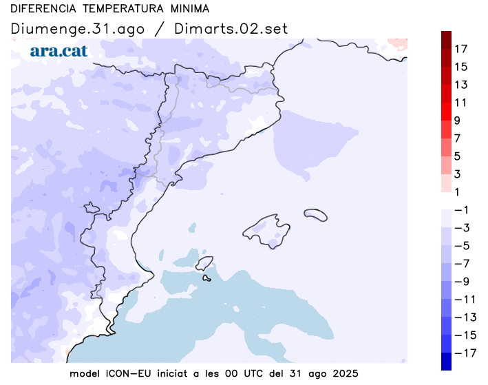
The week, and therefore meteorological autumn, begins with a notable drop in temperature and with traces of instability in the eastern half. Rain could still fall in some parts of the Girona region until mid-morning, with much more stable weather in the western and southern half, where the mistral wind will help clear the sky of clouds. Showers could recur in the afternoon in the north and northeast, although they will not be as widespread or abundant as those seen in the early morning. Temperatures will drop significantly in the evening, with the lowest recorded at the end of the day.
The Catalan Meteorological Service maintains a warning for intense rainfall during Monday afternoon and evening, affecting the regions of Barcelonès, Maresme, Vallès Oriental, Selva, Garrotxa, Gironès, Pla de l'Estany, and Ripollès. In addition, a warning is in effect for possible rainfall accumulations of more than 100 l/m2 over 24 hours, affecting the regions of Vallès Oriental and La Selva.
Tuesday: Stability prevails
The weather will be more stable heading into Tuesday, although some showers could still occur in some coastal areas during the early morning. The rest of the day will be dominated by sunshine and periods of high and medium cloud cover, with no risk of precipitation. The minimum temperature will bottom out, and the early morning will be cool throughout, but midday will be somewhat milder, with highs of 30°C to 32°C in the south of the country.

Storm balance
Since Sunday afternoon, several waves of showers and thunderstorms have circulated across the country, accumulating very heavy amounts of precipitation in some areas. It was during the early hours of Monday morning that the rain reached more places and fell with greater intensity, often accompanied by thunderstorms. These are the most significant accumulations:
- Fogars de la Selva: 74 l/m²
- Alfarràs: 66 l/m²
- Ascó: 54 l/m²
- Taganante: 51 l/m²
- Malgrat de Mar: 45 l/m²
- Balaguer Bone: 29 l/m²
- La Pobla de Segur: 22 l/m²
- Vinebre: 20 l/m²
- Baldomar: 18 l/m²
- Puigcerdá: 16 l/m²
