Alert for a new strong wind storm in many regions this weekend
Sunday will be the most complicated day, especially in the Pyrenees, Pre-Pyrenees, in the Girona demarcation and in the Ebro.
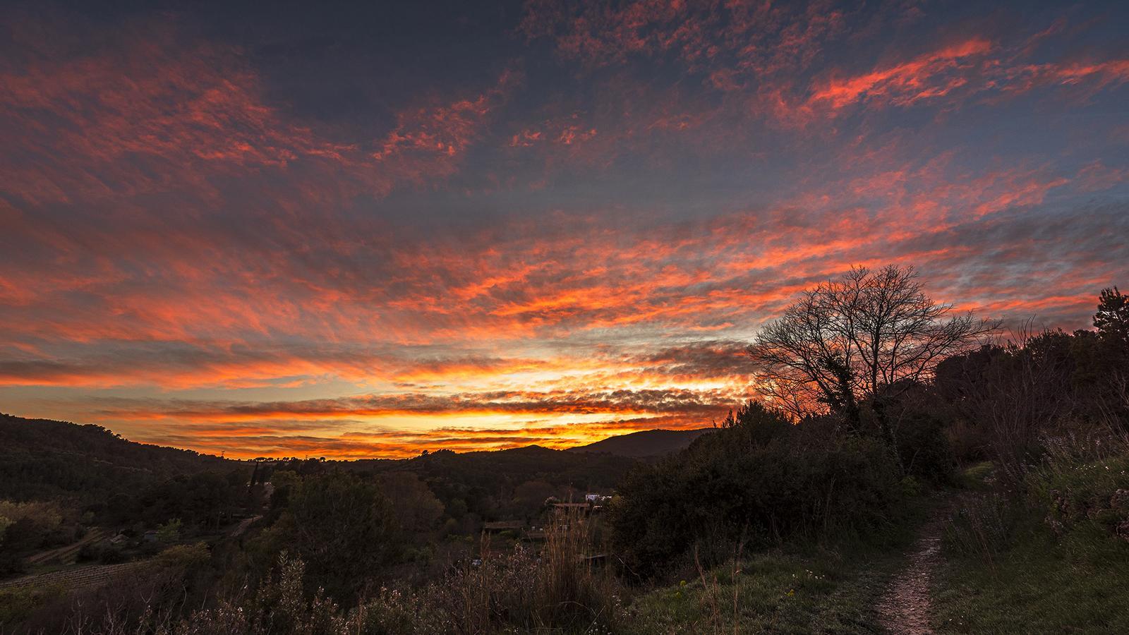
BarcelonaThe weather will become complicated this first weekend of Holy Week. The passage of a new cold front will cause a new snowfall in the Pyrenees at very low altitudes starting Saturday afternoon. The north wind will strengthen, and on Palm Sunday we will experience a storm of strong gusts in many regions. The most affected areas will be the Pyrenees, Pre-Pyrenees, Girona regions, the Ebro, the south of Camp de Tarragona, Castellón, and the Balearic Islands. The gusts will widely exceed 100 or 120 km/h in the most affected areas, and conditions will be especially adverse in the Pyrenees, where the atmosphere will be icy and the phenomenon of blizzard will occur. These are days of high mobility, so exercise maximum caution, especially in mountainous areas and in the northeast. Civil Protection has already activated the alert of the Ventcat plan in the face of this episode.
The cause of this gust of wind is found in the powerful corridor of cold northern wind towards our house that has been generated between a powerful anticyclone in the Atlantic and a low-pressure area in the Western Mediterranean. The atmosphere will be colder and more wintry on Sunday. Next week will still begin with wind and remnants of instability in the north of the country, but it seems that we will face the key days of Holy Week with more calm and good weather.

Saturday: changes throughout the day
Saturday morning will be quite calm and sunny in most of the territory, with only remnants of some clouds and weak morning drizzles between the Balearic Islands and southern Valencia. The tramontana will persist in Empordà –with rough seas– and in the Pyrenean peaks –with blizzards–, as well as moderate mistral in the south.
It will be from midday and during the afternoon when the approach of the cold front will begin to cause changes. Cloudiness will increase throughout the country from north to south, and the sky may even become overcast as the hours pass in many parts of the northern half. Precipitation will arrive on the northern face of the Pyrenees, which may punctually extend to the north of the southern face. The snowline will drop from 1,200 to 800 m in the western Pyrenees, and from 1,600 to 1,400 m in the eastern Pyrenees.
Some drizzle may also escape from the afternoon in the northeast, and at night, showers and some local thunderstorms or hail may fall between the coast and the pre-littoral of Barcelona and southern Girona. Temperatures will be kept in check, with maximums similar or slightly higher. Many values will range between 13°C and 18 °C.
Sunday: windy weather
Once the front passes, from tonight and throughout Sunday, a strong wind storm will occur in many regions. The most affected areas will be the Pyrenees and Pre-Pyrenees – also in the valleys–, in the regions of Girona, Camp de Tarragona, Ebro, and Castellón. In these areas, speeds can easily exceed 100 or 120 km/h, with some local hurricane-force gusts of more than 140 or 150 km/h. Meteocat has various alerts activated for strong winds this weekend.
Little or much, the wind will be felt everywhere, although it will blow more weakly in the Barcelona area. Also pay attention to the Balearic Islands, where the wind and rough sea storm will be very harsh. Maritime situation very altered on the Costa Brava, and very adverse conditions in the high areas of the Pyrenees, with very strong wind, icy atmosphere, snow and blizzard, a phenomenon that greatly reduces visibility and can cause accidents in the midst of an extreme weather context. Much caution, all planned high mountain activities will have to be postponed.
The snowfall will remain on the north face of the Pyrenees, and will intermittently jump to the south face. The snow line will be very low, and it can snow at practically all altitudes. Meteocat warns of accumulations of more than 10 cm from 900 m upwards on the north face, and of 30 to 40 cm at high altitudes. Variable sky in the northeast, and more sun in the rest. Clear drop in temperatures, with a more wintry atmosphere and values below average.
Little by little, more calm
Next week will still start with strong winds in the extremes and snow on the north face of the Pyrenees. But as the days go by, the meteorological situation will gradually improve. The maps indicate that by mid-week the situation will be calmer, with temperatures rising and becoming milder. Therefore, it seems we will reach the key days of Easter with much more usable weather.
