Weather with a little bit of everything in a new week of bearable heat
Showers will fall irregularly in some regions and the wind will blow strongly in the extremes of the country.
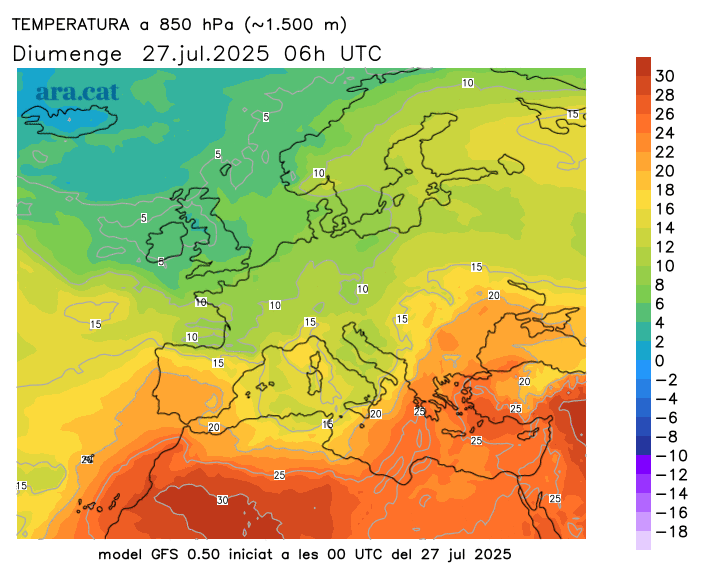
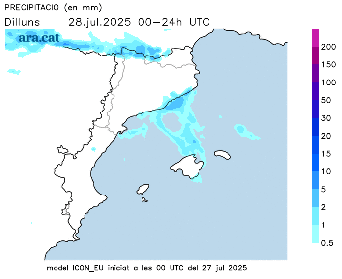
BarcelonaWe've left behind a fairly quiet weekend that ended with more heat, but far from extremes. In parts of the West and inland, temperatures reached or slightly exceeded 35°C yesterday, hardly remarkable values considering we're in the middle of the summer heat wave. But this week will begin with a new drop in temperature, and the weather will experience some changes, with a bit of everything depending on the area and the day. The sun will remain dominant in much of the country, but not everywhere. In the Empordà and the far south, the news will be strong mistral and tramontana winds today, with a very high risk of fires that has led to the closure of some natural parks in these areas. On the coast and the central pre-coastal region, more clouds and some irregular showers will appear this week. In fact, during the early hours of the morning, there have already been some, with 10 l/m² falling in Viladecans, in the Baix Llobregat region.

Monday: The slipstream will cause showers on the coast
The week begins with a cool morning, and today the heat will remain very moderate, with temperatures set to drop. The weather will be fairly stable in most regions, but both today and tomorrow the Tramuntana and Mistral winds will blow in the far corners of the country, causing a slipstream effect on the central coast. These winds will be offshore along the central coast, where some scattered showers will form, especially during the evening hours. In fact, a warning of danger due to intense rainfall from the Meteorological Service of Catalonia is in effect affecting the regions of Barcelonès, Baix Llobregat, Garraf, Baix Penedès, and Tarragonès. Elsewhere, the weather will be much calmer, with sunshine and some harmless cloudy periods.
Tuesday: More coastal showers early in the morning
We'll be approaching the end of July with weather very similar to Monday's, marked by the possibility of showers on the central coast and some other parts of the northern half, but with sunshine throughout the rest of the country. The wind will remain strong, although it will tend to weaken, and the temperature will remain unchanged, with moderate heat during the central hours of the day when the sun could shine brightly.
Ahead: The dog days will stay away
We could still experience a few showers along the coast during the early hours of Wednesday, but the weather will tend to be more stable and calm in this part of the country. All this with a stable mercury and no heat in sight, very good news after an intensely hot start to summer that suggested a hellish heatwave. The nights will continue to offer good sleep in most regions.