Weekend still keeping an eye on the sky
The instability will remain pronounced with more intermittent showers
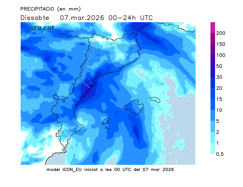
BarcelonaThe easterly winds have been relentless in recent hours, bringing almost 48 hours of continuous and heavy rain. Accumulations along the coast and pre-coastal areas range from 30 to 60 liters per square meter, but in several cases, these figures have been exceeded. The interior and pre-coastal areas of the northeast and south of the Ebro River have seen the heaviest rainfall during this storm, with some areas already exceeding 150 or 200 liters per square meter (you will find all the most relevant updated data at the end of this report). This has caused many rivers, whose courses are saturated from the heavy rainfall of recent months, to swell. Some have reached the flood stage, such as the Ter River in Sant Joan de les Abadesses (Ripollès), the Ges River in Torelló (Osona), the Brugent River in Amer (Selva), and the Muga River in Sant Llorenç de la Muga (Alt Empordà).
The weather will remain unsettled in the coming hours. The easterly winds will weaken and the low-pressure system will dissipate over the weekend, but there will still be a humid flow from the sea towards the inland area which, combined with the pocket of cold air aloft, will maintain the marked instability, with more changeable weather and more intermittent showers.
Saturday: more intermittent showers
The unsettled weather will remain very pronounced at the start of the weekend. Although the low-pressure system has largely dissipated, the presence of cold air aloft and moisture from the Mediterranean will still guarantee unsettled conditions. Rain continued overnight, moving from the sea towards the land, but in a more fragmented and scattered fashion, not as continuous as in recent hours. This morning, showers continue, particularly active in the northeast, Central Catalonia, the western lands of Catalonia, and the Pre-Pyrenees of Lleida. In the southern half of the region and along the Barcelona coast and pre-coastal areas, there will be a break in the morning, but from midday onwards, heavy downpours will return, locally accompanied by thunderstorms. In the rest of the region, showers will be more intermittent, with some breaks in the clouds. The snow level is dropping from 1,600 to 1,400 meters.

Saturday will be changeable and variable, with a possible break in the rain in many areas during the morning. Showers will increase in the afternoon due to growing cloud cover, with locally thunderstorms. It will be a day to keep an eye on the sky and expect spring-like weather, with cooler temperatures early on but warmer highs, especially in the northeast. Many areas will see temperatures between 13°C and 17°C. The wind and rough seas will gradually subside towards the coast.
Sunday: Time won't cleanse
It will be a very changeable day, with periods of sunshine followed by sudden cloud cover due to the continued instability. Light rain is possible in the morning, especially along the coast and inland areas, but from mid-morning until nightfall, showers will increase and could appear sporadically anywhere, locally accompanied by thunderstorms. A typically unpredictable spring day, with the snow level around 1,500 meters and temperatures similar to Saturday's are already approaching.
Busy weather next week too
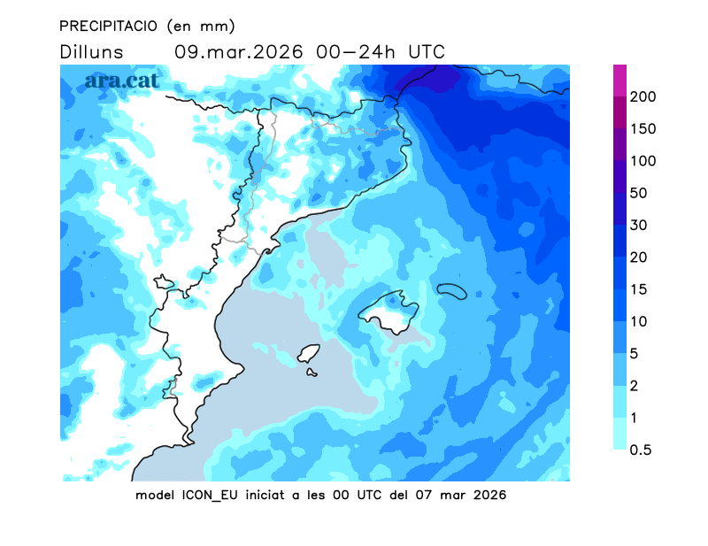
Over the next few days, we'll continue to be affected by storms and fronts, which will keep the weather unsettled. Rain is likely to return throughout next week, although it won't rain every day. We'll have a bit of everything again, but without any new periods of clearing; instead, we'll be visited by several showers.
Levante Weather Summary
The storm that began on Thursday has left behind some very significant rainfall totals. The rains have swept persistently across the entire country, from the coast to the land. Many areas have recorded between 30 and 60 l/m², although rainfall has been less in the west, especially in the northern part of the Lleida region. However, in some cases, these figures have been significantly exceeded. This is the case in the northeast interior and the Terres de l'Ebre region, where some areas have seen more than 150 or 200 l/m². As for snow accumulation, 55 cm of new snow has been recorded in Vallter (at 2,400 m).
This is a compilation of the most significant rainfall totals recorded up to Saturday morning in the Levante region:
- 242 l/m²: Els Ports
- 241 l/m²: Puig Sesolles (1,668 m)
- 214 l/m²: Viladrau
- 194 l/m²: Sant Hilari Sacalm
- 194 l/m²: San Pablo de Segúries
- 187 l/m²: Mieres
- 185 l/m²: Molló
- 166 l/m²: Espinelves
- 153 l/m²: Search
- 144 l/m²: San Celoni
- 116 l/m²: Tivissa
- 107 l/m²: Ulldecona
