Alert for new torrential rains in the Valencian Country, Catalonia and the Balearics
In the south of the Valencian Country they are already exceeding 600 l/m², historical records
-
CAT -
CAST
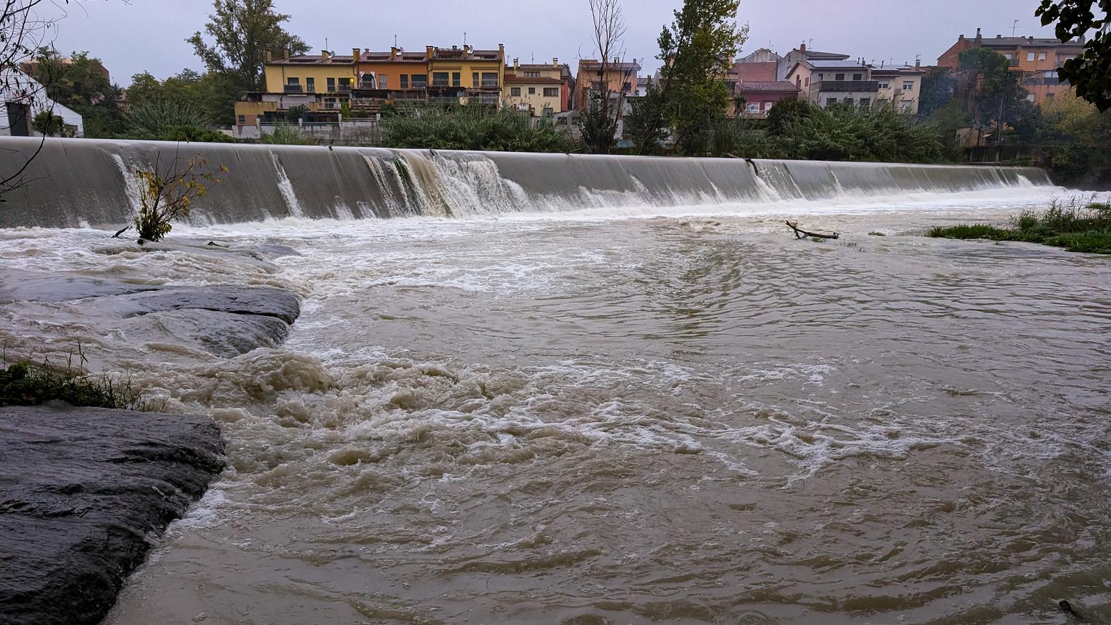
BarcelonaThe rains are not giving any respite, and in these last few hours the worst of the storm is punishing the south of the Valencian Country. The regions of La Safor and Marina Alta are bearing the brunt, where the rainfall records of the last few hours are historic and are already approaching or exceeding 600 l/m² in municipalities such as Pego, Oliva, Vilallonga, or la Vall d'Ebo. But Forna, l'Atzúbia (Marina Alta) stands out, the ground zero of the storm, where more than 700 l/m² have already been exceeded, according to data provided by Avamet. It has been raining there since Sunday, but the majority of the liters have fallen during this early morning. These are extraordinary records comparable to those reached during the tragic DANA from two years ago. All of this is causing the overflowing of some rivers - such as the Girona river - and many floods, with hundreds of incidents. A very complicated situation in this area, where a red alert is active and it may still rain heavily throughout the morning.
The DANA and the arrival of humid maritime winds are responsible for this situation that is causing such significant rainfall. Beyond the Valencian Country, the Pityusic Islands and Mallorca are also on alert due to the downpours that have already caused flooding in recent hours, while in Catalonia the rain that fell over the weekend will not give any respite today, with a new round of precipitation and the risk of further downpours, especially starting in the afternoon. There are many alerts activated, caution. Furthermore, in some cases it is raining on wet ground, as some monthly rainfall records are already approaching 400 mm in parts of the coastline and pre-coastal areas, especially in Barcelona.

Therefore, danger warnings for rain intensity and accumulation are maintained, as well as for maritime disturbance in some sections of the coast. In the case of rain accumulation, today practically the whole country is under a yellow warning for accumulations of more than 100 mm in 24 hours, with Berguedà, Solsonès, Ripollès, Cerdanya, and Alt Urgell at an orange level. Regarding rain intensity recorded in half an hour, there are several regions of the coast, pre-coast, and center of the country under an orange level warning during the afternoon and night. In these regions, the threshold of 40 mm accumulated in just half an hour could be exceeded, a torrential intensity that we have already seen during the weekend.
Monday: more rain
The week begins with still very unstable weather and locally intense precipitation that will advance from the sea towards land, with humid maritime winds that will help maintain this unsettled weather situation. The rain will be locally intense in parts of the coast and pre-coastal areas, but also in some inland regions, with storms and new downpours in areas that have already received a lot of water since the beginning of the month. The main event in Catalonia is expected especially in the afternoon, extending locally until the night. But in the morning, it will already be raining in a more scattered way in any region. The minimum temperature has dropped a little more, and the maximum will remain stable or a little lower, with a rather cold atmosphere in general. Most maximums will be between 13 and 17 ºC.

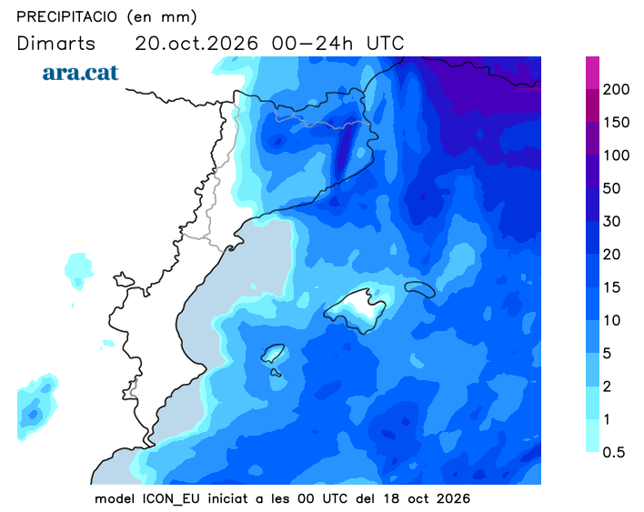
Attention to the Valencian Community and the Balearic Islands, where rainfall could still be heavy and abundant, with a risk of torrential downpours and significant accumulations. Aemet maintains orange and yellow alerts active along the coast of the Valencian Community and throughout the Balearic archipelago for accumulations that in 24 hours may still accumulate between 200 and 300 mm more today. Alerts are also activated for rain intensity in all these sectors.
Tuesday: calmer weather
The meteorological situation will improve as the hours pass, although on Tuesday morning there will still be locally intense showers concentrated in the northern and eastern half of the country. Even so, clearings will gain ground from west to east and during the afternoon there will be plenty of sunny spells, especially in the West and the extreme south. The maximum temperature will recover thanks to this reappearance of the sun, but the atmosphere will still be autumnal.
Assessment of the floods in Catalonia
The rain began to fall in parts of the northeast during Saturday afternoon, and as the hours passed it spread to more areas, always more intense along the coast and pre-coastal regions. In some places, such as the port of Barcelona, Sant Pere de Ribes (Garraf), Cabrils (Maresme), or Montesquiu (Osona), more than 75 mm were exceeded between Saturday and Sunday. In fact, in Cabrils and Sant Pere de Ribes, more than 60 mm fell in just thirty minutes, an exceptional precipitation intensity for the country. In the case of Cabrils, the 37.8 mm that fell in 10 minutes is a new record for rainfall in this time period in Catalonia.
Also noteworthy are the downpours that have affected parts of the Balearic Islands and the Valencian Community. In the case of the Islands, this Sunday the 122.8 mm in Formentera and the 123.2 mm at Ibiza airport stand out. In the case of the Valencian Community, the regions of Safor and Marina Alta are the most affected, with some accumulations already exceeding 600 or 700 l/m² in just 24 hours, historical records.
