The weather will remain stable today, but with some new developments.
Showers will be present in some Pyrenean regions.

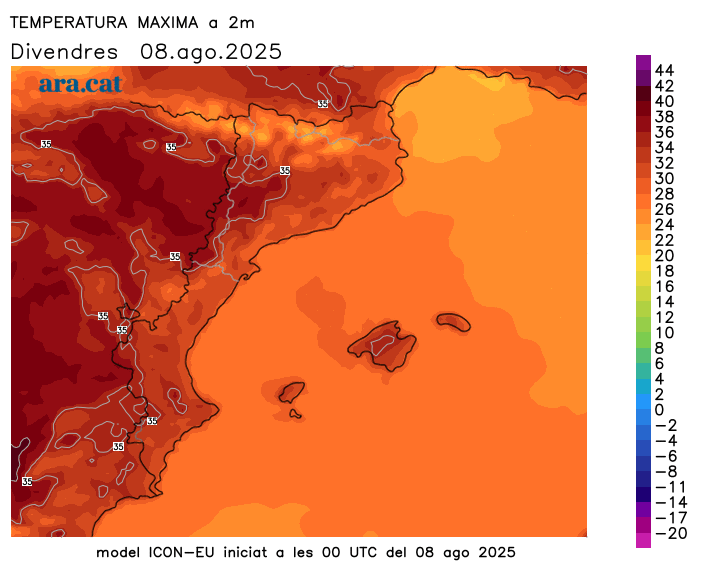
BarcelonaThere will be few changes in the weather forecast for the next few days, although there will be new developments not seen in previous days, such as low clouds at both ends of the coast and the formation of some afternoon showers in the Pyrenees. High temperatures will persist for another day, with intense and continuous heat throughout, which will intensify starting on Sunday (you'll find the highest temperatures reached so far at the end of this report).

Friday: scattered afternoon showers in the Pyrenees
We'll be approaching the weekend with very stable and placid weather. The latest developments will include some low coastal clouds and the formation of afternoon storm clouds in the Pyrenees, bringing the risk of some more extensive showers than in previous days. Temperatures will generally remain fairly steady, although they will rise more strongly at mid- and high altitudes in the Pyrenees. The weather will be intense, with highs between 34°C and 38°C inland and 29°C to 32°C on the coast.
Saturday: Mercury temporarily stabilizes
The first day of the weekend will be marked by stability and calm, with some low clouds at both ends of the coast and high clouds elsewhere. In addition, afternoon showers will recur in the Pyrenees. Maximum temperatures will approach or reach the 40°C mark in some areas of the West Coast, especially in the Segrià region.

The heat will be more intense starting on Sunday.
The warm air mass from the south, which will send temperatures soaring, will be with us for at least the first half of August, with highs that could once again reach or exceed 40°C or 41°C starting Sunday in the usual inland areas of the Ebro Valley and the West. Elsewhere, the heat will also be intense, with highs of 35°C to 38°C inland and 30°C to 34°C on the coast. It will be especially during the first half of next week that the mercury could reach its highest values, and we will be talking about the second official heat wave of the summer.
Nighttime temperatures will also continue their gradual rise, and tropical nights will become widespread along the coast and pre-coast, also reaching other inland areas. Some torrid nights will even be recorded along the central coast.
Heat balance
Temperatures had already risen significantly on Monday, with many highs between 28°C and 32°C on the coast and above 36°C in Ponent and the south, but they rose further on Tuesday, when the highest values of the episode were recorded. On Wednesday, the mercury cooled slightly, but Thursday saw a further rise in temperature. These are the most notable temperatures of this new episode of intense heat:
- Vinebre: 39.8°C
- Torroja del Priorat: 39.0 °C
- El Masroig: 38.6 °C
- Ribarroja Reservoir: 38.5 °C
- Benissanet: 38.2 °C
- Lleida - la Femosa, Tremp and Ascó: 37.7 °C
- Seròs and Alcarràs: 37.6 °C
- Flails: 37.3 °C
- Oliola, Torres de Segre and La Pobla de Segur: 37.1 °C
