The heat will intensify on a Tuesday with some clouds
The highest maximum temperatures could reach 40°C in the interior of the Ebro and Ponente rivers.


BarcelonaThe week has started very calmly, with the weather dominated by the anticyclone and the entry of warm air, which will be the two elements that will define the weather throughout this week. This will make the heat even more pronounced everywhere on Tuesday, with a fully summery atmosphere after a few weeks of more normal temperatures, around the climate average. The heat will last at least until the weekend, with values well above normal in some cases (you will find the highest temperatures reached so far at the end of this report).

Tuesday: clear skies in the morning
A splendid day: sunshine will dominate throughout the morning, but with the arrival of harmless high clouds from midday onwards. Only a few more significant storm clouds will develop during the afternoon in the north, with even a few light showers in the eastern Pyrenees. Southerly winds will gain ground as the hours pass, with no complications beyond a few moderate gusts, and a heated north wind will appear in the Empordà region. Temperatures will rise slightly, with lows approaching or above 25°C on the central and southern coasts and highs once again reaching 38°C or 40°C in the West and inland parts of the Ebro Valley.
In this sense, a warning for intense heat from the Meteorological Service of Catalonia is active that affects the regions of Segrià, Terra Alta, Ribera d'Ebre and Alt Empordà.
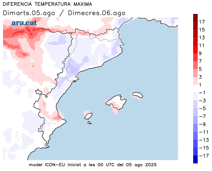
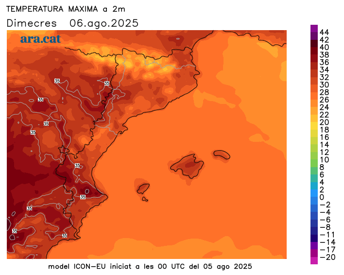
Wednesday: Mercury relaxes temporarily
Temperatures will stabilize or drop slightly by Wednesday, with intense heat but a brief respite from the rising temperatures. The arrival of high clouds will leave generally cloudy skies, with locally strong southerly winds in the southern pre-coastal region and the southern regions of Ponent.
The heat will be intense throughout the week
The warm air mass from the south, which will send temperatures soaring, could accompany us throughout the week and even intensify towards the weekend, with highs that could once again reach or exceed 40°C or 41°C occasionally in the usual inland areas of the Ebro Valley. Elsewhere, the heat will also be intense, with highs of 34°C to 37°C inland and 30°C to 33°C on the coast.
Nights will be heavier and more difficult to sleep throughout the week, not just on the coast. In addition, the mugginess will be more intense along the coast and pre-coast. In short, all the ingredients of the hottest days of the dog days, although aside from the heat wave that will be experienced in the central and southwestern parts of the Iberian Peninsula. This situation will last for several days, and there is no rain in sight.
The first day of the heat wave is here.
Temperatures have already risen significantly this Monday, with many highs between 30 and 35°C on the coast and inland. These are the most notable figures from this latest bout of intense heat:
- Seròs: 36.9°C
- El Soleràs: 36.6 °C
- Vinebre, Tremp, Alcarràs, Lleida and Llimiana: 36.0 °C
- Torroja del Priorato: 35.9 °C
- Torres de Segre: 35.7 °C
- Albesa: 35.6 °C
- Roquetas: 35.4 °C
- Vilanova de Segrià: 35.3 °C
