Strong storms, downpours and cooler weather
The Inuncat plan remains active due to heavy rain and very heavy accumulations.

BarcelonaThe front with cold air at altitude associated with a deep Atlantic disturbance (ex-hurricane Erin) will cause instability to continue in our territory, in the form of strong storms. Civil Protection maintains the Inuncat plan activated in the alert phase.
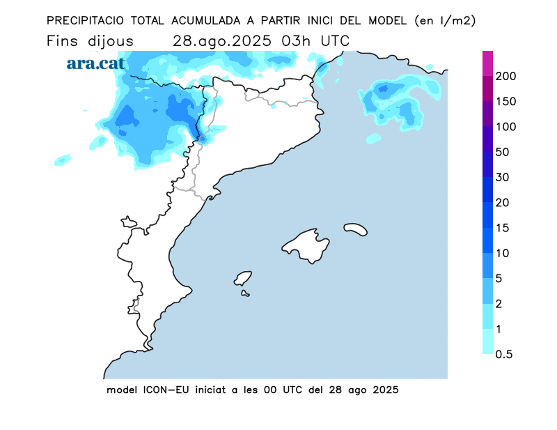
In the last few hours, we have already seen quite a bit of meteorological movement, in the form of showers and the first storms associated with the previous part of the predicted frontal system. As of last night, 15 to 25 l/m (15 to 25 l/m) had accumulated.2 At some observatories in Ponent, and this morning, new showers have begun to fall inland and in the westernmost Pyrenees (you'll find more information on rainfall amounts at the end of this report).
Instability will increase as the hours pass, with a more complicated morning on the coast and an afternoon with storms, locally strong, in the northeast.


Thursday: More intense storms in the eastern half and cooled
Today, atmospheric instability will continue. The sky will remain overcast, with significant cloud cover throughout, and heavy showers accompanied by thunderstorms and hail or hail. These events will be more likely along the coast and the pre-coastal areas in the morning and in central Catalonia and northeastern regions in the afternoon.
Meteocat also maintains warnings for very heavy rainfall (up to 100 mm in 24 hours) on the coast and in the pre-coastal area.
Showers and thunderstorms, locally strong, will move during the afternoon to the eastern half and parts of the coast and central pre-coastal, with locally heavy downpours, which will dump significant amounts of rain wherever they strike. Temperatures will drop, both day and night, with tropical lows now concentrated only along the coast and lower highs. Temperatures will hover around 30°C on the southern coast, but generally, temperatures will remain between 23°C and 28°C.

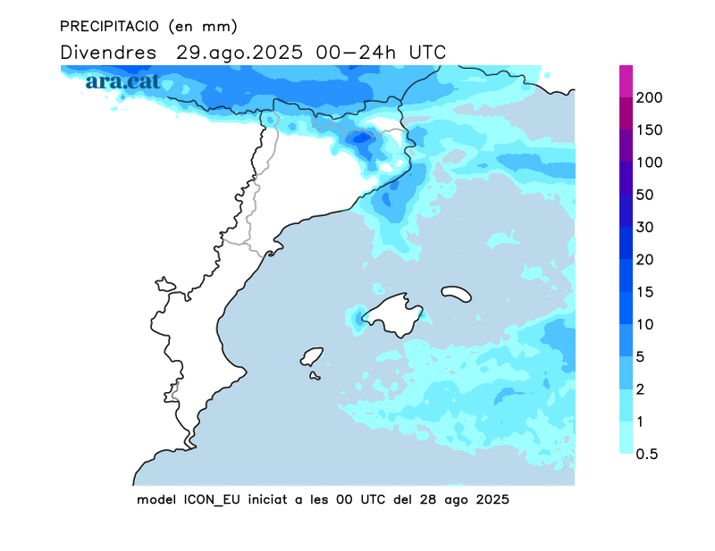
More calm weather from Friday onwards, but with cool nights
With the passage of the front, clouds will remain in the northeast of the country, with some final showers on the central coast or the southern Costa Brava. The weather will be cooler and even somewhat cold in the Pyrenees (in the valleys, they will drop to 7°C). Maximum temperatures will not exceed 25°C on the coast. Winds will blow with strong gusts during the early morning in the Empordà region and will ease as the hours pass. Clear skies will occur in the rest of the country, with some afternoon clouds that, locally, may leave some final showers in the northeast.
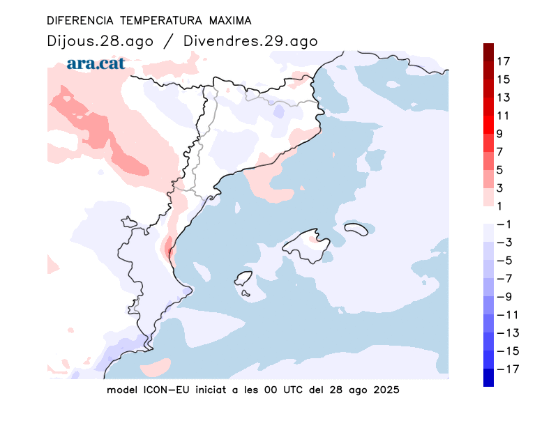
A quiet Saturday, with rising temperatures but no major heat expected. Maximum temperatures will remain moderate, a few degrees below what would be expected for this time of year, except in the Empordà, Ponent, and the Ebro, where temperatures will rise slightly. Showers and some new storms will return on Sunday, especially in the north and along the coast.
Accumulated rainfall until 8 p.m. on Wednesday (in l/m)2):
- Manresa: 25
- Talarno: 24
- Raimat: 22
- Ships: 22
- San Lorenzo Savall: 21
- Viladrau: 21
- the cube: 16
- Temple: 15
- Tárrega: 13
