More heat and strong storms during the afternoon
Warning of heavy rain in the Pyrenees and Central Catalonia


BarcelonaThe latter part of the weekend will be marked by more unstable weather. The entry of some cold air from the upper layers of the troposphere will cause powerful storm clouds to develop, especially this afternoon, in the northern third of the country. Meteocat has issued a warning for heavy rain and showers that could accumulate between 30 and 40 l/m.2 in less than half an hour, accompanied by hail and hail. The regions most likely to experience the heaviest showers are Berguedà, Ripollès, and La Garrotxa.

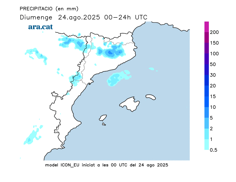
Sunday: Cloudy on the coast, warmer weather in the West, and storms in the afternoon
Today, the weather will become more unstable, but this will continue during the second half of the day, when cold air will enter the middle and upper layers of the atmosphere, resulting in the formation of showers and thunderstorms. Early in the morning, cloudy skies will appear along the coast, and we will have some showers offshore or, locally, in parts of the central coast or the pre-coastal region. By mid-morning, the skies will clear up and there will be more clear skies. The rest of the country, however, will be calmer in the morning, and from midday onwards, cloud cover will form and thunderclouds will form in the northern half of the country and inland regions, where irregular showers will occur. Storms may affect inland areas of the northern half of the country, the pre-coastal region, Central Catalonia, the regions of Ponent, the Pre-Pyrenees, and the Pyrenees. They are also not ruled out towards the central and southern Pre-coastal, as well as in Els Ports and the interior of the Ebro and, with less probability, on the coast, where there will be clouds, but it will not rain.
The alert plan has been activated #INUNCAT Heavy rain is forecast starting at noon. Rainfall may exceed 20 liters per square meter. in 30 minutes in the pre-coastal area of Barcelona and Girona, Central Catalonia, Poniente and the Pyrenees.
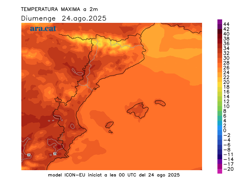
Temperatures will rise slightly further and could exceed 35°C in the West, where the weather will be warm but not as extreme as last weekend. Elsewhere, temperatures will range between 31°C and 33°C, while along the coast, they will be around 30°C, where it will feel more muggy.
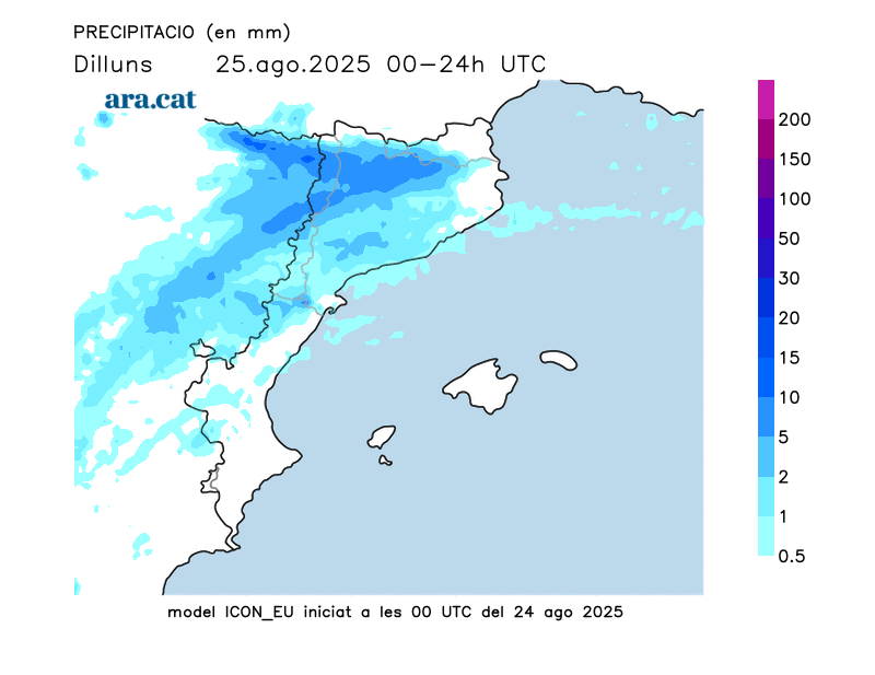
Monday: calm morning and showers in the afternoon
We'll start the week with few changes, with a clear morning and a more cloudy sky in the eastern half, where a few showers are possible, especially from midday onwards. Temperatures will rise slightly further in the West and inland Terres de l'Ebre, where they will reach 37°C. The trend, as far as the thermometer is concerned, is for a drop, which will be slight tomorrow and somewhat more noticeable midweek. On the coast, however, this drop will be barely noticeable, with the muggy feeling remaining.
Next week: with an eye on a possible DANA
Midweek we will be on the lookout for the arrival of a pocket of cold air at altitude associated with the ex-hurricane Erin, This could trigger atmospheric instability again. Weather models predicted it would reach our country a few days ago, but now it appears it will be held back in the western Iberian Peninsula and not cross the Iberian Peninsula. However, what is clear is that instability will increase, and we will once again experience showers and thunderstorms, locally of some intensity. Temperatures will drop starting Wednesday, with a generally cooler atmosphere.
We'll be monitoring it!
Storm balance during the week
The arrival of cold air from high altitude caused the first widespread showers on Monday afternoon, locally accompanied by thunderstorms and hail or stones. 77 l/m² accumulated in La Seu d'Urgell, 68 l/m² in Lake Redon (Aran Valley), 44 l/m² in Espot (Pallars Sobirà), and 29 l/m² in the Sanctuary of Queralt (Berguedà). During the second half of Tuesday, the rain was again concentrated in the western Pyrenees, with 52 l/m² in Sort, 37 l/m² in Lake Redon, and 33 l/m² in El Pont de Suert.
On Wednesday, the rain was again intense in the same regions in the northern half of the country, although it also reached parts of the coast and the center. The 67 l/m² in Guixers (Solsonès), the 45 l/m² in San Juan de las Abadesas (Ripollès), the 36 l/m² in Lladurs, in Solsonès, and the 29 l/m² in the University Zone of Barcelona stood out. On Thursday the showers were more dispersed and weaker, with 10 l/m² in Girona and Castell d'Aro (Baix Empordà) and 8 l/m² in the Bas Valley (Garrotxa) as the most notable records. This past Friday the rain was much less, with 27 l/m² in the Raval neighborhood of Barcelona, 20 l/m² in Cabrils (Maresme), 19 l/m² in Fogars de la Selva and 18 l/m² in Badalona. All this means that in some places the accumulated rainfall since Monday has already exceeded 120 l/m²:
- 156 l/m²: Lagoons
- 130 l/m²: La Seu d'Urgell
- 125 l/m²: Lake Redon (2,247 m)
- 112 l/m²: Luck
