More clouds and some showers before Saint Martin's summer
The temperature will rise notably between Tuesday and Wednesday


-
CAT -
CAST
BarcelonaThe weather will continue to be dominated by the influence of an Atlantic storm, Bruna, which, although it does not affect us directly, will have an influence on the meteorological situation in our area. This Monday, a more defined Atlantic front will arrive, with abundant cloud cover that will leave the sky covered for practically the entire day and with some scattered drizzles or showers. The temperature will start to rise, especially the minimum, and we will have to wait until Tuesday and Wednesday to reach the peak maximum temperature. The traditional St. Martin's summer arrives right on time.

Monday: cloudy sky and some precipitation
Start of the week with many clouds, especially during the morning, when we will have a cloudy sky everywhere. The first showers and drizzles will arrive from the peninsular center, which will mainly affect the western half and the southern coast and pre-coastal areas, but with minor accumulations. In the rest of the country, the drizzles will arrive during the afternoon, although in many cases the rain will not even make an appearance. The minimum temperature will rise notably due to the presence of clouds, while the maximum will remain stable, with many values between 17 °C and 22 °C.

Tuesday: milder environment
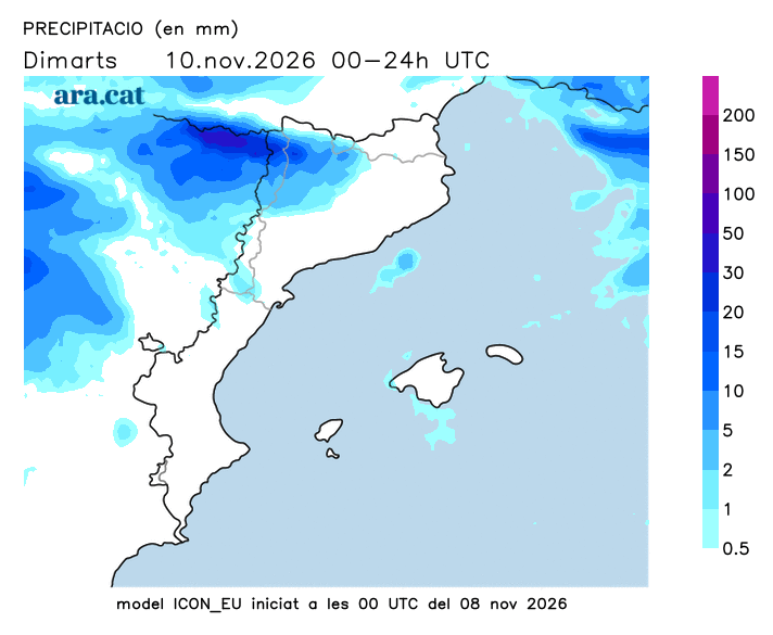
On Tuesday we will still have some precipitation, concentrated in the western Pyrenees, and in the rest of the territory bands of clouds and a partly cloudy sky will remain, although it seems less than on Monday. The rise in temperatures will intensify, with mildness at midday and many highs of 18 °C to 24 °C, locally above 25 °C in the Terres de l'Ebre and in some points of the coast. On Wednesday we will reach the warm peak of this Indian summer and we will be on the lookout for a possible more significant rain episode towards Thursday, with general and abundant precipitation.