The weather will not be entirely clear, with more showers in the Pyrenees and the northeast.
The temperature will reach 31 or 32 °C where it is hottest.
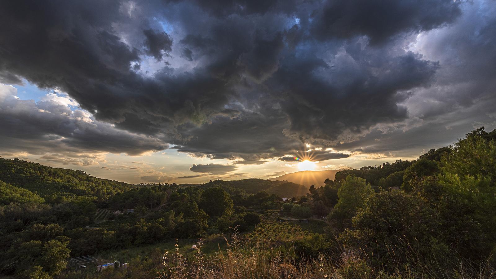

BarcelonaThe unstable weather that began on Monday has already reached its peak, with intense and widespread storms that have dumped more than 100 liters per square meter in some places in just a few days and will continue to affect some areas this Friday. Friday will be a generally calm day, with sunshine remaining dominant in the west and south and some showers in the northeast and along the central coast, which will contribute to adding to the already abundant rainfall records (more storm data is available at the end of this report).

Friday: more stability
We'll be approaching the weekend with more stable weather, although some morning showers could recur in some coastal areas, and in the northeast and the Pyrenees during the afternoon, although they will be widely scattered. These showers will be strong only in the southern and western half of the country, with a fairly cool early morning throughout the country and a maximum temperature that will rise slightly in the north and remain similar or slightly lower in the rest of the country, with temperatures generally below 30°C.
In this regard, the Catalan Meteorological Service maintains a warning of danger for intense rainfall, covering the regions of Barcelonès, Baix Llobregat, and Maresme during the morning, and La Selva, Vallès Oriental, and Maresme during the afternoon. In these regions, more than 20 mm of precipitation could fall in one hour, and the showers could be accompanied by thunderstorms and hail.
Saturday: cloudy intervals and fewer showers
The weekend will start with few changes, marked by a fairly sunny Saturday morning, although there will be traces of clouds from the early morning showers on the coast. During the afternoon, clouds will again grow, leaving showers in the inland regions of Girona and the Pyrenees, but they will be isolated and generally minor. Maximum temperatures will rise slightly throughout, although they will remain around the average for late August.

With an eye on a possible DANA
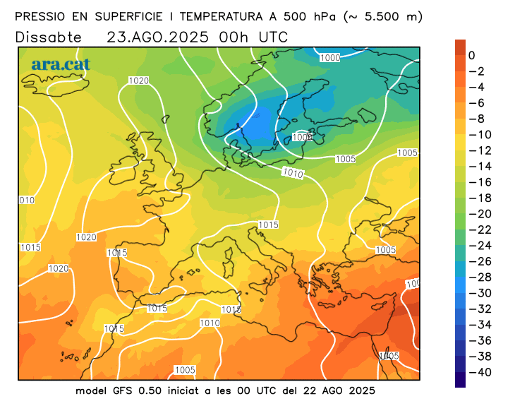
Starting Sunday, we'll be watching for the possible arrival of a pocket of cold air aloft that could trigger atmospheric instability once again. However, while a few hours ago, weather models predicted it would reach our home, it now appears it will remain blocked in the western Iberian Peninsula and not cross the Peninsula. The situation is even more uncertain than usual because the remnants of the hurricane will also reach the vicinity of the continent. Erin, which is currently near the US east coast, and which, depending on its movement, will alter the configuration of the different weather centers in Europe in one way or another.
Storm balance
The arrival of cold air from high altitude caused the first widespread showers on Monday afternoon, locally accompanied by thunderstorms and hail or stones. The most notable were 77 l/m² in La Seu d'Urgell, 68 l/m² in Lake Redon (Aran Valley), 44 l/m² in Espot (Pallars Sobirà), and 29 l/m² in the Queralt sanctuary (Berguedà). During the second half of Tuesday, the rain was again concentrated in the western Pyrenees, with 52 l/m² in Sort, 37 l/m² in Lake Redon, and 33 l/m² in El Pont de Suert.
On Wednesday, the rain was again intense in the same regions in the northern half of the country, although it also reached parts of the coast and the center. Of note were the 67 l/m² in Guixers (Solsonès), the 45 in Sant Joan de les Abadesses (Ripollès), the 36 in Lladurs, in Solsonès, and the 29 in the University District of Barcelona. On Thursday, the showers were more scattered and weaker, with the 10 l/m² in Girona and Castell d'Aro (Baix Empordà) and the 8 in the Bas Valley (Garrotxa) being the most notable records. All of this means that in some places the accumulated rainfall since Monday has already exceeded 120 l/m²:
- 156 l/m²: Lagoons
- 130 l/m²: La Seu d'Urgell
- 125 l/m²: Lake Redon (2,247 m)
- 112 l/m²: Luck
- 106 l/m²: Cadí Norte (2,143 m) - Prat d'Aguiló
- 99 l/m²: Guixers - Valls
- 97 l/m²: Peramea
- 93 l/m²: Malniu (2,230 m)
- 90 l/m²: I live in Llevata
- 86 l/m²: Berga
- 74 l/m²: Gisclareny
- 60 l/m²: Puigcerdá
- 52 l/m²: Planoles
