Temperatures on the rise, many clouds and little rain
The storm 'Bruna' will bring us south winds, mild atmosphere and some rains on Monday

-
CAT -
CAST
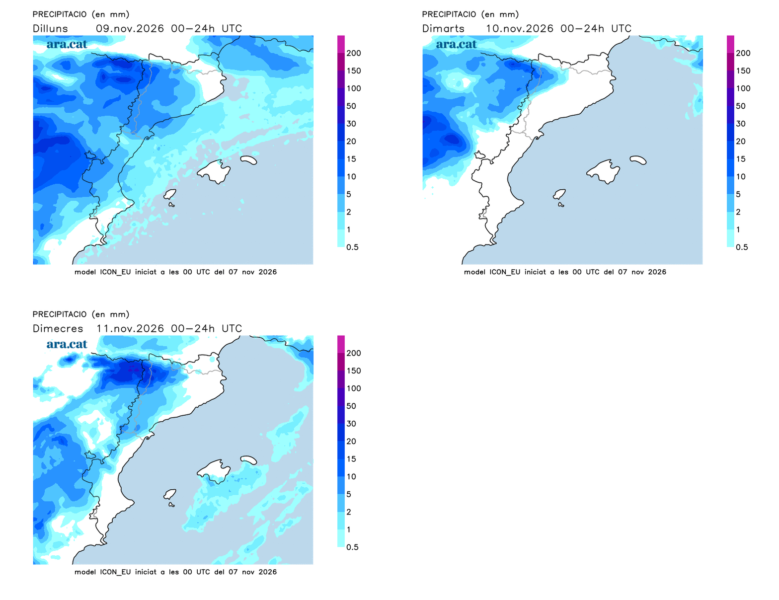
BarcelonaThe Atlantic storm Bruna will continue sending fronts towards our territory and will keep bringing plenty of rain to the west of the Peninsula. In Catalonia, very little water is expected, at least this Sunday, and beyond some drizzle or very weak showers during the afternoon, the day is expected to be quite calm. However, a more active front could leave more scattered drizzles or showers towards Monday afternoon and during the early hours of Tuesday. Temperatures will clearly rise starting Sunday, as the counter-clockwise rotation of this storm – located off the western coast of the peninsula – will push warmer winds from the southwest towards us.

Sunday: no major changes
Throughout Sunday, various bands of clouds will continue to circulate. The day will begin with many clearings, but also with low clouds along the coast and pre-coastal areas, in addition to the presence of fairly compact inland fog, present in parts of the Central Depression, the Ebro Valley, or in some pre-Pyrenean basins. The weather will be changeable and will not bring general rain, although some local, minor drizzle cannot be ruled out, most likely during the second part of the day towards the southern coast and pre-coastal areas. Temperatures will rise by 2 °C to 3 °C compared to Saturday, especially the maximums, with a milder atmosphere at midday. The highest temperatures could exceed 20 °C along the coast and pre-coastal areas, with values close to 22 °C in the Empordà and on the coast.
Minimum temperatures will rise slightly, but the cold atmosphere will remain in the early hours. There will be very light frosts in the Pyrenees area (with minimums between 0 °C and -2 °C). The sea will be marked by areas of swell and light wind from the south and southeast.

Indian summer and more showers next week
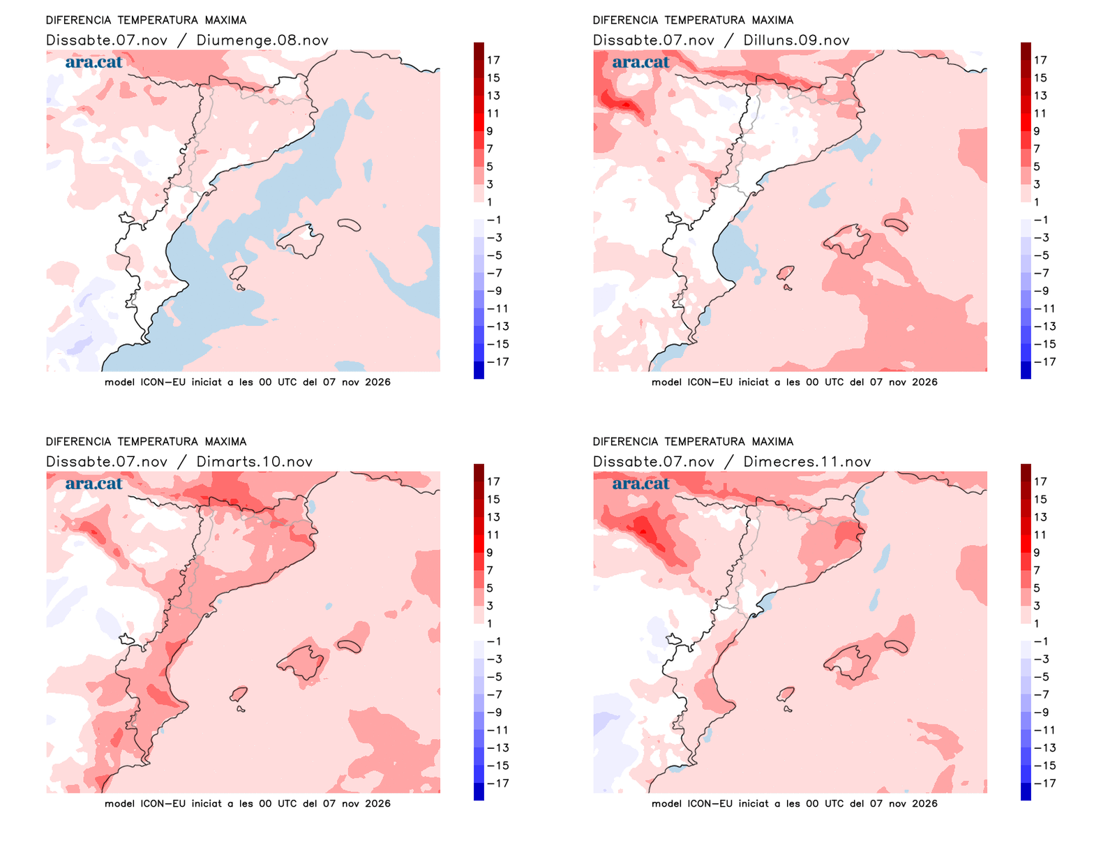
The rise in temperatures will intensify at the beginning of next week, with little cold at night and a lot of mildness at midday. Many maximums of 17 °C to 23 °C are expected, but locally 25 °C can be reached in the Terres de l'Ebre and in some points of the coast. These will be values above the average, as we usually have at this time of year, which will make the usual fair weather of the 'estiuet de Sant Martí' (St. Martin's summer) a reality. In fact, between November 10 and 11 we could record temperatures 4 °C to 5 °C higher compared to those of today and tomorrow.
The maps indicate that the storm Bruna could affect us a little more and increase instability, with showers heading into Monday afternoon and during the early hours of Tuesday. A new front would arrive towards Thursday, more active, and could leave some more abundant downpours in the south and in Ponent, including some heavy rain. We will have to keep following it and confirm it. The winds from the south and southwest will keep the environment very mild for the time of year throughout the week.