Start of the week with stable and calm weather
The temperature will continue its progressive rise


-
CAT -
CAST
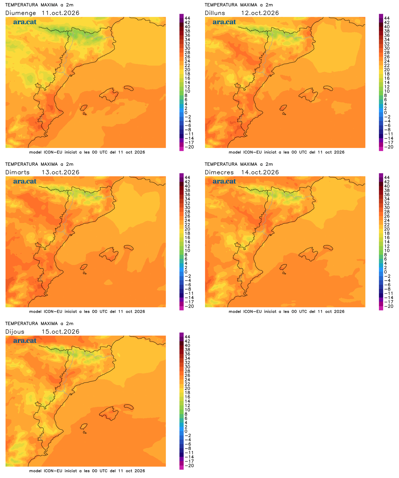
BarcelonaMonday morning has been much less cool everywhere, with a temperature that dropped less than on Saturday and Sunday, with minimums of 4 to 8 ºC in the inland spots where it was coldest, after the sub-zero values of Friday morning. Maximums will also rise everywhere and midday will be less cool, as already happened during the weekend, with some maximums locally returning to exceed 27 ºC. This week begins with very stable and anticyclonic weather, but with the passage of more high clouds and the formation of some harmless low clouds.

Monday: more softness
The week has begun very calmly, although with low clouds on the coast, in the pre-coastal area and in central Catalonia, especially during the morning, and with temperatures that will rise slowly but steadily. It will be warmer at midday and the nights will not be as cold, although they will still be quite cold or cool in the Pyrenees and the Pre-Pyrenees. In fact, some maximums could reach 27 or 28 ºC in parts of the extreme south.

Tuesday: no changes
The week will progress with few changes, with very calm weather and more periods of sunshine. The sky will be quite clear almost everywhere, with little cloud cover and no risk of precipitation. The temperature will not move much and the morning chill will remain inland, with mildness at noon, which will make it advisable to leave home with several layers of clothing first thing in the morning to be able to adapt to the thermal changes between the morning and the central hours of the day.